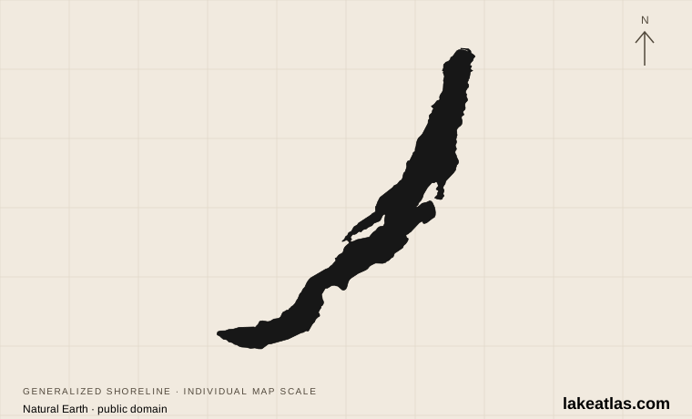
Where is Lake Baikal?
Baikal lies entirely within Russia, in southeastern Siberia north of Mongolia. It curves between mountain ranges rather than spreading across a flat plain. The lake has northern, central and southern basins; its deepest measured point is in the central basin, off the eastern side of Olkhon Island.
Use the lake’s southwest end, Olkhon and the Selenga delta as three reference points. Listvyanka is near the Angara outlet at the southwest end. Olkhon lies beside the western shore farther north. Across the southern part of the lake, the Selenga spreads into a broad delta on the eastern side. These are distinct settings, not interchangeable names for one resort area.
Match the numbered places to the list below. Open the full-size map for labels and detail.
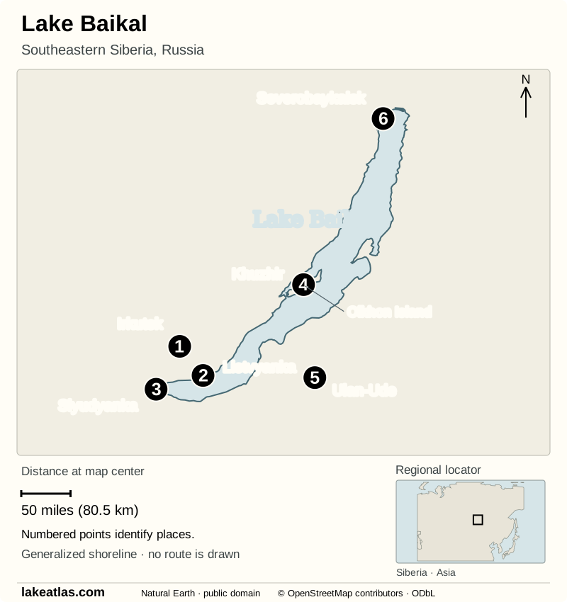
- 1Irkutsk
- 2Listvyanka
- 3Slyudyanka
- 4Khuzhir
- 5Ulan-Ude
- 6Severobaykalsk
Map design: LakeAtlas. Shoreline, boundaries, locator and some places: Natural Earth (public domain). Additional place points: © OpenStreetMap contributors (ODbL). Map data (GeoJSON).
How deep and how large is Lake Baikal?
The accepted maximum is 5,387 ft (1,642 m). The northern basin reaches 2,966 ft (904 m) and the southern basin 4,793 ft (1,461 m), so the lake floor is far from a single level. Maximum depth is the greatest measured vertical distance from the surface to the bottom, not the average depth of the whole lake.
Baikal covers 12,248 sq mi (31,722 km²), excluding islands. Its volume is about 5,666 cu mi (23,615 km³): the amount of water held beneath that surface. A lake can have a smaller area but a larger volume if its basin is much deeper. Lake Superior occupies a much larger area on a map, while Baikal holds more water.
Why do depth figures differ? Earlier surveys reported 5,371 ft (1,637 m), and UNESCO’s short description uses a rounded 5,600 ft (1,700 m). The Limnological Institute explains that the sounding of 5,387 ft (1,642 m) came from a hydrographic survey whose results were initially restricted. It recommends that value, which LakeAtlas uses consistently.
How the rift basin formed
Baikal occupies an active continental rift, where the Earth’s crust has stretched and faulted. Movement along faults created space for a deep, elongated basin. This differs from the glacial excavation that shaped many familiar northern lakes: Baikal’s exceptional depth reflects the structure of the rift beneath it.
The visible lake bottom is not the bottom of the geological depression. Thick sediments have accumulated below the water, preserving records of environmental change. USGS research uses those sediments and seismic profiles to study both the history of the lake and the process by which continents begin to pull apart.
UNESCO places Baikal’s age at about 25 million years. That long continuity is crucial to its biological importance: species have had an unusually long time to evolve in an isolated freshwater environment.
The Selenga, Angara and the lake’s water
The Selenga is Baikal’s main river inflow. It drains land in both Mongolia and Russia, carrying water and sediment into the southeastern part of the lake. Its branching delta contains channels, marshes and habitat for migrating birds. What happens upstream therefore matters to the lake as well as to the river itself.
Many streams and rivers feed Baikal, but only the Angara carries water out. It leaves near Listvyanka at the southwest end. The broad delta and the single outlet tell different parts of the same story: one builds a wetland landscape as sediment arrives, while the other connects the lake to the downstream river system.
A freshwater-volume ranking describes the amount stored in lakes. It is not a ranking of all water supplies: groundwater and water frozen in ice sheets are separate stores. Nor does a large volume establish how much water is readily usable or how quickly it is replenished.
Why Baikal’s wildlife is distinctive
An endemic species occurs naturally only in a particular place. Baikal has an exceptional concentration of endemic freshwater life, including its freshwater seal and distinctive sponges. Its deep water is well oxygenated, allowing aquatic life to occupy habitats far below the sunlit surface.
World Heritage recognition in 1996 reflected this ecosystem and its importance to evolutionary science. It does not mean that the lake is untouched. Limnological Institute scientists continued monitoring disease in Baikal’s endemic sponges during a May–June 2026 expedition, alongside work on cyanobacteria and shallow-water conditions. Clear-looking water is not proof that an ecosystem has no pressures.
Listvyanka, Olkhon and the different shores
Listvyanka brings the lake’s science and geography together at the Angara outlet. The Baikal Museum, part of the Siberian Branch of the Russian Academy of Sciences, interprets the lake’s depths and biodiversity. Its virtual museum visit also offers a useful way to explore Baikal without traveling to Russia.
Olkhon offers a different view of the lake: an island beside the western shore, with the Maloye More strait separating it from the mainland. The national-park authority distinguishes walking routes, water routes and longer island routes. Its Sarayskoye Ring is a wooden walking route of 1.1 miles (1.7 km) at Saraysky Beach; it should not be confused with the much longer routes covering the island’s north or south.
The Selenga delta is a wetland landscape rather than a substitute for the rocky island shore. Choosing a place around Baikal should follow the landscape or subject you want to understand. Connecting distant shores adds a separate transport problem; a point on the map is not evidence of an operating road, boat or ice crossing.
Baikal through the seasons
Open water and winter ice create very different versions of Baikal. NASA’s historical observations show ice developing in winter, with breakup beginning in the south before progressing north. Ice can remain in the northern lake after southern areas have opened. A single calendar date cannot describe conditions along the entire shoreline.
The national-park authority identifies cracks, pressure ridges, wind and patches of open or thin ice as hazards on winter routes. Route-opening dates depend on that year’s ice conditions. Photographs of clear blue ice do not establish that it is safe to walk or drive on, and a published winter route is not confirmation that it is currently open.
For an open-water visit, the practical advantage is access to shore walks and water-based activities when they are operating. Winter replaces those choices with an ice-dependent landscape. Spring breakup and fall freeze-up are transitions, not reliable extensions of either season.
Getting to the different shores
Irkutsk is the main air and rail gateway for the western side. Roads lead from the city to Listvyanka and other western-shore settlements; reaching Olkhon adds a crossing of the Olkhon Gates strait. A car can help with mainland roads, but it does not remove that seasonal crossing requirement.
Ulan-Ude provides a different approach from the east. The protected-area authority describes the road and bus route through Ust-Barguzin to Zabaykalsky National Park. Choose the shore before arranging onward transport: arriving in Irkutsk and arriving in Ulan-Ude place you on different sides of the lake. Current departures and crossings still need confirmation with the operator.
Current travel and park access
As checked October 9, 2026, the U.S. Department of State rates Russia Level 4: Do Not Travel. Its advisory, dated December 29, 2025, cites wrongful-detention risks, arbitrary law enforcement, terrorism and dangers associated with the war in Ukraine. It says U.S. citizens in Russia should leave immediately and warns that U.S. government assistance is limited, especially outside Moscow. This advice applies to Baikal as well as other parts of Russia.
Protected areas have separate access rules. Pribaikalsky National Park requires an entry permit; the Baikal-Lena Nature Reserve uses special permits, and not all protected areas admit tourists. The authority publishes route and fire-restriction notices. Save the permit offline before entering areas without reliable mobile coverage.
Transport and park permission are separate arrangements. Do not treat an island excursion, a museum ticket or a winter crossing as permission to enter every protected area. Confirm the specific route with the managing authority; this article does not verify current ferry departures, ice-road openings or international flight connections.
On the eastern shore, Zabaykalsky National Park introduced a temporary restriction on independent tourist visits on October 6, 2026, following increased bear encounters. As checked October 9, tourist groups could enter only with the authority’s state inspectors, by advance application. Check that authority’s current notice before planning a visit.
Check the current U.S. travel advisory for Russia
What did we learn about Lake Baikal?
Baikal’s record is a story of depth and time: a long-lived rift basin holds extraordinary freshwater volume and habitats that developed in isolation. Olkhon, the Selenga delta and the Angara outlet make that geography visible at the surface. For a prospective American visitor, understanding the lake can begin now, while any travel decision must account for the current U.S. advice not to travel to Russia.
Sources & data notes17 references · Checked October 9, 2026
Data notes
Area excludes islands. Maximum depth follows the Limnological Institute; rounded figures in general descriptions may differ.
- The INTAS morphometric dataset reports 12,248 sq mi (31,722 km²) excluding islands and 5,666 cu mi (23,615 km³) of water. The article rounds volume to whole cubic kilometers; US values are presentation conversions from the original metric figures.
- Maximum depth follows the Limnological Institute’s explanation of the accepted sounding of 5,387 ft (1,642 m), rather than UNESCO’s rounded 5,600 ft (1,700 m). Neither value is an average depth.
- Seasonal ice descriptions are historical patterns, not an ice-safety assessment or confirmation that a route is open. Travel advisory and permit information were checked October 9, 2026.
Suggested visits are researched planning guidance, not firsthand travel reports.
References
- Limnological Institute — Morphometric data
- Limnological Institute — More on the maximum depth of Lake Baikal
- UNESCO — Lake Baikal
- USGS — Lake Baikal: A Touchstone for Global Change and Rift Studies
- NASA — Lake Baikal and the Selenga River, October 1994
- NASA Earth Observatory — Snowfall on the Selenga River Delta
- Baikal Museum, Siberian Branch of the Russian Academy of Sciences
- Zapovednoye Pribaikalye — Routes and maps
- Limnological Institute — R/V Titov expedition, May 29–June 10, 2026
- NASA Earth Observatory — Ice Melting on Lake Baikal
- Zapovednoye Pribaikalye — Route hazards and guidance
- Zapovednoye Pribaikalye — Entry permits
- U.S. Department of State — Russia Travel Advisory
- USGS — Crustal structure of central Lake Baikal: Insights into intracontinental rifting
- Zapovednoye Pribaikalye — Getting there
- Zapovednoye Podlemorye — Getting there
- Zapovednoye Podlemorye — Temporary accompanied-access restriction
Source selection & methodology. Image credits appear beside each image.