Where is Lake Garda?
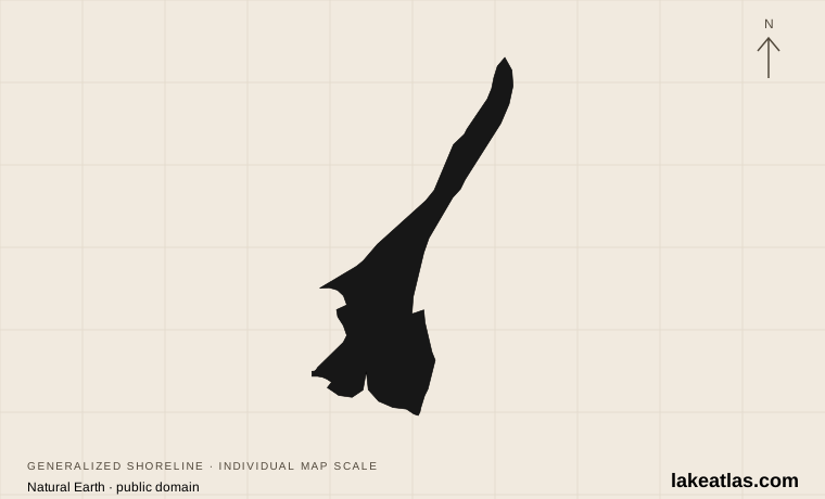
Lake Garda, also called Benaco, lies in northern Italy. The most useful distinction for a first visit is between its narrow northern end and its much wider southern basin. Mountains enclose the north, giving the water a fjordlike appearance; farther south, the shoreline opens toward hills left by retreating glaciers.
Those morainic hills are accumulations of glacial material, part of the lake’s physical history. They help explain why the southern landscape feels different from the steep mountain walls around the northern lake. Garda is freshwater: a fjordlike shape describes its appearance, not a connection to the sea.
The shore spans Lombardy, Veneto and Trentino. Those administrative regions help explain differing local transport and visitor organizations, while the north–south contrast describes physical geography. Keep the two ideas separate when choosing a base or looking up local access information.
Match the numbered places to the list below. Open the full-size map for labels and detail.
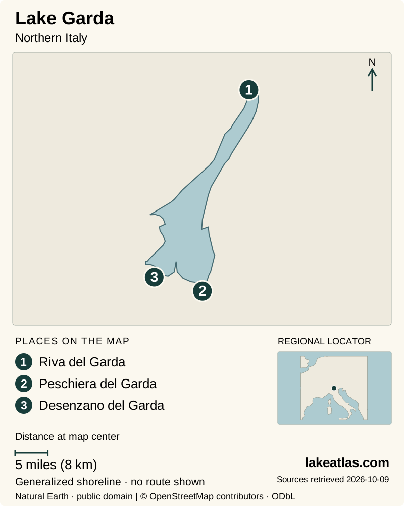
- 1Riva del Garda
- 2Peschiera del Garda
- 3Desenzano del Garda
Map design: LakeAtlas. Shoreline and place sources: Natural Earth (public domain) and © OpenStreetMap contributors (ODbL). Locator: Natural Earth. Retrieved October 9, 2026. Individual source links are in the downloadable GeoJSON. Map data (GeoJSON).
How big and deep is Lake Garda?
VisitGarda publishes a surface area of 142.9 sq mi (369.98 km²) and a maximum depth of 1,135 ft (346 m). The extra digits in the area preserve the source’s published figure; they should not imply that the visible shoreline never changes. ILEC rounds the area to 142.9 sq mi (370 km²) and reports a mean depth of 446 ft (136 m).
The contrast between maximum and mean depth matters. The deepest point says how far the basin descends locally, while the average describes the lake as a whole. Garda is Italy’s largest lake by surface area, but that ranking does not make it Italy’s deepest lake. Como reaches a greater maximum depth in a smaller footprint.
Garda’s elongated shape also matters for travel. A hotel with a lake view may be far from the particular towns you want to visit. Choosing a northern or southern base is a practical decision about access and activities, not just a choice of scenery.
The northern and southern shores offer different days
Riva del Garda and Torbole sit at the northern end. VisitGarda identifies this area with sailing and windsurfing, alongside nearby Malcesine on the eastern shore. It suits a trip in which the relationship between mountains, wind and water is part of the attraction. A calm-looking waterfront photograph is not a forecast for conditions on the lake.
On the south, Desenzano and Peschiera are useful arrival towns; Sirmione is another prominent destination along that wider shoreline. Here it is easier to structure a day around towns and the low surrounding hills. Along the western shore, places such as Salò and Gardone Riviera provide further alternatives, while Limone lies farther north.
Think of these as regions to choose among. A northern stay can concentrate on Riva, Torbole and a selected crossing or shoreline excursion; a southern stay can connect a few nearby towns. Trying to sample both ends every day makes the journey dominate the visit.
Which train station should you use?
The railway stations on the southern shore are Desenzano and Peschiera del Garda. VisitGarda names Rovereto as the nearest rail gateway for the northern lake. Buses provide onward connections from these stations to lakeside destinations, so choose a rail arrival that matches your lodging rather than booking only for the most familiar station name.
Desenzano is the gateway to consider for destinations along the southern and western shore; Peschiera serves southern and eastern-shore connections. Rovereto is relevant to Riva, Torbole and other northern destinations. These are planning groupings, not a promise of a direct bus at every hour: check the route and date before booking a tight connection.
For travelers coming from the United States, separate the long-distance arrival from the local transfer. A rail ticket to the lake region does not include the bus or boat that reaches your final town. With luggage, minimizing changes on arrival may matter more than choosing the shortest line on a map.
Use ferries to connect a visit, not to race the shoreline
Navigazione Laghi publishes the lake’s passenger boat schedules and a separate Maderno–Torri–Maderno ferry with vehicle transport. Passenger service and car carriage are different choices; only stops marked for the ferry permit vehicles. Check the current sailing table for the exact pair of towns and your travel date.
A boat can make the crossing itself part of the visit, but a route drawn along the lake does not guarantee frequent service between every stop. Confirm the last suitable return before leaving your base. The operator publishes different seasonal schedules and warns that poor weather or strong waves can suspend routes.
Leave space around onward rail or bus connections. If your aim is to explore a town, avoid using the entire visit on successive transfers. One well-chosen crossing, followed by time ashore and a known return, is a sensible first introduction.
Wind and seasons on Lake Garda
Around the northern lake, the Pelèr generally comes from the north and the Ora from the south. Garda Trentino connects this daily pattern to temperature contrasts between the water and the surrounding mountains. In fair weather the southerly Ora tends to develop later in the day, and its influence is stronger in summer than winter.
These patterns explain the concentration of sailing and windsurfing around Riva and Torbole; they are not a forecast for an individual outing. Wind also changes waves and the practicality of a ferry crossing. Check local conditions before renting equipment, and choose instruction or a shore activity when conditions exceed your experience.
Summer supports a broader water-activity visit, while spring and fall can work well for towns and walks with appropriate transport planning. Winter requires closer attention to what is operating. Navigazione Laghi issues seasonal sailing tables and notices, so check the return sailing and allow room for a changed crossing rather than treating a summer schedule as permanent.
A first visit organized by region
For an arrival by train at the southern shore, begin with your gateway town and one nearby destination. For a northern stay, make Riva or Torbole the center of the day and choose a further outing after checking the weather and transport. There is no need to complete a circuit to understand Garda’s scale.
Before reserving lodging, compare the exact location with the station, bus stop or boat landing you expect to use. Then check seasonal service and the individual attraction you want to see. The important choice is whether your base supports the kind of day you want: southern town visits, northern water activities or a quieter stretch of the western shore.
What did we learn about Lake Garda?
Garda’s appeal comes from its changing shape: mountains close around the northern water, while the south opens into a broad basin with railway gateways and historic towns. Surface area and depth explain its scale; the transport network explains the sensible way to visit. Choose a region first and build outward with selected bus or boat journeys.
Sources & data notes9 references · Checked October 9, 2026
Data notes
Surface area and maximum depth follow VisitGarda. ILEC’s rounded area is 142.9 sq mi (370 km²); its mean depth of 446 ft (136 m) is not the maximum.
- Surface area and maximum depth follow VisitGarda. ILEC’s rounded area is 142.9 sq mi (370 km²); its mean depth of 446 ft (136 m) is not the maximum.
- US displays are conversions from the published metric values. Area precision follows the source and does not imply a fixed waterline.
- Approximate coordinates follow ILEC; they locate the lake, not a visitor entrance.
Suggested visits are researched planning guidance, not firsthand travel reports.
References
- VisitGarda — Lake Garda data
- VisitGarda — Lake Garda map
- VisitGarda — Arriving by rail
- Navigazione Laghi — Lake Garda tickets and timetables
- VisitGarda — Garda resorts
- ILEC World Lake Database — Lake Garda
- ILEC World Lake Database — Italy
- Garda Trentino — Lake Garda Winds
- VisitGarda — Garda Unico
Source selection & methodology. Image credits appear beside each image.