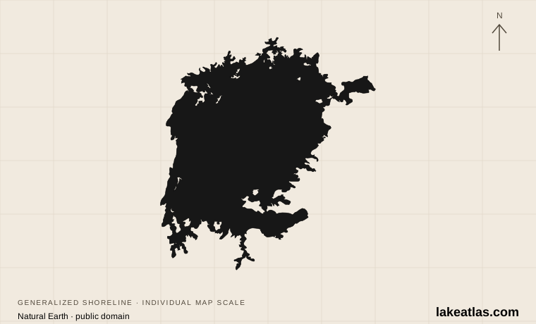
Where is Lake Victoria?
The lake lies between the eastern and western branches of the East African Rift system. Uganda borders the northern shore, Tanzania the southern and much of the western shore, and Kenya the northeastern corner. The equator crosses its northern part. Unlike the narrow, deep rift lakes farther west, Victoria fills a wide depression on the plateau.
Understanding the gulfs helps make sense of a map. Winam Gulf extends east into Kenya toward Kisumu; Mwanza sits on an inlet of the southern shore in Tanzania. The lake also contains substantial inhabited islands, including Ukerewe, and Uganda’s Ssese archipelago. Open water, sheltered bays, urban waterfronts, and papyrus wetlands are all parts of the same lake.
Match the numbered places to the list below. Open the full-size map for labels and detail.
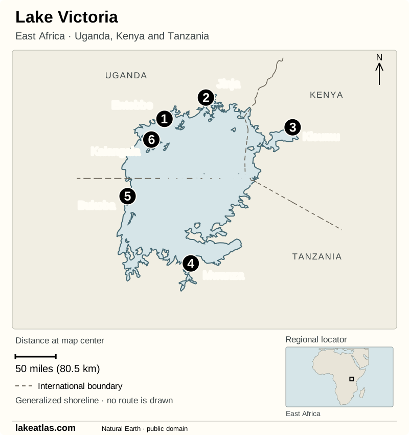
- 1Entebbe
- 2Jinja
- 3Kisumu
- 4Mwanza
- 5Bukoba
- 6Kalangala · Ssese Islands
Map design: LakeAtlas. Shoreline, boundaries, locator and places: Natural Earth (public domain). Map data (GeoJSON).
How large and deep is Lake Victoria?
LakeAtlas uses a surface area of about 26,600 sq mi (68,800 km²) and a maximum depth of 270 ft (82 m). ILEC gives a mean depth of about 131 ft (40 m). The mean describes the basin as a whole; the maximum identifies the deepest reported point. Neither tells you the water depth at a beach, harbor, or boating route.
Victoria is Africa’s largest lake by surface area. It is commonly ranked second among separately named freshwater lakes, after Lake Superior. That is an area ranking, not a claim about depth or the volume of water stored. Its broad, relatively shallow basin makes a useful contrast with deep mountain lakes.
Published maximum depths differ: the Tanzania tourism board gives 270 ft (82 m), while ILEC’s detailed reference table gives 276 ft (84 m). LakeAtlas keeps the former consistently in its facts and comparisons and records the alternative here. Those figures should not be blended into a falsely precise average.
How Lake Victoria connects to the Nile
The Kagera enters from the west and is the lake’s principal river inflow. Other tributaries drain the surrounding countries, while rain falling directly on the enormous water surface is a major part of the lake’s water supply. Much of that water returns to the atmosphere through evaporation.
The Victoria Nile leaves at Jinja in Uganda and continues through the Nile system. Calling Jinja the source of the Nile identifies this lake outlet; it does not mean there are no upstream rivers. Lake Victoria receives water from an extensive drainage network before that water reaches the outlet.
A working lake under environmental pressure
Fishing is central to the lake’s economy and food supply. Nile perch, Nile tilapia, and the small fish known as dagaa are major commercial catches. The lake’s many native cichlid fishes and shoreline habitats also make it important for freshwater biodiversity.
Those ecological and economic roles are closely connected. Nutrient enrichment promotes algal growth, changes in mixing can reduce oxygen in deeper water, and shoreline degradation affects breeding and nursery habitat. Water hyacinth can obstruct shallow bays and nearshore waters. The Lake Victoria Fisheries Organization’s 2021–2026 management plan treats these pressures alongside fishing practices; restoring fisheries involves the surrounding watershed as well as the catch itself.
Choose a shore and a base
Entebbe and the nearby Ugandan shore suit a visit centered on wetlands and islands. Mabamba is associated with papyrus habitat and shoebill watching; the Ssese Islands offer a different, more island-focused stay. Jinja is a separate destination at the Nile outlet. Allow time for the transfer between bases rather than treating all of northern Lake Victoria as one waterfront.
Kisumu is the clearest starting point for the Kenyan shore and Winam Gulf. Kisumu Impala Sanctuary offers lakeside paths and wildlife close to the city. It is a useful land-based introduction if an island boat trip does not fit your time or the weather.
Mwanza provides a southern-shore base in Tanzania. Saanane Island National Park is designed mainly for day visits reached by a short boat transfer from the city. Rubondo, on the southwestern side of the lake, is a separate forest-and-wildlife destination with papyrus shores and boat excursions. It needs its own transport arrangements; it is not simply another stop on a Mwanza waterfront walk.
Best time to visit Lake Victoria
Plan around the rainfall pattern at your chosen shore. TANAPA’s Saanane brochure identifies June through September as the local dry season, with short rains from October into January and a longer rainy period from February through May. That makes the drier months a useful starting point for a Mwanza-based walking and island visit, rather than a promise of dry conditions everywhere on the lake.
Wet periods can make land excursions muddier and affect transfers, but a dry-season date does not remove the risk of rough water. Marine forecasts and severe-weather warnings matter for any crossing. Ask the operator which forecast they use, check the departure conditions, and leave room to postpone a boat outing.
Getting there and planning boat trips
Choose the shore before booking onward transport. Kisumu’s airport serves the Kenyan base, Mwanza Airport serves the Tanzanian city, and Entebbe is the natural base for a visit to the nearby Ugandan shore. Crossing between countries is a separate journey with entry and transport requirements; the lake’s presence does not guarantee a convenient international passenger service.
For Saanane, TANAPA directs visitors to a boat transfer from Capri Point or the official jetty in Mwanza. Use the park’s designated landing arrangements, carry identification, and confirm the boat and park charges with the operator. Do not assume an old online timetable describes a currently operating route.
A car is useful for an itinerary that continues beyond a lakeside city, but it is not necessary for every lake visit. City transport plus an arranged park transfer can serve a Mwanza day outing; Kisumu Impala Sanctuary also admits visitors on foot. A car does not replace the need to arrange island transport.
Water contact, wildlife, and park access
Lake Victoria is not a place to assume that clear-looking freshwater is safe for swimming. The CDC identifies it as a transmission site for schistosomiasis and advises travelers to avoid swimming, wading, and other freshwater contact in affected areas. Plan shore walks, birding, and organized boat outings instead of treating the lake as a swimming destination.
For boat transfers, wear a properly fitted life jacket and follow the crew’s weather decisions. At Saanane, TANAPA asks visitors to stay on marked paths, keep away from wildlife, and follow park landing instructions. A permit is required for fishing there, with catch-and-release under ranger guidance. Check the specific park’s rules before planning an activity.
A first visit from Kisumu
A straightforward introduction is a land-based visit to Kisumu Impala Sanctuary, on the shore near Hippo Point. Kenya Wildlife Service places it about 1.9 miles (3 km) from the city and directs pedestrians to the Main Gate and drivers to Sitatunga Gate. Confirm admission arrangements before setting out.
Use the sanctuary paths to look across Winam Gulf and observe the shoreline wildlife. This lets you understand the gulf as part of a much larger lake without making a boat crossing essential to the day. Keep any island excursion for a separate outing with confirmed transport and a suitable forecast.
What did we learn about Lake Victoria?
Victoria’s defining scale is horizontal: its wide basin connects three countries and supports a working landscape of cities, fisheries, islands, and wetlands. Its Nile outlet is one connection in that larger water system. For a visitor, the most useful decision is which shore to understand first; choosing one base creates a more coherent trip than trying to collect distant lake stops.
Sources & data notes12 references · Checked October 9, 2026
Data notes
Reported reference values vary across datasets and surveys. Area follows ILEC; maximum depth follows the Tanzania tourism board.
- Area follows ILEC’s 26,600 sq mi (68,800 km²). The independently rounded US value is retained from Tanzania tourism’s published pair. These are reference figures, not a live measurement of the shoreline at a particular lake level.
- The comparison value remains the Tanzania tourism board’s maximum depth of 270 ft (82 m), retaining its original US value. ILEC’s detailed historical dataset reports 276 ft (84 m). The source pages do not establish that one is a newer lake-wide survey; the difference is retained rather than described as a change in lake depth.
- Mean depth of 131 ft (40 m) is an average for the basin. Maximum depth refers to its deepest reported point. Surface area measures the horizontal footprint; volume measures the amount of water and cannot be inferred from area alone.
- ILEC’s detailed environmental observations include data from the 1970s and 1980s. They are not used here to describe today’s swimming conditions or current water quality.
- Park access, marine-weather planning, and CDC guidance were checked October 9, 2026. Confirm operational details for the actual travel date; no ferry schedules, fares, or swimming-safety guarantee are supplied.
Suggested visits are researched planning guidance, not firsthand travel reports.
References
- International Lake Environment Committee — Lake Victoria AFR-05
- Tanzania tourism board — Lake Victoria
- International Lake Environment Committee — LAKE VICTORIA
- African Center for Aquatic Research and Education — Lake Victoria
- Lake Victoria Fisheries Organization — FISHERIES MANAGEMENT PLAN IV (FMP IV), 2021–2026
- Kampala Capital City Authority — Lake Victoria
- Kenya Wildlife Service — Kisumu Impala Sanctuary
- TANAPA — Visitor Guide | Saanane National Park
- TANAPA — About Rubondo Island
- TANAPA — Saanane Island National Park brochure
- Met Office — High impact weather lake system (HIGHWAY)
- CDC Yellow Book — Schistosomiasis
Source selection & methodology. Image credits appear beside each image.