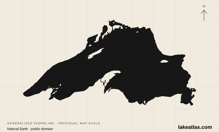
Where is Lake Superior?
Superior sits at the upstream end of the Great Lakes system. Ontario borders its Canadian shore; Minnesota, Wisconsin and Michigan border its U.S. shore. Duluth and Superior mark the western end, while the lake narrows toward the St. Marys River in the east.
The St. Marys River carries water from Superior into Lake Huron, passing the communities of Sault Ste. Marie on either side of the international boundary. The Canadian and American shores belong to one connected lake, but a trip crossing the border still requires the appropriate travel documents and entry permission.
The regional map helps separate destinations that are often grouped together as “Lake Superior.” Minnesota’s North Shore, Wisconsin’s Apostle Islands, Michigan’s Pictured Rocks and Ontario’s eastern coast are different bases, not nearby stops on a short outing.
Match the numbered places to the list below. Open the full-size map for labels and detail.
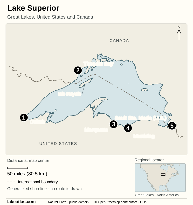
- 1Duluth
- 2Thunder Bay
- 3Marquette
- 4Munising
- 5Sault Ste. Marie (U.S.)
Map design: LakeAtlas. Shoreline, boundaries, locator and some places: Natural Earth (public domain). Additional place points: © OpenStreetMap contributors (ODbL). Map data (GeoJSON).
How large and how deep is Lake Superior?
Superior covers about 31,700 sq mi (82,100 km²). It extends roughly 350 miles (563 km) east to west and 160 miles (258 km) north to south. Those are lake dimensions, not road distances; a shoreline drive has to follow bays, peninsulas and the roads actually available.
Its maximum depth is 1,332 ft (406 m), while its average depth is 483 ft (147 m). Maximum depth describes the deepest point; average depth accounts for the entire basin. The EPA reports a water volume of approximately 2,900 cu mi (12,100 km³) at low water. Surface area measures the lake’s footprint, while volume measures the water it contains.
The familiar “largest freshwater lake” ranking refers to surface area and treats Superior as an individual named lake. There is a useful qualification: Michigan and Huron are connected deeply enough to function as one hydraulic lake, and NOAA groups them for water-level reporting. Their combined surface area exceeds Superior’s. By freshwater volume worldwide, Baikal holds more than Superior despite its smaller surface area.
An ancient rift shaped by glaciers
The rocks around Superior tell a much older story than the present lake. About 1.1 billion years ago, continental rifting opened fractures and released enormous lava flows. The rift stopped developing, leaving volcanic and sedimentary rocks that still shape the region.
Much later, glaciers eroded and reshaped the basin. Meltwater filled the depression as the ice retreated. The resulting shore is varied because waves now work on different materials: resistant volcanic rock in some places and layered sedimentary cliffs in others. “Glacial lake” describes an important part of its formation, but it does not explain all the bedrock beneath it.
The practical result is a coastline with different forms of access. A rocky headland, a beach and a high cliff are not interchangeable places to approach the water. At cliff viewpoints, remain behind barriers and away from unsupported edges; erosion continues even where the landscape looks solid.
Cold water, seiches and the lake’s ecosystem
Superior is generally nutrient poor, a condition called oligotrophic. Low nutrient availability limits plant and algal growth and helps explain its often-clear water. The lake still supports plankton, invertebrates and cold-water fish; clear water should not be mistaken for an empty ecosystem.
Wind and pressure changes can push water toward one part of the lake. When that water moves back, it creates a seiche, a standing oscillation that can change nearshore levels. This is different from a predictable ocean tide. The lake is classed as non-tidal because its astronomical tidal changes are too small to be significant for ordinary coastal planning.
Seasonal temperature differences also create layers within the water. As those density differences weaken, wind can mix the lake, moving oxygen and nutrients. For visitors, the immediate lesson is simpler: a calm-looking shore does not rule out cold water, changing wind or waves elsewhere on the lake.
Which shore should you choose?
Minnesota’s North Shore is useful for combining rocky lakefront with river gorges and waterfalls. Gooseberry Falls State Park has both waterfalls and Lake Superior shoreline, so a land-based visit can show how the smaller rivers meet the larger basin.
Wisconsin’s Bayfield Peninsula and the Apostle Islands suit travelers interested in islands, sandstone sea caves and boating. Meyers Beach provides mainland access to the sea-cave area, but reaching caves by kayak is a cold-water paddling trip, not an easy beach rental. NPS recommends appropriate sea-kayaking equipment and experience; authorized guided trips can provide instruction and equipment.
Michigan’s Pictured Rocks is a strong choice for a first look at cliffs from land. Munising is the western gateway, with Miners Castle reachable by road. Longer walks reach stretches of shoreline that cannot be approached as simple roadside overlooks.
Isle Royale is a separate island expedition. Visitors leave vehicles on the mainland and travel by ferry, seaplane or private boat, arriving at Rock Harbor or Windigo. It needs its own transport and overnight planning rather than being treated as another driving stop.
Ontario’s Lake Superior Provincial Park offers eastern-shore beaches, headlands, river valleys and both roadside and remote coastal access. Agawa Bay is one of its main visitor areas. Some culturally significant places have special access rules: the Agawa Rock Pictographs Trail closed for the 2026 season on September 11, according to the park notice checked October 9.
Walks and viewpoints at Pictured Rocks
Miners Castle is about 11 miles (17.7 km) by road northeast of Munising. Its upper overlooks are reached on a short paved path. Reaching the lower overlook adds stairs and a steeper path; visitors who want to avoid that descent can stay at the upper viewpoints.
For a longer day, the Chapel Loop is approximately 10 miles (16.1 km) and includes an extended section above the cliffs. NPS warns that its parking area fills quickly and prohibits pets on the loop. The backcountry trail map also notes rough gravel-road access, limited facilities and no drinking water at the trailhead. Carry water and use the actual trail map rather than the lake overview map for navigation.
Boat trips provide a different perspective below the cliffs, but weather can affect the outing. Beach access is not a swimming assurance: Pictured Rocks beaches have no lifeguards, and rip currents occur in Lake Superior. Check the marine forecast and local beach hazard notices as well as the ordinary land forecast.
Best time to visit Lake Superior
Summer is the simplest starting point for most first visits, with more options for island transport and open-water activities. The lake moderates shore temperatures, so an inland forecast can feel very different from the exposed waterfront. Bring layers and keep a land-based alternative when wind changes a boat or paddling plan.
Spring warming is slow beside the cold lake. Fall brings a different shoreline atmosphere but also shorter services and possible early freezes. At Pictured Rocks, NPS notes that freezing temperatures can occur in any month, and that strong storms can develop in any season.
Winter is appropriate for activities supported by specific parks and current conditions, not for assuming that the lake becomes a continuous travel surface. Isle Royale is closed to visitors November 1 through April 15. Its ferries and seaplanes generally operate only from mid-May through September, so the park’s legal opening dates do not guarantee a transport connection.
Getting around and planning a first visit
A car is useful for linking mainland parks and trailheads, whose access roads and parking areas are spread along the shore. It does not solve island transport: Isle Royale departures must be arranged separately, and vehicles remain on the mainland. Choose the region before choosing an airport or building an itinerary around the whole lake.
For a first visit based in Munising, start with Miners Castle’s upper overlooks to understand the cliffs and Grand Island setting. Add the lower overlook only if the stairs and incline suit your group. The full overlook circuit is approximately 0.5 miles (0.8 km); the separate trail from the cliff area down to Miners Beach is 1 mile (1.6 km) each way, so it is a longer addition with an uphill return.
That makes a coherent shore visit without committing to a boat departure or the much longer Chapel Loop. Check the park’s current alerts before driving, and use a different accessible shoreline stop if a road, trail or facility is closed.
What did we learn about Lake Superior?
Superior’s broad surface, deep basin and long exposure to wind make it behave on a scale that a small inland lake cannot. Its shores also preserve different chapters of the same geological story, from volcanic rock to sandstone cliffs and glacially shaped islands. A satisfying first visit comes from choosing one stretch of that shoreline and allowing the lake’s weather to guide how you explore it.
Sources & data notes18 references · Checked October 9, 2026
Data notes
Rounded National Park Service figures. Maximum and average depth are different measurements; comparison uses maximum depth.
- Area, dimensions and depth preserve the National Park Service’s published US/metric pairs. EPA depth and volume figures are referenced to low water, not a live lake-level measurement.
- EPA publishes volume as 2,900 cu mi (12,100 km³). These are independently rounded source values, so one should not be reconstructed by converting the other rounded number.
- The Chapel Loop, Miners Castle overlook circuit and Miners Beach trail are different walks. Route measurements do not describe the length of Lake Superior’s shoreline.
- The Lake Superior area ranking treats the conventionally named lakes separately; Michigan–Huron is one hydraulic unit in NOAA water-level reporting.
Suggested visits are researched planning guidance, not firsthand travel reports.
References
- National Park Service — Lake Superior Overlook Wayside
- EPA — Physical Features of the Great Lakes
- NOAA — Great Lakes water levels
- EPA — St. Marys River Area of Concern
- National Park Service — Lake Superior Geology
- National Park Service — Lake Superior
- Minnesota DNR — Gooseberry Falls State Park
- National Park Service — Kayaking at Apostle Islands
- National Park Service — Miners Castle
- National Park Service — Plan Your Visit to Pictured Rocks
- National Park Service — Isle Royale transportation
- National Park Service — Isle Royale Operating Hours & Seasons
- Ontario Parks — Lake Superior Provincial Park
- Ontario Parks — Lake Superior Provincial Park alerts
- National Park Service — Pictured Rocks weather
- National Park Service — Pictured Rocks safety
- National Park Service — Chapel/Mosquito and Beaver Basin trail map
- NOAA Technical Memorandum GLERL-167 — Great Lakes evaporation
Source selection & methodology. Image credits appear beside each image.