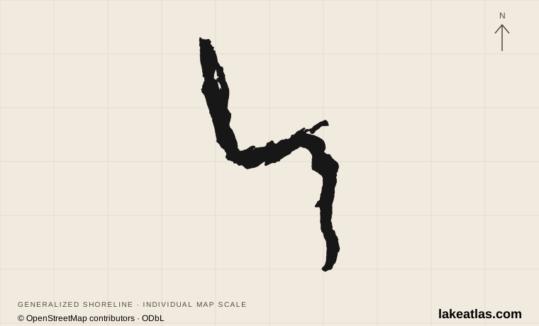
Where is Lake Whakatipu?
Whakatipu lies in Otago, in the southwest of New Zealand’s South Island. Queenstown sits beside the central part of the lake, close to the entrance to Frankton Arm. Glenorchy is at the northern head, where river valleys open toward the mountains; Kingston stands at the southern end. The Remarkables rise along the southeastern side.
Whakatipu and Wakatipu both appear on maps and visitor information. Whakatipu-wai-māori is the name used in the statutory acknowledgment of Ngāi Tahu’s relationship with the lake. The lake and the Dart valley were part of travel routes connecting inland settlements and pounamu sources with the west coast, long before Queenstown developed as a visitor center.
Match the numbered places to the list below. Open the full-size map for labels and detail.
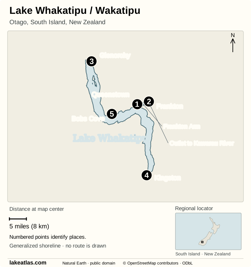
- 1Queenstown
- 2Frankton
- 3Glenorchy
- 4Kingston
- 5Bobs Cove
Map design: LakeAtlas. Shoreline and places: © OpenStreetMap contributors (ODbL). Locator: Natural Earth (public domain). Map data (GeoJSON).
A deep basin carved by glaciers
The lake occupies a long glacial trench that bends sharply through the mountains. That shape matters on the ground: places that seem close across the water may lie on quite different road approaches. Glacial debris forms a natural moraine barrier at the southern end near Kingston.
LAWA’s lake-specific measurements give an area of 111.6 sq mi (289 km²) and a maximum depth of 1,247 ft (380 m). The lake surface lies about 1,017 ft (310 m) above sea level, so its deepest bed is below sea level even though it is an inland freshwater lake. This is a comparison of two different measurements: elevation above sea level and water depth below the lake surface.
The depth figure describes the deepest point, not an average or the depth beside Queenstown Bay. Surface area describes the footprint on a map; the amount of water also depends on the shape of the submerged basin. Comparing Whakatipu with Tahoe is useful precisely because both are deep mountain lakes, yet their areas and basin histories differ.
Rivers, water quality, and the lake’s seiche
The Dart and Rees enter at the northern end; the Kawarau carries water out of Frankton Arm. Their position explains the lake’s broad drainage pattern: water travels from the mountain catchments toward the eastern outlet rather than simply leaving at the southernmost tip.
LAWA describes the lake as oligotrophic, meaning relatively low in nutrients. That basin-wide description does not guarantee conditions at every beach. Rain and urban runoff can affect the creeks entering Queenstown Bay, so a scenic view of clear water is not a substitute for the site’s current monitoring information.
The small rise and fall sometimes called Whakatipu’s tide is a seiche, a standing oscillation within the lake. Wind and changes in atmospheric pressure can set the water moving; the basin’s shape and depth determine its natural periods. Otago Regional Council identifies the strongest oscillation at about 27 minutes. It is a lake process, not an ocean tide reaching inland.
Queenstown, Glenorchy, and Kingston
Queenstown suits a visit built around the waterfront, gardens, restaurants, and organized lake trips. Frankton, farther east, is the transport hub near the airport and the Kawarau outlet. Staying near the town center makes a short lake visit possible without a car; staying elsewhere around the basin changes the daily transport calculation.
Glenorchy gives access to the head-of-the-lake landscape, where the Dart and Rees valleys meet the shore. Kingston offers a southern view of the same elongated basin. These are distinct outings, not interchangeable versions of the Queenstown waterfront. Choose one direction for a day that also includes time to walk and stop by the water.
Lake walks and viewpoints
The Queenstown Gardens loop starts beside Queenstown Bay Beach and follows the garden peninsula. The signed outing is about 1.2 miles (2 km), with benches and open views across the water. It is the most straightforward first walk from central Queenstown because the start and finish are beside the town rather than at a remote trailhead.
For native forest and a more enclosed cove, Bob’s Cove Track begins at a parking lot on the Queenstown–Glenorchy Road, about 8.7 miles (14 km) from Queenstown. DOC lists the walk as 0.93 miles (1.5 km) one way: around 20 minutes to the cove and 30 minutes to Picnic Point. The final viewpoint loop includes a short steep climb. Use the marked track; the old bridle track is permanently closed. Bikes are not permitted on the Picnic Point loop.
The Frankton shoreline offers a longer walk or cycle toward the eastern arm. As checked October 9, 2026, Queenstown Trails says infrastructure work places a detour along the sealed Frankton Road footpath throughout 2026. Check the current trail map before extending the Gardens outing: the detoured route and the short peninsula loop are separate plans.
A boat trip gives a different perspective on the mountain walls and the lake’s bends. Queenstown is a departure point for organized cruises. Select a route by the part of the lake you want to see and confirm its operating day and return arrangements directly with the operator.
Best time to visit Lake Whakatipu
For American visitors, remember that the seasons are reversed. Summer is December through February, fall March through May, winter June through August, and spring September through November. Summer’s longer days suit shoreline walks and time on the water; DOC notes that parking along the Glenorchy road can be particularly busy then.
Fall brings changing foliage around the developed shores. Winter shifts much of Queenstown’s activity toward the surrounding ski areas, with shorter days and colder conditions at the lake. A central waterfront walk is a different undertaking from a high mountain hike: choose the route for the actual forecast and available daylight.
Spring combines the returning walking season with snow still present in the mountains. The lake can be part of a trip in any season, but a weather-dependent boat outing works best with a flexible date. Build a land-based alternative around the gardens or waterfront instead of making every plan depend on a crossing.
Getting around without a car
Queenstown Airport is in Frankton. Orbus connects it with central Queenstown and the local network; the airport and regional council publish the current route maps. For a stay focused on Queenstown Bay and the Gardens, public transport plus walking is a practical option. Confirm the last connection for your arrival date rather than relying on a general statement about service frequency.
A car or arranged transfer becomes more useful for Bob’s Cove, Glenorchy, or Kingston. The published local bus network centers on Queenstown, Frankton, and nearby suburbs; do not assume it provides a lakeside circuit. At Bob’s Cove, DOC warns against roadside parking or reversing into traffic on the Glenorchy road. If the parking lot is full, choose another stop or return at a quieter time.
Before entering the water or heading farther out
Check LAWA’s Queenstown Bay page for the latest available test and local advice before considering a swim. Rain can wash contaminants into the bay through nearby creeks and stormwater. The monitoring information is location-specific and time-specific; a favorable historical grade does not establish conditions on the day you arrive.
Use DOC’s track information for route restrictions and current alerts. At Bob’s Cove, dogs must be leashed and fires are prohibited. Stay on the marked route and keep the steep Picnic Point section separate from the easier walk to the shore when deciding what suits your group.
A first afternoon by the lake
Start at Queenstown Bay and follow the 1.2 miles (2 km) Gardens loop around the peninsula. Pause at the outward-facing shore to see how the mountain walls frame the water, then look east toward Frankton Arm: this is the arm that leads to the Kawarau outlet.
Return to the town waterfront for the rest of the afternoon. If you have a longer stay, use this first view to choose the next outing: the cove and forest toward Glenorchy, the river-valley landscape at the northern head, or an organized cruise. There is no need to add the Frankton detour to the first walk simply to make it longer.
What did we learn about Lake Whakatipu?
Whakatipu’s glacial trench, sharp bends, and eastern river outlet explain more of the landscape than the Queenstown view alone. Its gentle seiche adds another reminder that the lake is an active body of water. Begin with the compact waterfront and Gardens, then choose a shore or valley deliberately; that reveals the geography without turning the visit into a race between distant viewpoints.
Sources & data notes14 references · Checked October 9, 2026
Data notes
Area and depth follow LAWA. Other sources round area differently; figures from different sources should not be silently mixed.
- LakeAtlas consistently uses LAWA’s lake-specific reference values: area 111.6 sq mi (289 km²) and maximum depth 1,247 ft (380 m). LAWA’s broader regional overview reports 113.1 sq mi (293 km²). These are different published reference figures; the page does not combine them or claim a recent change in lake area.
- The maximum depth is not a mean depth. No lake-wide average is supplied here because the selected lake profile does not establish one. Surface elevation of 1,017 ft (310 m) is measured above sea level; depth is measured downward from the water surface.
- The Gardens outing is the 1.2 miles (2 km) loop described by Destination Queenstown and DOC. Other walks advertised from downtown have different start points and distances. The loop distance does not include a longer Frankton extension.
- DOC gives Bob’s Cove Track as 0.93 miles (1.5 km) one way, with 20 minutes to the cove and 30 minutes to Picnic Point. The viewpoint loop has a short steep climb. These are the manager’s planning estimates, not a promised walking time.
- Frankton’s 2026 detour, DOC access notes, public-transport information, and the water-quality guidance were checked October 9, 2026. This article does not provide a live water-quality clearance or an assurance that every trail is open.
Suggested visits are researched planning guidance, not firsthand travel reports.
References
- LAWA — Lake Whakatipu/Wakatipu
- Otago Regional Council — Otago lakes’ trophic status
- Tourism New Zealand — Lake Wakatipu
- Ngāi Tahu Claims Settlement Act 1998 — Schedule 75 Statutory acknowledgement for Whakatipu-wai-māori (Lake Wakatipu)
- Te Rūnanga o Ngāi Tahu — Whenua
- Destination Queenstown — Queenstown Gardens Trail
- Department of Conservation — Queenstown day walks and bike trails
- Department of Conservation — Bob’s Cove Track and Nature Walk
- Queenstown Trails — Frankton Track
- Destination Queenstown — Queenstown Seasons & Weather
- Queenstown Airport — Orbus Public Bus Service
- Otago Regional Council — Queenstown bus & ferry timetables
- LAWA — Lake Whakatipu at Queenstown Bay
- LAWA — Lakes
Source selection & methodology. Image credits appear beside each image.