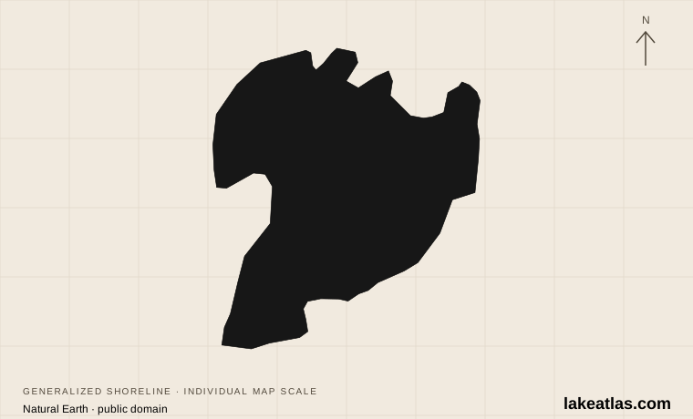
Taupō in the north, Tūrangi in the south
Lake Taupō lies in the central North Island’s volcanic landscape. Taupō town sits at its northern end, while Tūrangi provides a southern base associated with the Tongariro River and wider central North Island. Those gateways support different outings; a booking described simply as being near Lake Taupō is not enough to determine the journey.
The Waikato River leaves the northern lake and continues through Huka Falls downstream. More than 30 streams and rivers enter the lake. The water is freshwater, even though nearby geothermal features and the volcanic setting are prominent parts of the region’s identity.
Match the numbered places to the list below. Open the full-size map for labels and detail.
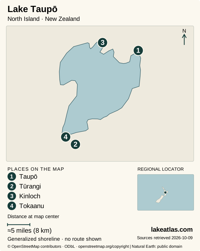
- 1Taupō
- 2Tūrangi
- 3Kinloch
- 4Tokaanu
Map design: LakeAtlas. Shoreline and place sources: Natural Earth (public domain) and © OpenStreetMap contributors (ODbL). Locator: Natural Earth. Retrieved October 9, 2026. Individual source links are in the downloadable GeoJSON. Map data (GeoJSON).
A volcanic basin, not a mountain-top crater
Earth Sciences New Zealand links the large caldera to the Ōruanui eruption around 25,500 years ago. A caldera develops when ground collapses after a major eruption; it need not look like a neat cone with a small crater at its summit. The scale of the basin is better understood from a regional map than from the town waterfront alone.
GeoNet describes a volcano with many vents, most now beneath the lake, and a geological footprint concentrated around the lake’s northern half. Its most recent major eruption was over 1,800 years ago. The modern lake outline and the complete volcanic structure are therefore related but not identical boundaries.
Geothermal attractions elsewhere in the Taupō region are separate destinations, not evidence that every lake beach is a hot spring. Treat posted geothermal areas on their own terms and use designated access. For present volcanic information, consult GeoNet rather than using the age of the last eruption as a prediction.
How large and deep is Lake Taupō?
Earth Sciences New Zealand’s lake-research summary gives an area of 237.8 sq mi (616 km²) and maximum depth of ≈604 ft (184 m). The first measures the surface; the second describes the deepest part. A broad lake can be deep without sharing the extreme basin shape of Lake Whakatipu.
Published official summaries are not fully consistent. Waikato Regional Council lists 240.2 sq mi (622 km²) and an approximate deepest point of ≈525 ft (160 m). LakeAtlas uses the matching Earth Sciences New Zealand series in cards and comparisons and records the other figures rather than averaging them or explaining away the discrepancy as ordinary daily water-level change.
The surface elevation is managed within a range influenced by inflows and hydroelectric operations. A reference map shows the lake’s geography, while a current level and navigation chart answer a boat operator’s different questions. This article does not substitute a single reference elevation for that live information.
Taupō Moana and Ngāti Tūwharetoa
Taupō Moana is a taonga, a treasure, for Ngāti Tūwharetoa. The Tūwharetoa Māori Trust Board’s cultural guidance asks recreational users to respect and care for the lake, its water and associated rivers. Cultural responsibility belongs in a visitor’s plan alongside the practical question of where to launch or walk.
The Trust Board holds title to Taupō Waters on behalf of Ngāti Tūwharetoa. Its published guidance distinguishes ordinary recreation from commercial operations, events and filming or photography activities requiring permission. An open lake view is not a reason to assume that every use of the lakebed or shoreline is unrestricted.
Read the cultural guidance before arranging activities, respect signs and local direction, and leave culturally important places and natural material undisturbed. This is a living relationship with the lake, not only a story about the distant past.
A town-based visit on the Great Lake Pathway
Taupō Lakefront Reserve extends from Ferry Road by the river outlet along Lake Terrace toward Two Mile Bay, connecting with further reserves. The Great Lake Pathway supports walking and cycling, with places to stop by the water. It is a useful introduction for someone who wants lake views without arranging a boat or remote trail transfer.
The council documented a widened concrete route along Lake Terrace through its pathway upgrade. That verifies a surfaced walking option, not blanket wheelchair access to every beach below it. Choose a named stretch and confirm any current works or the facilities you need before arrival.
A first afternoon can stay entirely within this northern setting: begin near the outlet, follow part of the lakefront and turn back at a comfortable point. The path’s town setting makes it a different undertaking from a long trail through the western bays.
Fishing waters and remote western shores
Fishing in the Lake Taupō district requires its own Taupō fishing license. DOC states that this license applies to the lake and specified connected waters, and does not cover separate Fish & Game areas. Buy the correct license before fishing and check rules for the exact water and season; a license is not a universal permit for every river in New Zealand.
For a remote shore experience, DOC’s Waihora Track reaches the lake through native bush, volcanic rock formations and a final descent beside Kotukutuku Stream. It is 10.6 miles (17 km) one way from the end of Waihāhā Road. Returning by foot doubles the distance, while a through outing requires a prearranged boat transfer.
These western trails are shared with mountain bikes and include steep sections, narrow parts and drop-offs. They should not be described as the lake’s standard access difficulty. A town pathway and a long western-bay hike are separate choices with separate preparation.
Weather and planning for the activity you choose
Summer draws people to boating and the waterfront, while cooler months can favor a town walk or a fishing-focused stay with appropriate clothing. A visit based in Tūrangi may combine river access and wider mountain-region plans, but mountain conditions should be checked separately from the weather at the lake.
For boating, follow the harbourmaster’s current rules and weather guidance, carry the required equipment and use a navigation chart. Wind can change the suitability of an open-water trip. A lake tour, a rented kayak near a beach and a remote transfer across a bay are different commitments.
A car is useful for reaching widely separated gateways and trailheads. Public transport to towns, where available, should not be assumed to include the final approach to a remote trail or boat landing. Confirm that last connection before booking an outing; this review did not establish a regular shuttle serving all lake access points.
What did we learn about Lake Taupō?
Taupō’s size is only the starting point: its volcanic basin, Waikato outlet and Ngāti Tūwharetoa connections explain why it matters. For a visitor, the essential choice is between the town lakefront, the fishery and a remote shore outing. Base the trip at the gateway that serves that choice, with the right license, transfer and weather information.
Sources & data notes11 references · Checked October 9, 2026
Data notes
Cards and comparisons use Earth Sciences New Zealand’s matching 237.8 sq mi (616 km²) area and ≈604 ft (184 m) maximum depth. The council’s 240.2 sq mi (622 km²) and ≈525 ft (160 m) summary differs; the sources are identified rather than combined. Maximum depth is not average depth. Neither the regional reference map nor these figures is a current navigation chart.
- Cards and comparisons use Earth Sciences New Zealand’s matching 237.8 sq mi (616 km²) area and ≈604 ft (184 m) maximum depth. The council’s 240.2 sq mi (622 km²) and ≈525 ft (160 m) summary differs; the sources are identified rather than combined.
- Maximum depth is not average depth. Neither the regional reference map nor these figures is a current navigation chart.
- Waihora distance is one-way and requires a return walk or a prearranged transfer. The Waihāhā Track is a separate route.
- Fishing, cultural-permission and transport guidance checked October 9, 2026; no live weather, boat departure or trail-opening guarantee is made.
- The world-map marker is a representative interior point calculated from the credited map shoreline. It is a location reference, not a public access destination.
Suggested visits are researched planning guidance, not firsthand travel reports.
References
- Earth Sciences New Zealand / NIWA — How New Zealand’s Deep and Large Lakes Reflect and Are Affected by Climate Change
- GeoNet — About Taupo
- Waikato Regional Council — Lake Taupō
- Tūwharetoa Māori Trust Board — Cultural Guidelines for Taupō Moana
- Tūwharetoa Māori Trust Board — Commercial Operations and Events
- Taupō District Council — Taupō Lakefront Reserve
- Department of Conservation — Taupō Fishing Licence Options
- Department of Conservation — Waihāhā and Waihora Tracks
- Department of Conservation — Taupō Area
- Taupō District Council — Great Lake Pathway Upgrade
- Lake Taupō Harbourmaster — Information About Lake Taupō
Source selection & methodology. Image credits appear beside each image.