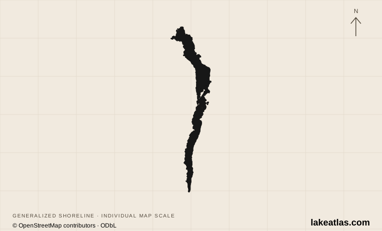
The lake, Windermere town, and Bowness
Windermere lies in Cumbria, within Lake District National Park. Windermere town has the railway station; Bowness-on-Windermere is the nearby lakeside center for many boat departures. They are linked places, but booking accommodation or a train to one does not put you directly on the shore at the other.
Ambleside lies at the northern end, with its lake landing at Waterhead. Lakeside and Newby Bridge anchor the southern approach. The wider Lake District contains many separate lakes and upland valleys: a stay on Windermere is a base for part of that region, not a synonym for having visited it all.
Match the numbered places to the list below. Open the full-size map for labels and detail.
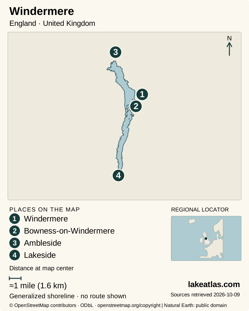
- 1Windermere
- 2Bowness-on-Windermere
- 3Ambleside
- 4Lakeside
Map design: LakeAtlas. Shoreline and place sources: Natural Earth (public domain) and © OpenStreetMap contributors (ODbL). Locator: Natural Earth. Retrieved October 9, 2026. Individual source links are in the downloadable GeoJSON. Map data (GeoJSON).
How large and deep is Windermere?
The UK Lakes Portal lists an area of 5.5 sq mi (14.36 km²), maximum depth of 210 ft (64 m) and mean depth of 70 ft (21.3 m). Mean depth is an average across the basin; it is much smaller than the deepest sounding. The lake’s surface footprint does not by itself describe the amount of water stored beneath it.
Other official summaries round the area to 5.7 sq mi (14.8 km²) or 5.8 sq mi (15 km²). These are source differences, not evidence that the lake changed by that amount between the publications. LakeAtlas keeps the portal’s series together for comparison and records the alternatives here.
Glaciation shaped the Cumbrian lake basins. Windermere has northern and southern basins, both included in UKCEH’s long-term scientific monitoring. Researchers track nutrients, oxygen, plankton and other conditions because an attractive mountain setting does not isolate a lake from pressures within its catchment.
Choosing between Bowness, Ambleside, and the west shore
Bowness suits a visit centered on the busy waterfront and boat services. Ambleside and Waterhead give a northern base, while Lakeside offers a southern departure point. Select the pier printed on your ticket: a cruise marketed under the lake’s name may not leave from the town where you are staying.
The western shore offers a more wooded walking setting around Ferry House, Claife and the route toward Red Nab. Getting there can become part of the day through a crossing from Bowness. It is still a managed landscape with roads, private property and paths, not an unrestricted right to walk every stretch of shoreline.
Arriving by rail and using the two kinds of boat service
The branch railway from Oxenholme reaches Windermere station. Local buses connect the station, Bowness and Ambleside; check the timetable and stop serving your lodging. This corridor makes a car-free visit realistic, particularly when the day stays within one part of the lake rather than depending on several tight transfers.
The council’s Windermere Ferry carries vehicles, bicycles and pedestrians between Ferry Nab and Far Sawrey. It is a cross-lake connection, distinct from the passenger cruises calling at lakeside piers. The council does not guarantee a fixed timetable or a return sailing and does not offer advance booking; weather, maintenance and demand affect operation.
For a cruise, use the operator’s current seasonal timetable and confirm the final return to your chosen pier before leaving. If you need to catch a train afterward, leave a margin for the boat-to-bus transfer. A line drawn across the water on a map is not a guaranteed connection.
A west-shore walk with clear turnaround choices
The national park’s Western Shore route runs from Ferry House toward Red Nab for 2.8 miles (4.5 km) one way. The first 1.2 miles (2 km) is graded suitable for many users; beyond Strawberry Gardens, the standard changes and steeper sections appear. Returning the full route doubles the distance.
The route begins with road and tarmac before moving onto improved stone track. The published guidance warns about traffic on the initial road section and distinguishes the main route from steeper or narrower side paths. Turning back at Strawberry Gardens is a purposeful shorter outing, not a failed attempt at the longer walk.
Accessibility and seasonal planning
Boat accessibility depends on the vessel as well as the pier. Windermere Lake Cruises identifies step-free boarding for specific services at Bowness, Waterhead and Lakeside. Its MV Swift has an accessible toilet, while some historic vessels have toilets reached by stairs. Check the symbol and vessel for the actual departure rather than treating all cruises as interchangeable.
On the council ferry, there are no steps, but ramp steepness changes with lake level. Crew assistance is available. That crossing information does not establish accessibility of every route on the far shore; use the path’s own access description as a second check.
Summer brings heavier demand at the ferry and busy waterfronts. Outside the main season, the attraction of a quieter walk must be balanced against shorter transport schedules, weather and daylight. Rain and wind can alter the day in any month, so pair one principal outing with a nearby alternative instead of relying on a complete circuit.
A first day that works without circling the lake
Arrive at Windermere station and continue to Bowness, then choose either a northern cruise with time ashore at Waterhead or a west-shore crossing and walk. Confirm the return before committing to the outward trip. Either plan connects the lake’s shape with a real place, rather than reducing the visit to a succession of departures.
If limited walking is the priority, choose a departure with the operator’s verified access features and spend time at the same waterfront before and afterward. If walking is central, choose the western route and a turnaround point suited to your group. A car adds flexibility for the wider Lake District but is not necessary for every Windermere visit.
What did we learn about Lake Windermere?
Windermere combines a glacial lake with a dense network of towns, piers and public transport. The useful distinction is between the station town, the lakeside bases and the crossing or cruise you actually need. Pick one part of the lake, match the route to its published access conditions, and leave time ashore as well as afloat.
Sources & data notes8 references · Checked October 9, 2026
Data notes
The UK Lakes Portal area is converted from its source area in hectares to 5.5 sq mi (14.36 km²), with maximum depth 210 ft (64 m) and mean depth 70 ft (21.3 m). The park’s 5.7 sq mi (14.8 km²) and UKCEH’s rounded 5.8 sq mi (15 km²) are separate summaries. Route distances are one-way unless explicitly described as return. The west-shore access grade changes beyond the first stated segment.
- The UK Lakes Portal area is converted from its source area in hectares to 5.5 sq mi (14.36 km²), with maximum depth 210 ft (64 m) and mean depth 70 ft (21.3 m). The park’s 5.7 sq mi (14.8 km²) and UKCEH’s rounded 5.8 sq mi (15 km²) are separate summaries.
- Route distances are one-way unless explicitly described as return. The west-shore access grade changes beyond the first stated segment.
- Transport and mobility information checked October 9, 2026; no live sailing, price or vessel assignment is guaranteed.
- The world-map marker is a representative interior point calculated from the credited map shoreline. It is a location reference, not a public access destination.
Suggested visits are researched planning guidance, not firsthand travel reports.
References
- UK Centre for Ecology & Hydrology — UK Lakes Portal: Windermere
- UK Centre for Ecology & Hydrology — Long-term Lakes Monitoring
- Lake District National Park — Explore Windermere and Ambleside
- Westmorland and Furness Council — Windermere Ferry
- Lake District National Park — Windermere’s Western Shore
- Windermere Lake Cruises — Accessibility: Access to Our Boats
- Windermere Lake Cruises — Timetables
- Lake District National Park — Facts and Figures
Source selection & methodology. Image credits appear beside each image.