Where is Loch Ness?
Loch Ness lies in the Highland region of Scotland, southwest of Inverness. It extends along the Great Glen, an unusually straight valley running across the Highlands. The River Ness carries its water toward Inverness and the Moray Firth, so the loch belongs to a freshwater drainage system despite its relatively low elevation.
Its long, narrow form creates distinct visitor areas. The western shore includes the Urquhart Castle area near Drumnadrochit, while Fort Augustus marks the southwestern end and its connection with the canal. Foyers provides a different approach on the side commonly described locally as South Loch Ness. Choose a shore and a purpose rather than treating every named attraction as a neighboring stop.
Match the numbered places to the list below. Open the full-size map for labels and detail.
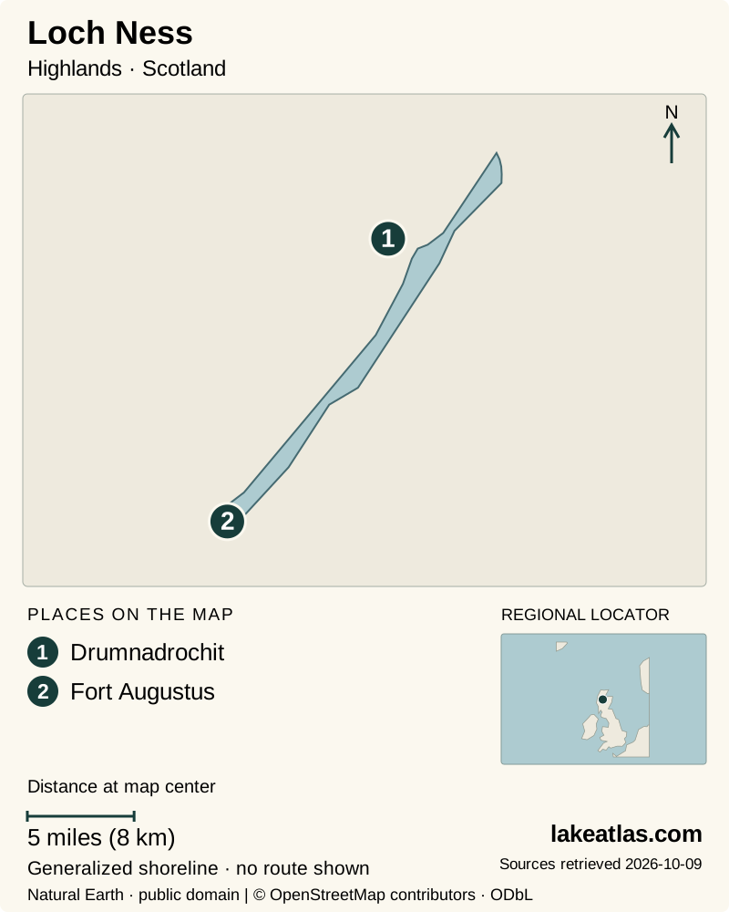
- 1Drumnadrochit
- 2Fort Augustus
Map design: LakeAtlas. Shoreline and place sources: Natural Earth (public domain) and © OpenStreetMap contributors (ODbL). Locator: Natural Earth. Retrieved October 9, 2026. Individual source links are in the downloadable GeoJSON. Map data (GeoJSON).
How deep is Loch Ness?
The UK Centre for Ecology & Hydrology lists a surface area of 21.4 sq mi (55.33 km²), a maximum depth of 754 ft (229.8 m) and a mean depth of 433 ft (132 m). Maximum depth is the deepest part of the basin; mean depth averages across the whole lake. That large average helps explain why a narrow-looking surface can contain so much water.
You may also see rounded figures of 21.6 sq mi (56 km²) and 755 ft (230 m). Those appear in ILEC’s reference entry. LakeAtlas uses the UK lake database for consistent comparison and does not combine one source’s precise area with another source’s different volume to calculate a new average.
The depth is a useful way to understand scale, but it is not visible from a roadside overlook. A shoreline visit reveals the steep surroundings and long reach of the water; bathymetric measurements supply the part of the landscape below the surface.
A fault valley deepened by ice
The Great Glen Fault formed during ancient mountain building. The British Geological Survey explains that the fault underlies the valley now occupied by Loch Ness, Loch Oich and Loch Lochy. Later glaciers scoured the valley during the ice age, modifying an already established geological structure.
This gives the landscape two different timescales: fault movement established a major line of weakness, and glacial erosion shaped the valley and lake basin that visitors see today. Calling Ness a glacial lake does not mean that glaciers created all of its geology from scratch.
The straight water corridor also matters to human geography. The Caledonian Canal uses the Great Glen to provide a coast-to-coast waterway. Seeing the loch alongside its canal connection makes the relationship between bedrock structure, glacial landforms and transportation unusually clear.
Urquhart Castle gives the shoreline a human history
Urquhart Castle stands on the western shore near Drumnadrochit. Its ruins record struggles for control of the Highlands, including the Wars of Independence and later conflict involving the Lords of the Isles. The gatehouse was deliberately destroyed in 1692 when the last garrison left, helping explain why the site is a ruin rather than an intact residence.
Visit for both the historical setting and the view along the lake. The surviving buildings are evidence of changing military and political priorities, not simply a platform for photographs. Historic Environment Scotland’s interpretation gives the castle context beyond the familiar shoreline silhouette.
Book ahead: the managing authority warns that tickets can sell out and requires parking to be booked online. The site includes steep approaches and stepped areas; the Grant Tower uses wooden stairs. Anyone who needs a gentler route should review the detailed access information before choosing which parts to visit.
Fort Augustus and the southern shore
Fort Augustus is a useful place to connect the natural lake with the engineered waterway. Scottish Canals’ visitor center interprets the Caledonian Canal, and the waterside setting allows a visit focused on navigation and the history of crossing the Great Glen. It offers a different theme from the ruined stronghold farther up the western shore.
Foyers offers another approach on the southern side of the loch, with wooded surroundings, waterfall walks and viewpoints. The local tourism organization describes road access as simplest, while noting a local bus option whose timetable affects what can be done. This is a place to plan time outdoors rather than add as an automatic brief detour.
If traveling without a car, start with the actual bus services for your chosen shore and arrange a day around a confirmed return. A route that reaches one settlement does not necessarily link all the places on a wish list. Boat excursions and shore visits are separate arrangements; confirm where a sailing begins and ends before combining it with another booking.
Best time to visit Loch Ness
Choose the season around the activity rather than the monster legend. A summer visit offers more daylight for combining a castle visit with time ashore, but Urquhart’s tickets and parking need advance planning. The managing authority publishes shorter opening periods later in the year; use the timetable for the date you will travel.
Winter is not simply the same itinerary with fewer people. Canal navigation can be interrupted by planned works, boat-excursion schedules change, and weather affects exposed shores. For a visit centered on Fort Augustus, check Scottish Canals’ current stoppage information separately from the opening of the visitor center. A canal-side walk does not require assuming boats will be transiting the locks that day.
How to make a first day at Loch Ness worthwhile
Choose a main experience: Urquhart for history and a lakeside setting, Fort Augustus for the canal, or a southern-shore outing for walks and woodland. Then add one compatible stop if the transport and weather leave enough time. This approach gives each place some context and avoids spending the day circling the water merely to say you have done it.
The monster story is part of the loch’s modern reputation, but the measurable lake does not need it to be interesting. The deep basin, fault-aligned valley, castle remains and working waterway provide a strong account of how natural forces and human journeys meet in the Highlands.
What did we learn about Loch Ness?
Loch Ness is best understood as deep water in an ancient structural valley reshaped by glaciers. Urquhart Castle adds a history of contested power, while Fort Augustus shows how the Great Glen became a navigation route. Choose a shore and an interest, and the loch becomes a coherent landscape to explore rather than a legend to chase.
Sources & data notes7 references · Checked October 9, 2026
Data notes
Area is converted from the UKCEH source’s 13,672 acres (5,533 ha) to 21.4 sq mi (55.33 km²); its maximum depth is 754 ft (229.8 m) and its mean depth is 433 ft (132 m).
- Area and depth follow UKCEH. Its area is published in hectares and converted for the display; the original measurement is retained in the data. Maximum and mean depth are separate values.
- ILEC’s rounded area and maximum depth differ slightly. This profile uses UKCEH consistently for the comparison facts.
- The map position is approximate, based on ILEC’s location coordinates; it is not a visitor entrance or sailing waypoint.
Suggested visits are researched planning guidance, not firsthand travel reports.
References
- UK Centre for Ecology & Hydrology — Loch Ness
- British Geological Survey — Great Glen Fault
- ILEC World Lake Database — Loch Ness
- Historic Environment Scotland — Urquhart Castle history
- Historic Environment Scotland — Plan a visit to Urquhart Castle
- Scottish Canals — Caledonian Canal
- Visit Inverness Loch Ness — Foyers
Source selection & methodology. Image credits appear beside each image.