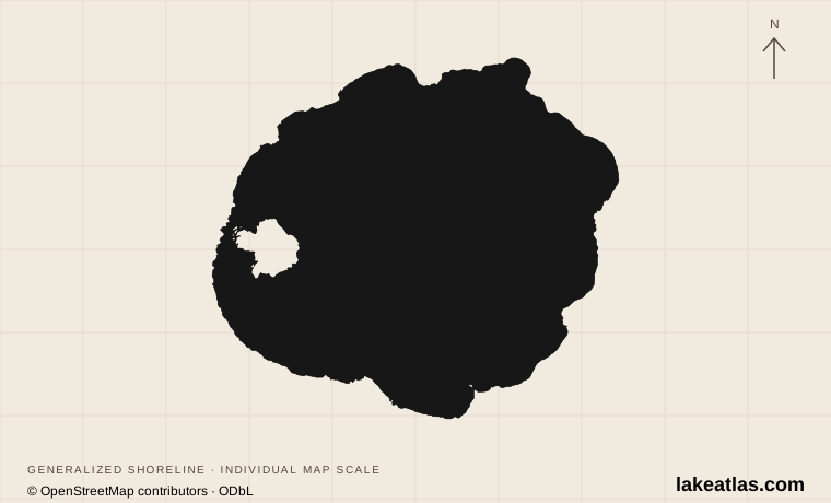
Where is Crater Lake?
Crater Lake lies on the crest of the Cascade Range in southern Oregon, entirely within Crater Lake National Park. The lake occupies a mountain basin rather than a valley connected to a large river system. Forested slopes surround a rim that encloses the water on every side.
For a first map reading, find Rim Village on the southern edge, Wizard Island toward the west and Cleetwood Cove on the northern shore. Rim Village is a practical viewing destination; Cleetwood is the lakeshore access point affected by construction. A pin for the lake itself should never be used as a driving destination.
Match the numbered places to the list below. Open the full-size map for labels and detail.
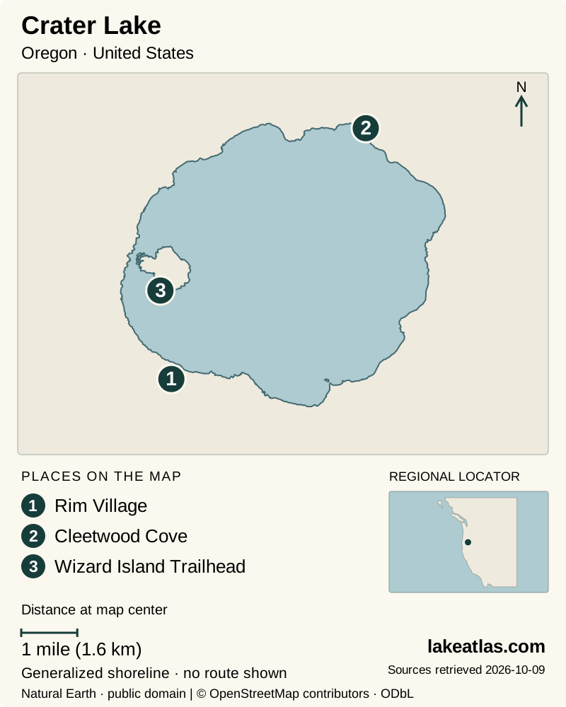
- 1Rim Village
- 2Cleetwood Cove
- 3Wizard Island Trailhead
Map design: LakeAtlas. Shoreline and place sources: Natural Earth (public domain) and © OpenStreetMap contributors (ODbL). Locator: Natural Earth. Retrieved October 9, 2026. Individual source links are in the downloadable GeoJSON. Map data (GeoJSON).
How Mount Mazama became a lake
About 7,700 years ago, a major eruption emptied part of the magma system beneath Mount Mazama. The summit collapsed into the space below, creating a caldera. Rain and snow subsequently accumulated inside it. Wizard Island is a younger volcanic cone that grew within the caldera.
The lake receives precipitation but has no surface outlet. Evaporation and seepage help balance its water supply. Its famous color reflects how light travels through deep, exceptionally clear water; changes in lighting and viewing angle can change the blue you see from the rim.
How deep and how large is Crater Lake?
The National Park Service’s lake profile reports a maximum depth of 1,943 ft (592 m), making Crater Lake the deepest lake in the United States. The published surface area used here is 20.5 sq mi (53.2 km²). That contrast is its defining scale: a relatively compact surface conceals a very deep basin.
Maximum depth refers to the deepest sounding, not the typical depth below every viewpoint. Published figures also differ: a USGS research overview gives 1,949 ft (594 m). LakeAtlas follows the current NPS lake profile consistently and preserves its original U.S. and metric pair; comparing numbers from different sources without their survey context can suggest a precision they do not share.
Seeing the lake from the rim
Rim Drive makes a circuit of 33 miles (53 km) through overlooks, forests and meadows. Different stopping points reveal how Wizard Island sits inside the larger depression and how steeply the caldera walls descend. A sequence of viewpoints is useful even if you have already taken a photograph at Rim Village.
The road is narrow and winding, with two-way traffic and cyclists. Allow time for stops rather than treating the loop as a fast connection between entrances. The park describes picnic areas and walks of different difficulties along the drive; choose a walk from the current trail information that fits your group and the day’s snow conditions.
Why lakeshore access is closed
As checked October 9, 2026, the Cleetwood Cove Trail is closed for major rehabilitation. NPS schedules the work across the 2026, 2027 and 2028 seasons and states that there will be no public boat tours during those summers. Cleetwood is the only legal public route to the shore, so a rim visit cannot be extended with an improvised descent.
This also changes the usual advice about swimming, fishing and visiting Wizard Island. Older descriptions of those activities may still appear in general park material, but they do not override the construction closure. The project includes trail, retaining-wall and marina work; a published construction schedule is not a guaranteed reopening date.
Choose the season around road access
Summer and early fall usually offer the broadest selection of rim roads and walks, but snow removal and temporary closures determine what is usable. North Entrance Road and the rim roads close to vehicles for winter and reopen in stages. A spring arrival can find substantial snow even when lower-elevation Oregon is already green.
Winter can be rewarding for snowshoeing and snowy rim scenery. It is also possible to arrive when clouds hide the lake or when the road from park headquarters to Rim Village is closed. Check the park webcam, weather and road report before committing to the drive. Snow-covered edges can conceal overhanging cornices, so stay well back from the rim. Wildfire smoke can affect summer and fall views.
Getting there and planning a first visit
The south and west approaches use Highway 62. The northern approach is seasonal; navigation software may propose it even when it is closed. NPS recommends using a specific destination such as Rim Village, checking road conditions and carrying navigation that works without mobile reception.
For a first visit, begin with the road report, then plan a lake view from Rim Village and additional open overlooks. Add a suitable rim walk if weather and time allow. Treat any complete circuit as optional until you know all of Rim Drive is open. A clear view and time to understand the caldera can make a satisfying visit without going down to the water.
What did we learn about Crater Lake?
Crater Lake is a deep volcanic basin whose best introduction is the view from above. Understanding the collapsed mountain, younger Wizard Island and precipitation-fed water gives those views meaning. For the current construction period, build the visit around the rim and verify roads and weather before leaving.
Sources & data notes10 references · Checked October 9, 2026
Data notes
Area is a published lake-surface reference; depth follows the NPS lake profile. Coordinates mark the approximate volcanic center, not an entrance.
- The surface area follows the USGS benchmark report. Its older depth figure is not used; maximum depth follows the NPS lake profile’s 1,943 ft (592 m).
- A USGS research overview reports 1,949 ft (594 m). Source methods and lake-level references can produce differences; this profile does not treat the figures as simultaneous measurements.
- The Cleetwood and public boat-tour closure was checked October 9, 2026. Consult NPS for any revised construction schedule.
Suggested visits are researched planning guidance, not firsthand travel reports.
References
- National Park Service — Crater Lake
- USGS — Crater Lake hydrologic benchmark station
- National Park Service — Scenic Rim Drive
- National Park Service — Cleetwood Cove rehabilitation
- National Park Service — Visiting in winter
- National Park Service — Directions
- National Park Service — Current conditions
- USGS — Crater Lake volcano
- National Park Service — Plan your visit
- USGS — Long-term limnological research at Crater Lake
Source selection & methodology. Image credits appear beside each image.