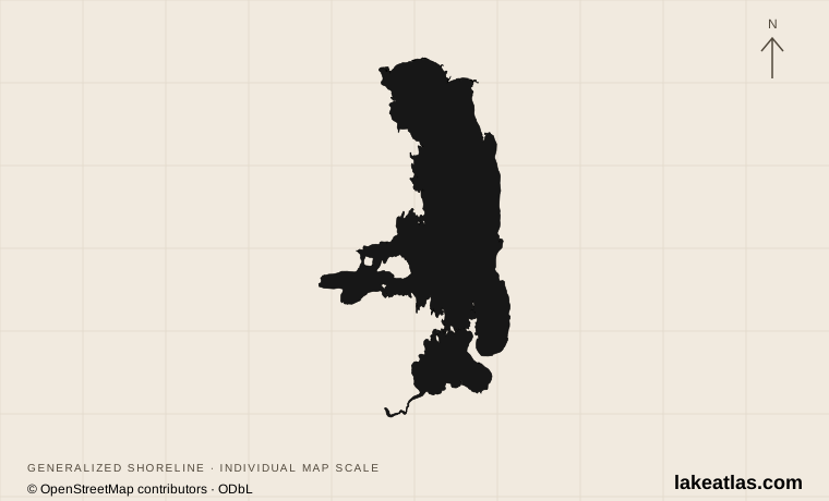
Where is Flathead Lake?
Flathead Lake lies in northwestern Montana, with Polson at the southern end and Bigfork near the northeastern shore. Kalispell is a regional gateway north of the lake rather than a lakeshore town. The Mission and Swan mountain ranges form part of its wider setting. Public state-park units are scattered around the water rather than concentrated at a single entrance.
The southern half lies within the Flathead Indian Reservation. The Confederated Salish and Kootenai Tribes describe the lake and river system as integral to the cultures and spiritual lives of its peoples. A visitor map should therefore show more than recreation stops: ownership, reservation boundaries and permission to use a landing also matter.
Match the numbered places to the list below. Open the full-size map for labels and detail.
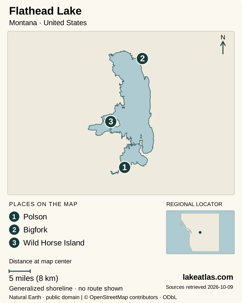
- 1Polson
- 2Bigfork
- 3Wild Horse Island
Map design: LakeAtlas. Shoreline and place sources: Natural Earth (public domain) and © OpenStreetMap contributors (ODbL). Locator: Natural Earth. Retrieved October 9, 2026. Individual source links are in the downloadable GeoJSON. Wild Horse Island reference point: Montana Fish, Wildlife & Parks. Map data (GeoJSON).
Size, depth and the glacial landscape
The Flathead Lake Biological Station reports a surface area of 191.5 sq mi (495.9 km²) and a maximum depth of 370.7 ft (113 m). Average depth is 164.7 ft (50.2 m). Its maximum length is 27.3 miles (43.9 km), large enough that an opposite shore is a separate destination rather than a nearby beach.
The Biological Station identifies Flathead as the largest natural freshwater lake by surface area in the western United States outside Alaska. The qualifications matter: Great Salt Lake is saline, reservoirs are a different category, and deeper Lake Tahoe holds more water despite a smaller surface. This is an area ranking, not a claim that Flathead has the greatest depth or volume.
Ice scoured the Flathead Valley, and the moraine at Polson helped retain water as glaciers withdrew. The present lake occupies part of that much larger Ice Age landscape. Later, steamboats carried passengers and freight between the northern valley and Polson, illustrating how the water once linked communities before road travel became dominant.
The lake is natural, but its outflow and level are regulated by Seli’š Ksanka Qlispe’ Dam. That distinction matters at the shore: a beach, dock or launch can look quite different as the level changes.
Choosing a mainland park
Wayfarers, near Bigfork on the northeast shore, combines forest with rocky shoreline and views. It is a useful starting point for a visit based around a mainland park. West Shore, on the opposite side south of Lakeside, offers another forested approach and views toward the mountain ranges.
Big Arm is on the western side north of Polson, facing the bay and Wild Horse Island. Finley Point is on the southeastern shore, while Yellow Bay provides an eastern-shore beach setting. Choose the unit closest to the landscape and activity you want instead of treating the park name as a single destination.
A northern base near Kalispell, Bigfork or Lakeside places the north and northeast parks within the same regional plan; Polson is the southern gateway. The lake’s length makes those different bases, not neighboring stops on a small town waterfront. A car is useful for choosing among mainland units, while a boat is essential for the island. Plan a shore region for the day before adding a cross-lake excursion.
For a first visit, one mainland park is enough to establish the lake’s scale. A picnic and shoreline walk can be combined with a second nearby stop if conditions and time allow. Reaching an island is a separate outing, with its own boat and landing requirements.
Visiting Wild Horse Island
Wild Horse Island is accessible only by boat, and Montana FWP does not provide transportation. Arrange your own suitable boat or a commercial service before making it the centerpiece of the day. The park is for day use only; camping and pets are prohibited.
The island has designated landing sites but no public dock. Some shoreline property and docks are private, so arrival is not permission to land anywhere. Use the park’s landing map, carry what you need and leave wildlife ample space.
Bighorn sheep, deer, birds and the island’s horses are among the animals visitors may see, but wildlife sightings are not guaranteed. Its open grassland and ponderosa pine landscape are reasons to visit in themselves. Plan for a shore walk and the return boat journey, rather than assuming the island has mainland-style services.
Tribal access and fishing permissions
Check access rules with the Tribes when your plan includes the reservation. The current Tribal Fish and Game page says non-CSKT members recreating on tribal lands need a Tribal Conservation permit and the licenses associated with their activities. The lake map and regulations explain the southern-lake context, while annual regulations provide the operative detail.
A state-park visit does not grant unrestricted access to neighboring tribal land or private shoreline. Fishing on the southern half of the lake has its own tribal licensing requirements, also highlighted by Montana FWP. Match the permission to the actual activity and location before launching or fishing.
This is also a useful reason to use established public parks and designated island landings for a first trip. They make the destination clearer, while the current tribal and park guidance explains what is needed beyond that particular site.
Lake levels and seasonal facilities
Summer generally gives the most straightforward combination of open campground services and usable docks. Wayfarers distinguishes year-round park access from its seasonal water supply, showers and campground operation. It also notes that its dock cannot be used at low lake levels; contact the park for current availability.
West Shore has its own seasonal schedule for drinking water and docks. That difference is important: one unit’s facilities should not be used as a proxy for all the others. Before a boat-based visit, check the lake wave-and-wind forecast linked by FWP as well as the condition of your intended launch.
Winter does not normally turn Flathead into a continuous frozen surface. Bays can freeze while the main lake remains open. In warmer seasons, the lake’s attractive clarity also does not mean its ecosystem is unchanged: introduced species have altered the fish community and food web. Treat the shore as a living place, and build the day around the conditions you actually find.
What did we learn about Flathead Lake?
Flathead’s scale is easiest to appreciate from a well-chosen stretch of shore. Mainland parks, a boat-only island and tribal lands are different kinds of places with different access arrangements. Choose the destination, understand the permissions and check lake conditions before deciding how much to add to the day.
Sources & data notes9 references · Checked October 9, 2026
Data notes
Area and depths follow the University of Montana Flathead Lake Biological Station. Retain its source-published US/metric pairs; independently rounded values need not be exact conversions.
- Area and depths follow the University of Montana Flathead Lake Biological Station. Retain its source-published US/metric pairs; independently rounded values need not be exact conversions.
- Natural-lake origin does not imply unregulated water levels. Measurements describe the basin, not the depth at a current launch.
- The location marker follows the USGS station at Polson on the southern shore; it is not a calculated lake centroid.
- The surface-area ranking is attributed to the Flathead Lake Biological Station and restricted to natural freshwater lakes in the western United States outside Alaska. It is not a volume ranking. Kalispell is a gateway north of the lake, not a lakeshore settlement.
Suggested visits are researched planning guidance, not firsthand travel reports.
References
- University of Montana Flathead Lake Biological Station — Lake Facts
- University of Montana — Flathead Lake
- Montana FWP — Flathead Lake State Park
- Montana FWP — Wild Horse Island
- Confederated Salish and Kootenai Tribes — Flathead Lake map and regulations
- Confederated Salish and Kootenai Tribes — Tribal Fish and Game
- Montana FWP — Wayfarers
- Montana FWP — West Shore
- USGS — Flathead Lake at Polson
Source selection & methodology. Image credits appear beside each image.