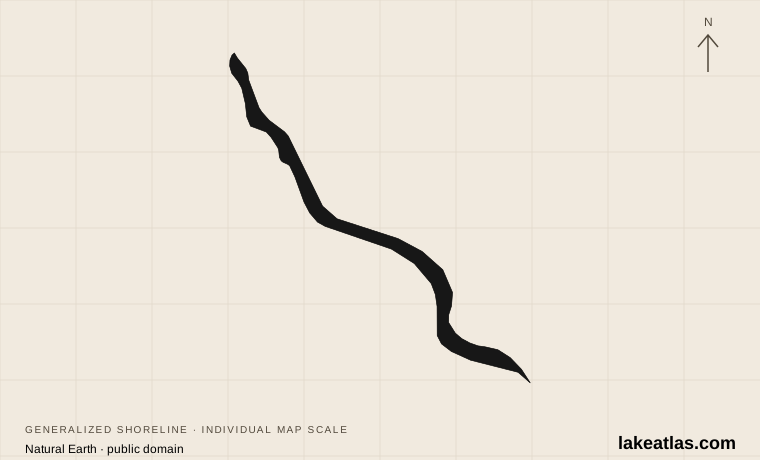
Where is Lake Chelan?
Lake Chelan occupies a long valley on the eastern side of Washington’s Cascade Mountains. The city of Chelan sits near its southeastern outlet; Stehekin lies at the upper end, where its river enters the lake. Water leaving the lake passes through the Chelan River system toward the Columbia.
The contrast between the ends is fundamental to visiting. The lower lake has road-accessible communities and state-park facilities, while the upper lake reaches into the North Cascades. Stehekin has a local valley road but no road connection to the outside highway network. A line following the shore on a map should not be read as a drivable circuit.
Match the numbered places to the list below. Open the full-size map for labels and detail.
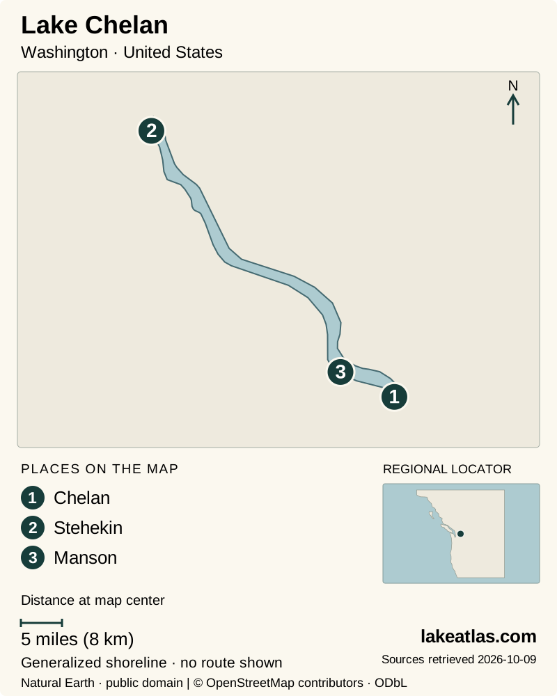
- 1Chelan
- 2Stehekin
- 3Manson
Map design: LakeAtlas. Shoreline and place sources: Natural Earth (public domain) and © OpenStreetMap contributors (ODbL). Locator: Natural Earth. Retrieved October 9, 2026. Individual source links are in the downloadable GeoJSON. Map data (GeoJSON).
A narrow lake with an exceptionally deep basin
Lake Chelan reaches a maximum depth of 1,486 ft (452.9 m) and extends about 50.4 miles (81.1 km). Washington Ecology’s physical-data table gives a surface area of 52.1 sq mi (134.9 km²). The combination is striking: much of Chelan’s scale is hidden vertically beneath a comparatively narrow surface.
Ice approached the basin from different directions. Washington State Parks describes a southern lobe moving up the valley and a northern glacier moving down it; they met around the Narrows. Their work left contrasting basins and a steep-sided upper lake. The surrounding landscape also shifts from the dry agricultural country near the lower lake toward the mountain wilderness.
Chelan is a natural glacial lake whose level is now regulated by a hydroelectric project at its outlet. Natural origin and modern regulation are compatible descriptions. Lake levels and facilities can change seasonally, so a general measurement of size does not establish the water depth at a particular launch.
Lower-lake recreation or a Stehekin visit?
Lake Chelan State Park, on the south shore, is a useful choice for a conventional beach-and-campground visit. It offers shoreline recreation, trails, a boat ramp and camping without requiring travel to Stehekin. Reservations matter for a summer stay, and a winter visit needs a check of the park’s off-season operating arrangements.
Stehekin calls for a different plan. Its setting at the head of the lake makes the journey by water part of the visit, and the valley has a long history as a route through the mountains. The community is also a gateway to Lake Chelan National Recreation Area and the surrounding wilderness. Arriving there is not the same as arriving at a roadside park with your own vehicle.
The developed lower lake is the practical choice when you want shops and a beach day without a ferry connection. A Stehekin stay trades that convenience for an upper-valley base; the local road does not connect through to the outside highway system, so supplies and return transport should be settled before departure.
Getting to Stehekin and moving up the valley
NPS identifies two passenger-ferry options. Lake Chelan Boat Company runs between Chelan and Stehekin with scheduled stops at Fields Point and Lucerne; Stehekin Ferry runs between Fields Point and Stehekin with other optional stops. Confirm the departure landing, actual sailing and return connection with the operator before committing to a day trip.
These are passenger services. Leave the car at the appropriate departure point, and discuss bicycles, bulky luggage, pets and accessibility needs with the company in advance. A ticket to Stehekin does not automatically include onward transport within the valley.
The valley shuttle operates seasonally between Stehekin Landing and High Bridge. Cycling is another option, with the lower valley road paved and the farther section becoming hard-packed dirt and gravel. Choose activities around the time actually available between your boat arrival and departure; a short layover is not a full day of exploration.
Rainbow Falls and a practical first outing
Rainbow Falls is around 3.5 miles (5.6 km) along the valley road from Stehekin Landing. The waterfall drops 312 ft (95.1 m), with lower and upper viewpoints reached by short paths from its parking area. NPS identifies the lower viewpoint as wheelchair accessible, but reaching that parking area still requires a separate transport plan.
Spring runoff, usually in May and June, gives the falls its strongest flow. For a first visit, check whether the seasonal valley transport fits your sailing rather than assuming you can comfortably walk out and back during a brief stop. If you stay overnight, you gain more flexibility, but lodging or camping and the return boat should be arranged together.
Visitors who mainly want to spend time beside the water may be better served by the lower-lake state park. Choosing that simpler day is entirely consistent with understanding Chelan: the accessible lower basin and remote upper valley are two parts of the same lake.
Summer access, mountain weather and quieter seasons
NPS identifies mid-June through late September as the generally favorable weather period for the North Cascades. Stehekin is on the warmer, drier east side, but a pleasant lower-valley day does not establish conditions on high trails. Snow can persist into the summer mountains, and rain or wind can change a plan.
For the 2026 season, there is an additional constraint beyond the usual seasonal pattern. NPS reported that winter flood damage disabled the wastewater system at Stehekin Landing. Checked October 9, 2026, its visitor pages still state that the North Cascades Lodge’s public lodging, food, retail, fuel, laundry and shower services are unavailable for the season, while ferries and private shuttle and tour operators continue. Check current Landing services before booking; do not assume that a running ferry means normal lodge facilities are available.
Fall and spring bring fewer services as well as changing weather. In winter, snow can cover Stehekin from late fall into spring. Check ferry operations, valley transport and overnight facilities separately instead of treating an open boat route as a guarantee that all visitor services are running.
Backcountry camping requires a permit year-round. An overnight wilderness trip therefore adds another layer of planning beyond the passenger boat, while a lower-lake park stay follows the state park’s own reservation and access arrangements.
Plan transportation to Stehekin
What did we learn about Lake Chelan?
Chelan’s unusual depth comes with a practical division between a developed lower shore and a remote upper valley. Decide which experience you want first. A state-park day can be straightforward; a Stehekin visit becomes much easier once boat travel, valley transport and overnight arrangements fit together.
Sources & data notes13 references · Checked October 9, 2026
Data notes
Surface area is the historical physical-data value published by Washington Ecology, not a live lake-level calculation. Canonical metric area and depth are conversions of original US measurements, with US originals retained.
- Surface area is the historical physical-data value published by Washington Ecology, not a live lake-level calculation. Canonical metric area and depth are conversions of original US measurements, with US originals retained.
- Maximum depth and length follow Chelan PUD. NPS sometimes rounds the depth in general descriptions.
- Rainbow Falls distance is along the valley road from the landing, not the short viewpoint path. The marker follows the USGS outlet-area station at Chelan, not the midpoint of the lake.
- Stehekin Landing service restrictions were checked October 9, 2026 against NPS’s May 7 and June 9 notices. They describe the 2026 disruption, not a permanent closure of the valley or passenger ferries.
Suggested visits are researched planning guidance, not firsthand travel reports.
References
- Washington Department of Ecology — Lake Chelan water quality assessment
- Chelan PUD — Lake Chelan Project resource document
- Washington State Parks — Lake Chelan State Park History
- Washington State Parks — Lake Chelan State Park
- National Park Service — Stehekin
- National Park Service — Getting to Stehekin
- National Park Service — Stehekin Transportation
- National Park Service — Rainbow Falls
- National Park Service — North Cascades Weather
- National Park Service — Non-Peak Season
- USGS — Lake Chelan at Chelan
- National Park Service — Services Limited at Stehekin Landing Following Winter Flood Damage
- National Park Service — Camping in Stehekin
Source selection & methodology. Image credits appear beside each image.