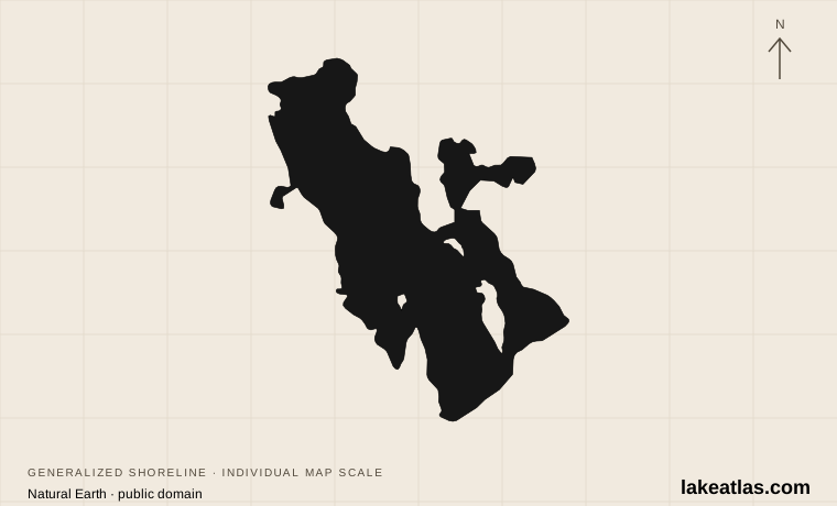
Where is Great Salt Lake?
Great Salt Lake lies in northern Utah, west of the Wasatch Front. It occupies a closed basin with no river outlet to the sea. Water leaves mainly through evaporation, while dissolved salts remain behind. Its setting in a broad, shallow depression makes a fixed shoreline a poor description of the lake over time.
The railroad causeway divides the open lake into northern and southern arms. USGS explains that most inflow reaches the southern part, so the arms can differ in water level. The name describes one lake system, but conditions at a northern monitoring station or shoreline should not automatically be applied to the south.
Match the numbered places to the list below. Open the full-size map for labels and detail.
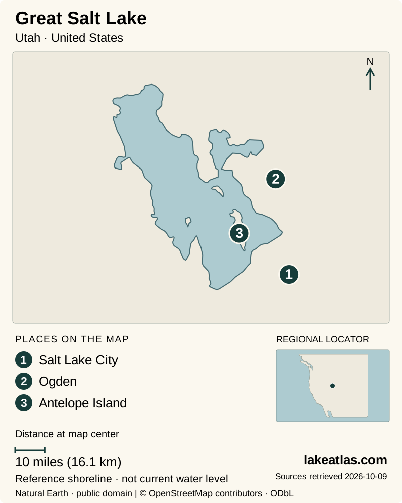
- 1Salt Lake City
- 2Ogden
- 3Antelope Island
Map design: LakeAtlas. Shoreline and place sources: Natural Earth (public domain) and © OpenStreetMap contributors (ODbL). Locator: Natural Earth. Retrieved October 9, 2026. Individual source links are in the downloadable GeoJSON. Map data (GeoJSON).
A remnant of Lake Bonneville
Great Salt Lake remains from the much larger Ice Age Lake Bonneville. As the regional climate became warmer and drier, that lake retreated within its closed basin. The modern lake occupies only part of the former lake landscape.
This history helps explain why surrounding dry land and mountain slopes matter to the story. The water visible today is one stage in a long history of changing lake extent, with modern water use and climate now influencing how much reaches the basin.
How big and deep is a changing lake?
LakeAtlas uses the Utah Geological Survey’s reference area of about 1,600 sq mi (4,144 km²) and maximum depth of 33 ft (10.1 m) at an elevation of 4,200 ft (1,280 m) above sea level. These describe a historical reference level, not October 2026 conditions.
A small vertical change can move the shore a long way across the shallow bed. Area, depth and the distance from a parking area to the water therefore change together. Other summaries publish different rounded reference areas; combining them as though they were one present-day survey would be misleading.
Why salinity and color vary
River water reaches the lake from the Bear, Weber and Jordan systems, among other sources. The southern arm receives more freshwater, while the northern arm is generally saltier. Microorganisms adapted to different salt concentrations help explain the contrasting colors sometimes visible across the causeway. There is no single permanent salinity value for every place and season.
Brine shrimp and brine flies are central to the lake’s food web. They help feed migrating birds, while fresher wetlands around the margins provide other habitats. Utah’s wildlife agency describes the lake as a major breeding, staging and wintering resource. Birdlife depends on this variety of water conditions rather than on one uniform body of salt water.
Antelope Island and the southern shore
Antelope Island offers trails, broad lake views, free-ranging wildlife and the historic Fielding Garr Ranch. It is a useful choice when you want time on land as well as a view of the water. The island’s name does not imply a boat trip: the visitor approach crosses a causeway from the Syracuse side.
Great Salt Lake State Park provides a different introduction from the southern shore, with a marina setting and views toward the lake and nearby landforms. Choose between these places by the experience you want, rather than treating either as a guaranteed swimming beach with water immediately beside the parking area.
Exploring the Bear River wetlands
Bear River Migratory Bird Refuge near Brigham City focuses attention on the lake’s wetland edge. The visitor center and the auto-tour route are separate destinations; reaching the center does not mean you have already reached the route through the refuge. Check the refuge map when deciding how much time to allow.
The auto route is one-way and includes pullouts for watching and photographing birds. Use those stopping places so others can pass, and keep to the public route. Species and numbers change with migration and habitat conditions, so approach it as a chance to observe a living wetland rather than a checklist with guaranteed sightings.
Seasons, insects and shoreline access
Seasonal insect activity is part of visiting the lake. Antelope Island distinguishes biting midges, mosquitoes and non-biting brine flies; a moving band of flies at the water’s edge is not the same problem as biting insects on a trail. The park posts current information and recommends fine-mesh head nets for biting midges.
As checked October 9, 2026, Antelope Island’s main boat ramp is closed because of low water. That does not mean the island’s land-based visits are closed, but it rules out assuming normal boat-launch access there. Check the specific park or refuge notice for your planned activity; conditions at one access point cannot stand in for the entire lake.
Getting around and planning a first visit
For Antelope Island, the road approach follows Antelope Drive from the mainland to the causeway. Arrange reliable return transportation: the state park warns that rideshare operators do not pick up from the park. Bear River’s visitor center is reached from the Brigham City area, with additional travel to its wetland auto route.
A first visit works best with one main purpose. Choose Antelope Island for an island landscape and walking, the southern state park for a lake viewpoint, or Bear River for wetland birdwatching. Combining distant shores adds travel rather than simply adding another stop on a lakeside road. Check access and weather, then leave time to watch how water, exposed ground and wildlife fit together.
What did we learn about Great Salt Lake?
Great Salt Lake is a changing lake system rather than a fixed blue shape on a map. Its shallow bed, closed-basin water balance and contrasting arms explain both its saltiness and its shifting shore. Visiting a specific island, shore or wetland makes that geography easier to see—and avoids expecting the same conditions everywhere.
Sources & data notes12 references · Checked October 9, 2026
Data notes
Area and maximum depth use Utah Geological Survey reference conditions at 4,200 ft (1,280 m) above sea level, not the present lake. Shoreline, depth and salinity vary; the pin marks Promontory Point.
- Area and maximum depth follow Utah Geological Survey values of 1,600 square miles and 33 feet at the reference elevation of 4,200 feet. Metric displays are conversions, not independent measurements.
- USGS gives a different approximate historical-reference area. The profile uses one internally consistent UGS area-and-depth reference rather than averaging across sources.
- No current area, depth, water elevation or numerical salinity is asserted. The USGS point locates the Promontory Point station, not a lake centroid or visitor entrance.
Suggested visits are researched planning guidance, not firsthand travel reports.
References
- Utah Geological Survey — Great Salt Lake questions and answers
- USGS — Great Salt Lake elevations and areal extent
- Utah Division of Wildlife Resources — About Great Salt Lake
- Utah Division of Wildlife Resources — Birds at Great Salt Lake
- Utah State Parks — Antelope Island
- Utah State Parks — Antelope Island current conditions
- Utah State Parks — Great Salt Lake State Park
- U.S. Fish and Wildlife Service — Bear River refuge visit
- U.S. Fish and Wildlife Service — Bear River refuge tours
- Utah State Parks — Antelope Island history
- USGS — Great Salt Lake at Promontory Point
- Utah State Parks — Antelope Island reservations
Source selection & methodology. Image credits appear beside each image.