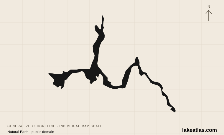
Where is Lake Mead?
Lake Mead lies east and southeast of Las Vegas, with Hoover Dam closing its downstream end. It straddles Nevada and Arizona. Boulder Basin, the Overton Arm and the Temple Bar area are useful map references for different parts of the lake; they are not stops on one compact waterfront promenade.
Lake Mead National Recreation Area is larger than the reservoir named Lake Mead. It also includes Lake Mohave downstream and extensive desert country. Check which lake a tour, campground or launch description refers to, particularly when browsing activities advertised under the recreation area’s name.
Match the numbered places to the list below. Open the full-size map for labels and detail.
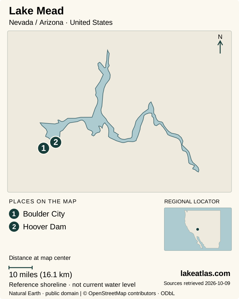
- 1Boulder City
- 2Hoover Dam
Map design: LakeAtlas. Shoreline and place sources: Natural Earth (public domain) and © OpenStreetMap contributors (ODbL). Locator: Natural Earth. Retrieved October 9, 2026. Individual source links are in the downloadable GeoJSON. Map data (GeoJSON).
How Hoover Dam created the lake
Hoover Dam began impounding the Colorado River in 1935. Water backed into existing river valleys and basins, creating an artificial lake within a much older desert landscape. The dam is therefore the key to the lake’s existence, while the shapes of its arms reflect the terrain that was flooded.
The Historic Railroad Trail connects this engineering history to the surrounding land: its route once carried supplies for building the dam. St. Thomas tells another part of the story. The town was inundated as the reservoir filled, and lower water has exposed its remains again. Together, those places make the lake’s changing relationship with the landscape easier to understand.
How large and deep is Lake Mead?
The reference surface area here is 246 sq mi (637 km²) and the maximum depth is 532 ft (162 m), both for full-pool conditions. The U.S. Geological Survey publishes these dimensions alongside their U.S. counterparts. NPS likewise identifies its headline figures as full-capacity measurements.
These numbers do not describe the current amount of water in storage or the present shoreline. A reservoir can retain the same name while its area and deepest water column change substantially. Maximum depth is also different from Hoover Dam’s structural height and from average depth across the lake. Compare Lake Mead with Lake Powell only after checking that both figures refer to comparable water levels.
Boulder Basin, the railroad and St. Thomas
The Boulder City side provides an introduction to the reservoir and dam landscape. The Historic Railroad Trail follows the old rail bed through tunnels with views toward Boulder Basin. Its history gives a walk here a focus beyond the water itself. NPS does not recommend the trail in summer because of extreme heat and exposed sections.
St. Thomas is farther north near the Overton Arm and Muddy River. It is a separate outing, reached by a dirt access road rather than a paved lakeside path. The townsite shows how a place can pass from dry land to reservoir floor and back into view. Check road conditions and leave foundations and artifacts undisturbed.
Choosing time on the water
NPS lists boating, paddling, guided outings and camping among the recreation area’s activities. For a lake visit, choose a specific marina or departure point and confirm that the excursion is on Lake Mead. Some well-known paddling experiences associated with the park occur downstream of Hoover Dam instead.
A boat outing provides a different sense of scale from a shore overlook, but it needs its own preparation. Check the current launch information and weather; changing water can expose obstacles and leave previously useful ramps unsuitable. Wear an appropriate life jacket and follow posted restrictions. Warm desert air does not establish that swimming conditions or the water temperature are comfortable.
When to visit and what can change
Cooler weather is the better starting point for planning a walk. NPS discourages hiking during the hot summer months; a short-looking route on a map can still involve serious sun exposure. Choose a season and activity together rather than scheduling the same outing regardless of forecast.
Water trips face a different set of weather decisions. Conditions can deteriorate quickly during monsoon storms, and wind can make open water difficult. NPS advises checking conditions before launch and remaining alert to storms while out. Lake access also changes independently of the weather: ramp maintenance and declining water can alter where a boat can be launched or retrieved.
Getting there and planning a first visit
Harry Reid International Airport in Las Vegas is the main nearby air gateway. Most visitors continue by car; NPS reports no public transportation to the recreation area, though commercial tours are available. Select a named destination before navigating, since the park covers widely separated areas and two lakes.
For a first visit in suitable weather, pair the Lake Mead Visitor Center with a Boulder Basin viewpoint or a portion of the Historic Railroad Trail. Add a confirmed boat outing if seeing the reservoir from the water is a priority. Treat St. Thomas or a distant shore as a separate plan with its own road and weather check, rather than squeezing it into an assumed circuit.
What did we learn about Lake Mead?
Lake Mead combines Colorado River engineering, desert geography and a shoreline that responds to changing storage. Full-pool dimensions explain its reference scale; the dam, railroad trail and St. Thomas explain how it transformed the land. For a visit, pick a specific basin and match the activity to current heat, wind and access conditions.
Sources & data notes13 references · Checked October 9, 2026
Data notes
Area and maximum depth describe full-pool reference conditions, not today’s lake. Lake Mead National Recreation Area also includes Lake Mohave. The pin marks the Hoover Dam end.
- The USGS full-pool table reports 157,418 acres (246 sq mi (637 km²)) and a maximum depth of 532 feet (532 ft (162 m)). U.S. square-mile display is rounded from the source acreage.
- Reference dimensions are not live reservoir readings, and no current elevation or volume is asserted.
- The monitoring-station coordinates locate Hoover Dam at the reservoir’s downstream end rather than its geographic center.
Suggested visits are researched planning guidance, not firsthand travel reports.
References
- National Park Service — Lake Mead frequently asked questions
- USGS — Environmental setting of Lake Mead National Recreation Area
- Bureau of Reclamation — Hoover Dam chronology
- National Park Service — Lake Mead maps
- National Park Service — Historic Railroad Trail
- National Park Service — St. Thomas, Nevada
- National Park Service — Lake Mead conditions
- National Park Service — Directions and transportation
- National Park Service — Plan your visit
- USGS — Lake Mead at Hoover Dam
- Bureau of Reclamation — Hoover Dam project
- National Park Service — St. Thomas Trail
- National Park Service — Water hazards
Source selection & methodology. Image credits appear beside each image.