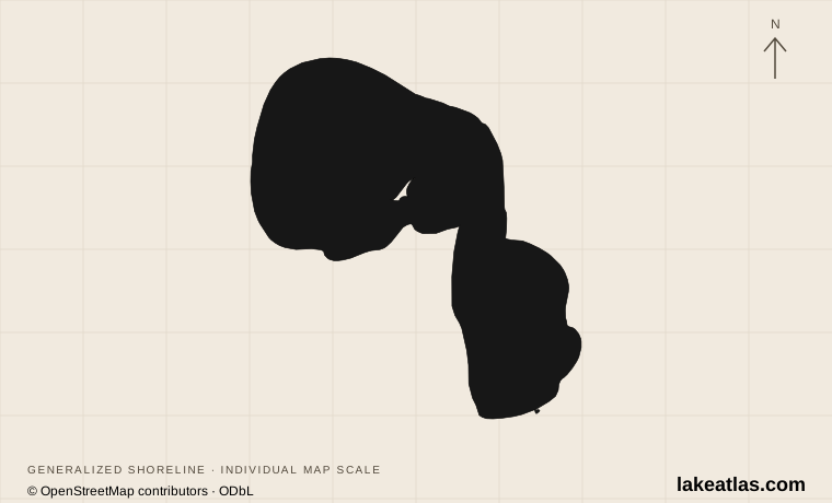
Where is Higgins Lake?
Most of Higgins Lake lies in Roscommon County, with a small northern portion in Crawford County. Roscommon is the principal nearby village; Grayling provides another regional base. The lake sits within the headwaters of the Muskegon River watershed, away from the shores of the Great Lakes themselves.
Its major public destinations face each other across the basin: North Higgins Lake State Park occupies the north shore and South Higgins Lake State Park the south. Homes and cottages occupy much of the intervening shoreline. Following a lakeside road is therefore not the same as finding a continuous public beach.
Match the numbered places to the list below. Open the full-size map for labels and detail.
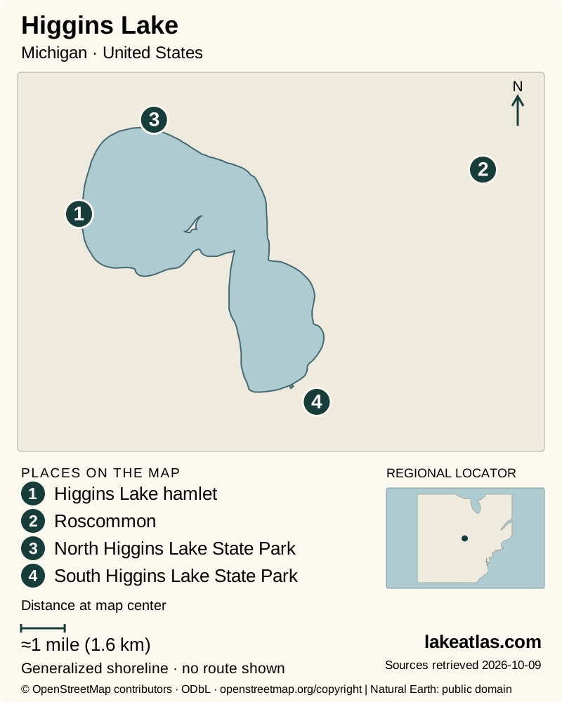
- 1Higgins Lake hamlet
- 2Roscommon
- 3North Higgins Lake State Park
- 4South Higgins Lake State Park
Map design: LakeAtlas. Shoreline and place sources: Natural Earth (public domain) and © OpenStreetMap contributors (ODbL). Locator: Natural Earth. Retrieved October 9, 2026. Individual source links are in the downloadable GeoJSON. Map data (GeoJSON).
A deep lake with sandy shallows
The DNR fisheries report gives a surface area of 15.9 sq mi (41.2 km²), a maximum depth of about 135 ft (41.1 m) and an average depth of 30.4 ft (9.3 m). These describe different things: maximum depth is one deep part of the lake; the mean averages the entire basin, including shallow water.
The basin is glacial in origin, with sand and marl among its bottom materials. The scientific report describes it as oligotrophic, meaning relatively low in nutrients and biological productivity. Clear water is part of that setting, but clarity alone neither establishes drinking-water quality nor guarantees the conditions at a swimming beach.
South Higgins: beaches, boats and a second lake
South Higgins concentrates a large campground, a busy boating access site and day-use swimming on the main lake. It is the logical choice when your group wants those facilities together. Campsite reservations and day-use entry are separate arrangements; choose the right entrance and parking area for the activity.
Across County Road 100, Marl Lake offers a different experience. The park permits nonmotorized craft and electric motors there, contrasting with the larger boats on Higgins. Its wooded trails give a land-based option when a main-lake outing does not suit the weather. The Cut River connects the two lakes, but a connection on the map should not be read as a promise of an unobstructed boat passage.
North Higgins: beach access and forest history
North Higgins combines a designated swim beach, a boating access site, campground and trails. It makes a useful base for visitors who want to pair a lake stop with the nursery and Civilian Conservation Corps museum rather than make the whole day a boat outing.
The forest here tells a recovery story. Heavy logging and fires left a damaged landscape before Michigan established its first state tree nursery in 1903. CCC workers later helped expand reforestation. The present woodland and museum explain why the park’s significance reaches beyond a clear-water photograph.
Access depends on the destination
Both state parks document accessible beach routes and beach-wheelchair availability. At North Higgins the walkway reaches the waterfront; at South Higgins the documented routes are near the day-use store and the campground’s east loop. Confirm the particular route and equipment availability, since a beach chair is an assisted option rather than a blanket description of every shore surface.
The nursery museum documents accessible public buildings and designated parking. Its outdoor interpretive routes are graded crushed limestone, which differs from a paved sidewalk or sand beach. South Higgins also offers a tracked chair under a reservation and training arrangement. Choose the facility that fits your needs and contact the park about the equipment before making the trip.
Best time to visit Higgins Lake
Summer supports the fullest beach-and-camping trip, with day-use concessions and paddlesport rentals listed seasonally at South Higgins. Reserve overnight stays ahead of travel and check the park’s current operating notices. The two parks allow a choice of base, but neither makes the whole lake’s shore publicly accessible.
Spring and fall are useful for forest walks and lake views when swimming is not the main objective. Museum access has its own seasonal schedule; the posted autumn arrangement is by appointment rather than a guarantee that a spontaneous stop will find the building open. Check directly when planning an October visit.
Winter recreation includes land-based skiing or snowshoeing where park trails and conditions allow. Ice fishing is a separate decision requiring current local conditions. The report’s deep-water measurements do not establish ice strength, and a snow-covered lake should not be treated as an extension of a marked park trail.
Choose one park for a first visit
A car is useful for reaching either park and moving between the separated north and south shores. Start at the day-use area rather than driving through a campground in search of public water access. Vehicle entry requires the applicable Michigan Recreation Passport or entry arrangement; overnight accommodation needs its own reservation.
For a varied first day, choose North Higgins, take a beach or shoreline stop, then visit the nursery interpretation when open. Choose South Higgins instead when boating facilities or the contrast with Marl Lake is central to the plan. In either case, one park and one main activity make a more coherent introduction than repeatedly driving between opposite shores.
What did we learn about Higgins Lake?
Higgins combines a deep glacial basin with substantial public recreation at two ends of an otherwise heavily developed shore. North Higgins adds a reforestation story; South Higgins provides a major boating base and a contrasting outing at Marl Lake. Pick the park for the facilities you need, rather than treating their entrances and access arrangements as interchangeable.
Sources & data notes8 references · Checked October 9, 2026
Data notes
The DNR 2021 fisheries report supplies the area of 15.9 sq mi (41.2 km²) and maximum depth of about 135 ft (41.1 m). Some DNR visitor pages give a different area or rounded depth; this profile uses the technical report consistently.
- The fisheries report’s area differs from the smaller figure on South Higgins visitor information. Maximum depth is about 135 ft (41.1 m); average depth is separately reported as 30.4 ft (9.3 m).
- The locator uses a USGS south-basin sampling point, not a beach entrance. Public access coordinates remain unverified.
Suggested visits are researched planning guidance, not firsthand travel reports.
References
- Michigan DNR — Higgins Lake, Status of the Fishery Resource Report 2021-320
- Michigan DNR — North Higgins Lake State Park
- Michigan DNR — South Higgins Lake State Park
- Michigan DNR — Accessible beaches
- Michigan History Center — Higgins Lake Nursery and CCC Museum
- Michigan History Center — About the Higgins Lake Nursery and CCC Museum
- Michigan DNR — Track chairs
- USGS — Higgins Lake, South Basin, Near Roscommon, Michigan
Source selection & methodology. Image credits appear beside each image.