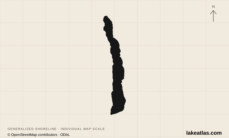
Which Torch Lake is this?
This profile covers the Torch Lake near Alden, Eastport and the Torch River in Antrim and Kalkaska counties. It is part of the Elk River Chain of Lakes in the northern Lower Peninsula. Torch Lake Township is one local jurisdiction, not another name for the entire lake; the shoreline extends beyond a single township.
Do not confuse it with Torch Lake in Houghton County on the Upper Peninsula. That separate lake is associated with the Keweenaw copper-mining district and its environmental cleanup. Using Alden or Antrim County with the lake name makes searches, accommodations and driving destinations less ambiguous.
Match the numbered places to the list below. Open the full-size map for labels and detail.
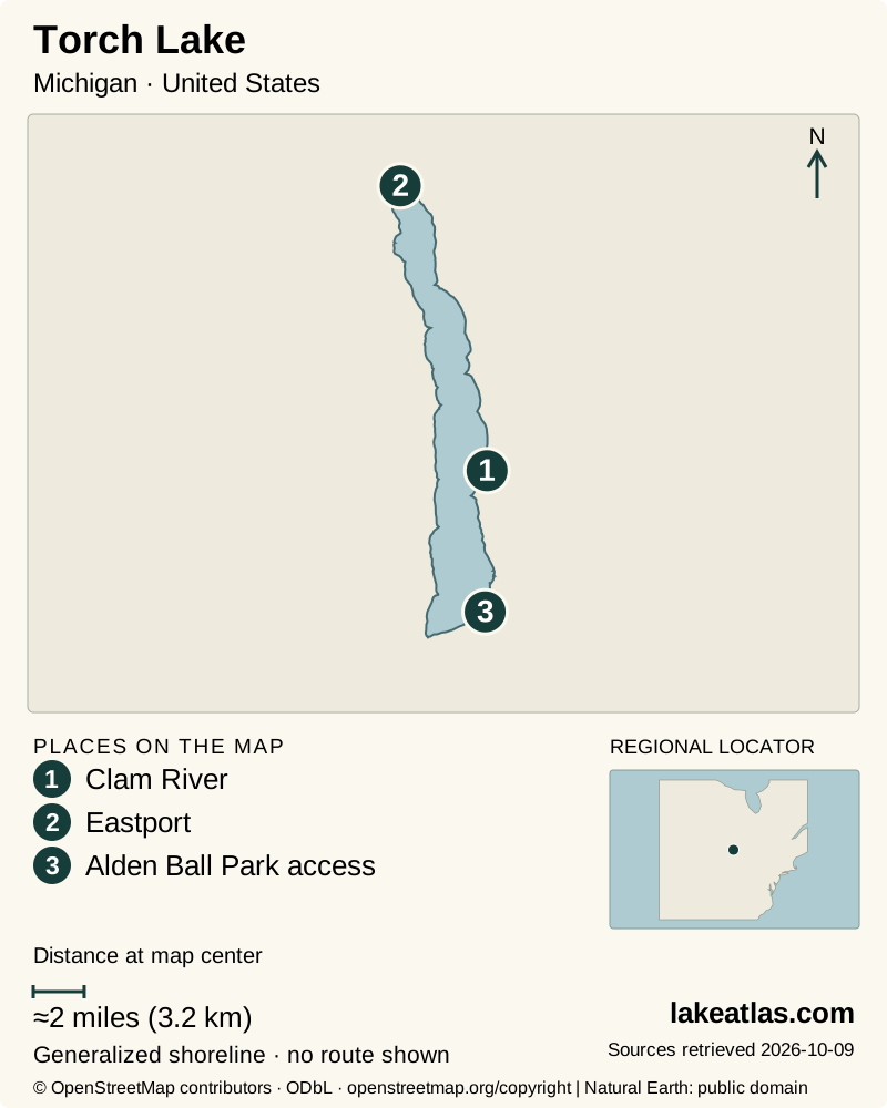
- 1Clam River
- 2Eastport
- 3Alden Ball Park access
Map design: LakeAtlas. Shoreline and place sources: Natural Earth (public domain) and © OpenStreetMap contributors (ODbL). Locator: Natural Earth. Retrieved October 9, 2026. Individual source links are in the downloadable GeoJSON. Alden access location: Michigan Water Trails. Map data (GeoJSON).
Why the sandbar does not describe the lake
The Watershed Council’s 2017 shoreline survey gives an area of 28.9 sq mi (74.8 km²) and a maximum depth of 285 ft (86.9 m). Other summaries give different areas or round its depth upward. Here the survey’s explicit area and bathymetric figure provide one consistent reference; maximum depth is not an average or a typical swimming depth.
Shallow shelves fringe parts of the shoreline before dropping steeply into the basin. The popular southern sandbar can therefore give a misleading first impression. In a documented 2025 holiday rescue, a swimmer who left the sandbar encountered deep water and increasing wind. Stay with your planned access and boat rather than treating the shallows as a route across the lake.
From an ancient bay to an inland lake
Glaciers excavated and deposited material across this landscape, and retreating ice changed the level and outlets of the ancestral Great Lakes. Torch Lake later occupied a deep bay connected with ancient Lake Michigan. A sand barrier eventually separated that bay from the larger water body.
Today the Clam River is its principal inlet, and water leaves the southern end through the Torch River toward Lake Skegemog. The shoreline varies between cobble and sand rather than forming one continuous beach. That glacial setting and deep basin help explain the striking change between pale shallows and deeper water, while the depth stores substantial heat and makes ice formation variable.
Alden is the practical base for a shore visit
Alden offers a cluster of municipal parks and public accesses instead of requiring visitors to book a private lakeside property. The small Safe Harbor has a boat launch and docks; parking is a separate consideration, with the water-trail listing directing visitors to Depot Park. Treat harbor space as working boat access, not a place to spread out across a launch.
For a land-based first look, start with the village’s public waterfront and return to Alden for services. A driving circuit can show more of the basin, but a road following the lake does not make the intervening private shoreline open to visitors. Choose the next public destination before setting off.
Choose the launch for your boat and abilities
Alden Ball Park provides a named carry-in option at 11656 South East Torch Lake Drive. Its route to the water is longer than 150 ft (45.7 m), with steps and a steep slope. A ramp helps move boats up and down; it is not evidence of a step-free route for people. Parking, restrooms and a picnic area are listed at the site.
William K. Good Day Park on the northwestern shore offers a different kind of stop: picnicking and a designated buoyed swim area. The township rules state that no lifeguard is on duty and reserve the dock for launching. Confirm the current facility rules before arriving with a particular craft, rather than assuming that every lakeside park serves kayaks, trailered boats and swimmers equally.
Best time to visit Torch Lake
Summer offers the most obvious boating and swimming plans, but holiday pressure is concentrated at the sandbar and boat accesses. The DNR’s July 2025 reports document large crowds and water-safety incidents there. An early decision about your access point, parking and return plan is more useful than arriving at the south end expecting an unlimited public beach.
Spring and fall shift the emphasis toward shore visits and paddling only when wind, water and facilities suit the outing. The Alden carry-in listing identifies spring, summer and fall availability; it is not a winter maintenance guarantee. In winter, the lake’s stored heat can delay or prevent freezing in some years. Visible ice at the edge does not establish a route across the basin.
Plan a focused first visit
A car is useful for reaching Alden and the scattered shore sites. Once in the village, combine a public waterfront stop with a walk through the compact center. If paddling is the main purpose, inspect the actual carry-in terrain first, then choose an outing compatible with wind and boat traffic rather than committing to a lake crossing.
The lake’s appeal also depends on the shoreline around it. Development can remove vegetation that filters runoff and protects habitat. Use established access, keep equipment and litter out of private or vegetated shore areas, and leave the sandbar as one optional stop rather than making it the definition of the entire lake.
What did we learn about Torch Lake?
Torch is a deep lake with a shallow edge, not a giant sandbar. Its best-known gathering place explains little about its full geography or the effort needed at a particular launch. For a first visit, use Alden and a named public waterfront destination, then let the conditions and access terrain determine how much time to spend on the water.
Sources & data notes11 references · Checked October 9, 2026
Data notes
Area and maximum depth follow the Watershed Council’s 2017 shoreline survey. Other source series differ. This is the Antrim/Kalkaska lake, not the Houghton County namesake.
- The 2017 survey’s area is 28.9 sq mi (74.8 km²); other inventories publish different delineations. Its original acreage is retained in the measurement record and converted directly for display.
- The overview coordinate identifies a USGS lake sampling location, not an entrance. The separate Alden access coordinate is from Michigan Water Trails.
Suggested visits are researched planning guidance, not firsthand travel reports.
References
- Tip of the Mitt Watershed Council — Torch Lake Shoreline Survey 2017
- Tip of the Mitt Watershed Council — Torch Lake Michigan
- Torch Conservation Center — How Torch Lake Was Formed
- Helena Township — Parks and Recreation
- Michigan Water Trails — Alden Ball Park Water Access
- Michigan Water Trails — Alden Safe Harbor
- Torch Lake Township — William K. Good Day Park rules
- Michigan DNR — Conservation Officer Biweekly Reports, June 22–July 5, 2025
- Michigan EGLE — Torch Lake Area of Concern
- USGS — Torch Lake Near Creswell, Michigan
- Torch Conservation Center — Boating
Source selection & methodology. Image credits appear beside each image.