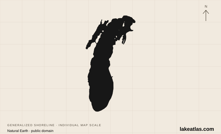
Where is Lake Michigan?
Michigan, Indiana, Illinois and Wisconsin surround the lake. Chicago occupies the southwestern shore; the Michigan side runs north toward the Straits of Mackinac, where the water connects with Lake Huron. Green Bay is a large arm on the northwestern side, so a shoreline view there has a different orientation and degree of shelter from the open main basin.
The distinction between Michigan and Huron is geographic and conventional. Water can move through the deep, open straits in either direction, and the basins maintain nearly the same level. NOAA consequently treats Michigan–Huron as one hydraulic lake. This does not make the usual separate names wrong; it explains why a water-level chart may combine them while a travel map does not.
Michigan’s basin is part of the Great Lakes landscape shaped by the Laurentide ice sheet. Moving ice excavated the underlying terrain, and water occupied the basin as the ice retreated. Modern beaches, dunes and wetlands are parts of a shoreline that continued to develop after that glacial beginning.
Match the numbered places to the list below. Open the full-size map for labels and detail.
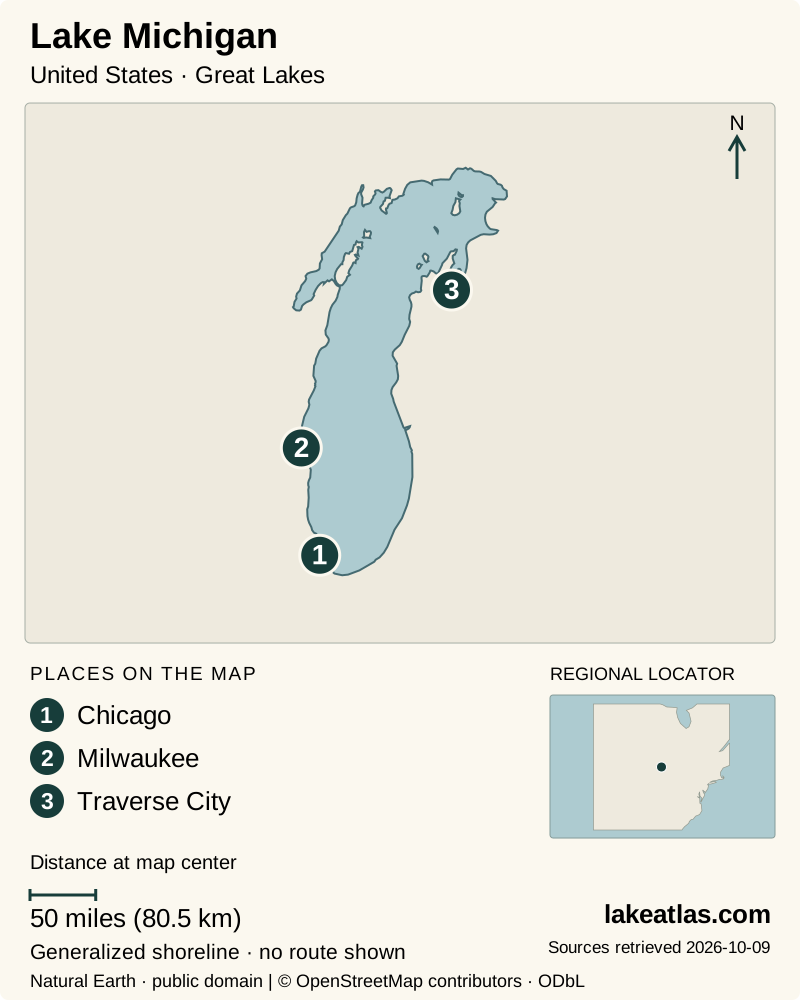
- 1Chicago
- 2Milwaukee
- 3Traverse City
Map design: LakeAtlas. Shoreline and place sources: Natural Earth (public domain) and © OpenStreetMap contributors (ODbL). Locator: Natural Earth. Retrieved October 9, 2026. Individual source links are in the downloadable GeoJSON. Map data (GeoJSON).
How large and deep is Lake Michigan?
Lake Michigan covers 22,300 sq mi (57,800 km²). Its maximum depth is 925 ft (282 m), compared with a mean depth of 279 ft (85 m), and its reference volume is 1,180 cu mi (4,920 km³). These measurements describe the water basin, not the area of the states around it.
A deep lake can still have shallow swimming areas, offshore bars and abrupt local drop-offs. The basin’s maximum depth is therefore useful for comparisons but tells you little about conditions at a particular beach. Choose a beach using the managing park’s information and the day’s warnings.
Choosing a shore: dunes or Green Bay?
Sleeping Bear Dunes National Lakeshore, around Empire on the Michigan side, is a strong choice for high views over open water. Forest, dune country and historic Glen Haven give a visit variety without requiring a boat. The Philip A. Hart Visitor Center is a useful first stop for maps and advice on matching walks to the group’s abilities.
Indiana Dunes National Park offers a southern-shore alternative near the Chicago region. Its protected areas include beaches, woods and wetlands as well as sand hills. The park is spread among communities and roads: decide which beach or trailhead you mean before starting navigation, rather than assuming that arriving at the visitor center means arriving at the water.
In Wisconsin, Peninsula State Park near Fish Creek looks across Green Bay. Shore Road follows the lower coast, while Skyline Road reaches higher terrain and views toward islands. This is a good base for a combination of woodland, overlooks and shoreline stops. It also makes a useful distinction for a map: Door County separates Green Bay from the main body of Lake Michigan.
A practical first visit to Sleeping Bear Dunes
Begin with orientation in Empire, then use Pierce Stocking Scenic Drive for a sequence of forest and dune viewpoints. The drive lets a group sample several landscapes without making every stop a long hike. Its overlooks have different access conditions, so a scenic-drive label should not be read as a promise that every viewpoint is step-free.
The Dunes Overlook has a ramped viewing deck, while reaching the Lake Michigan and Sleeping Bear Dune overlooks involves steeper pavement and loose sand. Choose stops individually if mobility is a concern. NPS also excludes trailers from the drive; consult the park’s vehicle guidance before bringing a larger rig.
At the Lake Michigan bluff, enjoying the view from above is a complete activity. Descending the steep face creates a strenuous return and can dislodge material onto people below. The separate Dune Climb is the designated familiar sand-climbing destination; neither the name nor an apparent view toward the lake means that a full crossing to the water is a short stroll.
Beaches need their own plan
Lake Michigan can produce surf and dangerous currents despite being freshwater. Indiana Dunes advises staying out when high waves or rip-current warnings occur and avoiding water near structures such as seawalls. Wind can carry floating toys away from land. Beach plans should follow local warnings rather than a general forecast for the nearest city.
Keep a land-based option ready: a dune overlook, visitor center or woodland walk can still make a worthwhile lake day. At Peninsula State Park, Nicolet Beach has an access mat and a beach wheelchair, but no lifeguard. Those access features help people reach the beach; they do not remove the need to assess the water.
When to go and how to get around
Summer provides the most straightforward combination of beaches and visitor facilities, and Sleeping Bear’s popular stops can be crowded. Spring and fall can suit walking and quieter sightseeing, but do not assume a scenic road is open merely because a trail remains accessible. Pierce Stocking normally opens to vehicles from late May into late October, with exact access dependent on conditions; during its vehicle closure, walking access is treated separately.
A car makes it easier to connect the scattered mainland stops. Indiana Dunes also has South Shore rail stations within the park area, giving travelers from the Chicago direction a public-transport option. The final connection still needs planning: check the station, walking route and current train timetable for the specific destination.
For a manageable first trip, keep Sleeping Bear, Indiana Dunes or Peninsula State Park as the main focus rather than joining them into a rushed circuit. Within that region, pair one shoreline activity with a second option that does not depend on calm water. This gives the trip a clear shape while leaving room for the conditions you actually encounter.
What did we learn about Lake Michigan?
Lake Michigan combines the scale of a major freshwater basin with very different ways of meeting its shore. Its connection to Huron explains the water system; dunes, park roads and city-region access explain the visitor experience. Choose a shoreline region first, then match the day’s walk or beach stop to its terrain and weather.
Sources & data notes13 references · Checked October 9, 2026
Data notes
Rounded NOAA GLERL reference statistics. Depths and volume are measured at Low Water Datum; present water levels vary. Comparisons use maximum depth, not mean depth.
- Area is water surface area, not the surrounding drainage basin. Maximum depth and mean depth describe different properties. Depths and volume use the source’s Low Water Datum, not today’s water level.
- NOAA’s published US and metric figures are independently rounded; both are retained instead of converting one rounded value into the other. ILEC uses a different source series for lake areas; its coordinates alone are used for the overview marker.
- Newer NOAA technical material gives slightly different Michigan area and maximum-depth figures. This profile retains the coordinated GLERL table for a consistent Great Lakes comparison series rather than mixing reference datasets.
Suggested visits are researched planning guidance, not firsthand travel reports.
References
- NOAA GLERL — Physical Characteristics of the Great Lakes
- ILEC — United States lake inventory
- ILEC — Lake Michigan
- NOAA — Technical Memorandum NOS CS 42
- National Park Service — Sleeping Bear Dunes things to do
- National Park Service — Pierce Stocking Scenic Drive
- National Park Service — Sleeping Bear Dunes safety
- National Park Service — Indiana Dunes directions
- National Park Service — Indiana Dunes basic information
- Wisconsin DNR — Peninsula State Park sightseeing
- Wisconsin DNR — Peninsula State Park water recreation
- National Park Service — Indiana Dunes swimming
- NOAA — Great Lakes ecoregion and formation
Source selection & methodology. Image credits appear beside each image.