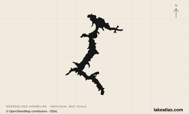
Where is Lake Coeur d’Alene?
The lake lies in Kootenai and Benewah counties in Idaho’s Panhandle. The city of Coeur d’Alene occupies the northern end; Harrison is a useful southeastern gateway, and Plummer provides an approach to Heyburn State Park near the southern connected lakes. Spokane, Washington, is a regional gateway rather than a town on the lake.
The Coeur d’Alene and St. Joe rivers feed the lake, and the Spokane River is its surface outlet at the north end. This drainage connection should not be confused with the city’s name: a waterfront outing on the Spokane River is a different location from a beach on the lake itself. The southern lake is part of the Coeur d’Alene Tribe’s homeland and reservation setting.
Match the numbered places to the list below. Open the full-size map for labels and detail.
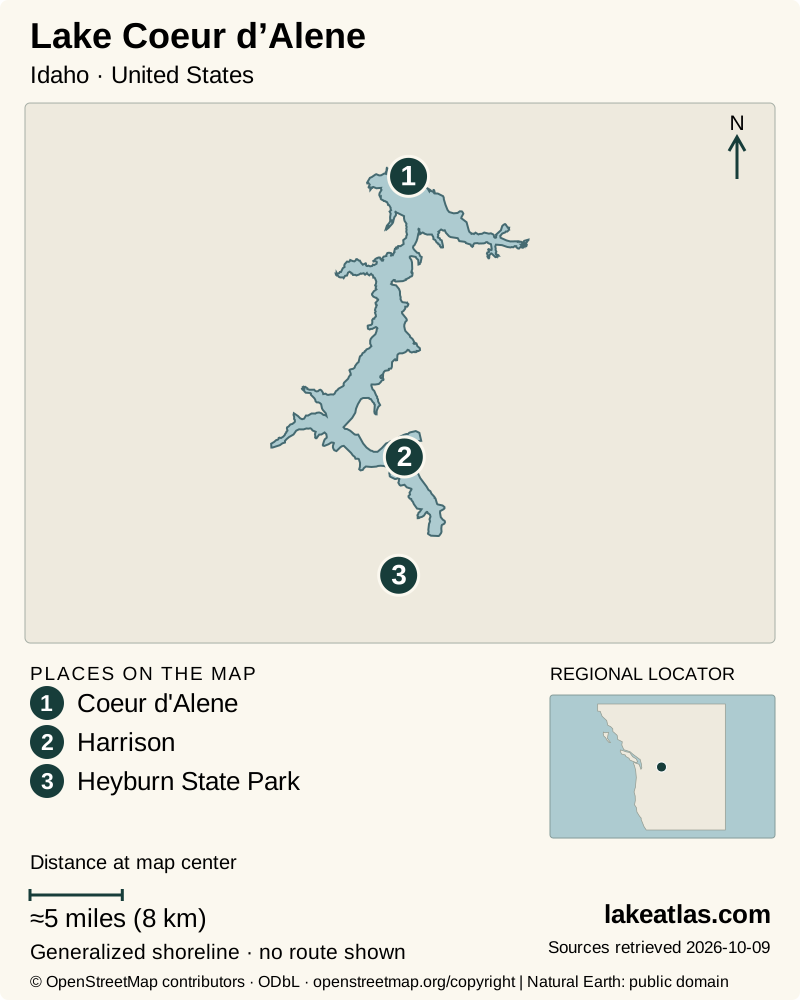
- 1Coeur d'Alene
- 2Harrison
- 3Heyburn State Park
Map design: LakeAtlas. Shoreline and place sources: Natural Earth (public domain) and © OpenStreetMap contributors (ODbL). Locator: Natural Earth. Retrieved October 9, 2026. Individual source links are in the downloadable GeoJSON. Map data (GeoJSON).
Ice Age floods, modern regulation and lake depth
USGS explains that floods from Glacial Lake Missoula deposited gravel across the Spokane valley, blocking an older drainage and creating the lake. Its elongated arms follow the drowned river landscape. Later construction of Post Falls Dam raised and regulated water, expanding the connection with shallow lakes and wetlands at the southern end.
The scientific reference surface area is 49.8 sq mi (129 km²), at full summer pool. Maximum depth is approximately 210 ft (64 m), while mean depth is about 72 ft (22 m). The deepest basin is therefore very different from the shallow connected southern waters.
These measurements describe the basin at a stated reference level. They do not establish the depth at a marina today. For comparison with another lake, retain the distinction between maximum depth, average depth and surface area rather than treating any one of them as a complete measure of size.
City beaches, McEuen Park and Tubbs Hill
The northern waterfront is the most convenient starting point for visitors staying in Coeur d’Alene. City Park has a public beach, picnic facilities, restrooms and a playground. Nearby McEuen Park combines waterfront views and recreation space with a boat launch and the western trailhead for Tubbs Hill.
Tubbs Hill is a wooded peninsula bordered by water on three sides. The city identifies a 2.2 miles (3.5 km) interpretive route around its perimeter, with a second trailhead at the south end of 10th Street. The loop is a lake-view hike, not a flat promenade; choose a route and turnaround point that match your ability rather than assuming every shoreline path has the same surface.
A useful first visit pairs the city waterfront with part or all of the Tubbs Hill loop. It gives both an urban approach and a more enclosed forest-and-cove landscape without a long drive around the lake. Beach access, a trailhead and a boat launch are separate facilities, so follow the signs for the activity you actually intend.
Harrison, Bell Bay and the connected southern lakes
Harrison offers a different base from the city waterfront. Bell Bay Campground, north of Harrison on the southeastern shore, has forested camping and boat docks. Recreation.gov describes the dock-to-campground walk as short but steep, a useful reminder that a lakeside campsite can still involve a climb.
Heyburn State Park occupies the southern lake complex around Chatcolet, Benewah and Hidden lakes. The St. Joe River and wetlands create a landscape of sheltered water and marsh rather than the open northern basin. Choose Heyburn for its own paddling, camping and trail setting instead of expecting another version of downtown Coeur d’Alene.
The Trail of the Coeur d’Alenes passes through this region on a paved former rail corridor, including lakeshore sections and the Chatcolet crossing. The state identifies an accessible trail, but parking and the chosen trailhead still matter. Private docks and properties beside the corridor are not public rest stops.
Clear-looking water and a complicated mining legacy
Historical mining in the watershed left metal-rich sediments in the lake bed. Idaho DEQ explains that nutrients and oxygen conditions influence how those metals behave; controlling erosion and nutrient input is therefore part of protecting the lake, not merely preserving an attractive view.
Use designated recreation facilities and follow posted health guidance. Along the Trail of the Coeur d’Alenes, managers ask visitors to stay on the trail, use designated picnic areas and wash hands before eating. A maintained path through the watershed is not permission to explore adjacent disturbed soil or private shore.
The Tribe, state and scientific agencies bring different responsibilities to this shared water. The lake’s significance includes its cultural setting and environmental history as well as beaches, boating and waterfront development.
Getting around and choosing public access
A car is useful for moving between the northern city, Harrison and the southern park complex. The city waterfront can be explored on foot once parked, and McEuen Park connects with the Centennial Trail for a separate cycling option. Do not confuse that trail with the Trail of the Coeur d’Alenes farther south.
For boating from the city, use the Third Street Boat Ramp and follow its launch, trailer-parking and dock-time rules. A hotel or private marina shown beside the water does not automatically provide public access. If a tour or rental is central to the visit, confirm its departure point and operating arrangements before arriving.
On the busy summer waterfront, allow time to park and walk to the intended facility rather than planning around an assumed space beside the beach. A shorter visit within one shore region is more practical than trying to combine every park and community on the lake.
Seasonal visits and current park constraints
Summer concentrates beach, boating and campground use; shoulder seasons suit a more land-based trip when individual facilities may have reduced service. Winter conditions can change the footing on trails, and an open park does not mean every dock, campground or route is operating.
Checked October 9, 2026: Heyburn’s park page reports storm-damaged trails and construction at Rocky Point Boat Launch, with Chatcolet identified as an alternative launch. The project notice extends at least through the end of the year and potentially into spring. Confirm current status directly before choosing that destination; older pages still display a different construction phase.
For a first day, keep the plan coherent: City Park and Tubbs Hill for a northern lake introduction, or a confirmed southern park and trailhead for wetlands and the connected lakes. They offer different experiences because they occupy different parts of the basin.
What did we learn about Lake Coeur d’Alene?
Coeur d’Alene is both a city waterfront and a much larger river-and-lake landscape. The northern parks, wooded eastern shore and shallow southern complex reward different plans. Start with a named public destination, then let its terrain, current access and place in the basin shape the visit.
Sources & data notes12 references · Checked October 9, 2026
Data notes
Area and maximum depth follow the USGS study at full summer pool: 49.8 sq mi (129 km²) and approximately 210 ft (64 m). Maximum depth retains the National Academies’ source-published US/metric pair. Other visitor summaries round area or quote different depths; these are not averaged into the scientific baseline.
- Area and maximum depth follow the USGS study at full summer pool: 49.8 sq mi (129 km²) and approximately 210 ft (64 m). Maximum depth retains the National Academies’ source-published US/metric pair. Other visitor summaries round area or quote different depths; these are not averaged into the scientific baseline.
- The 72 ft (22 m) mean depth is a separate basin measure, not the deepest point. Natural-lake origin is distinguished from present regulation through Post Falls Dam.
- Tubbs Hill distance is the city’s 2.2 miles (3.5 km) perimeter interpretive route, a loop rather than a parking-to-beach distance. The global marker uses the USGS north-end station.
- Heyburn construction and storm-damage notices were checked October 9, 2026; confirm the named launch and trail before traveling. The older Trail of the Coeur d’Alenes closure banner differs from the current park notice, so the park is the primary source for present access.
Suggested visits are researched planning guidance, not firsthand travel reports.
References
- USGS — Coeur d’Alene Lake, Idaho: Description of Study Area
- National Academies — The Future of Water Quality in Coeur d’Alene Lake
- Idaho DEQ — Coeur d’Alene Lake Management
- Idaho DEQ — Spokane River (Upper) Subbasin
- City of Coeur d’Alene — Tubbs Hill Natural Area
- City of Coeur d’Alene — McEuen Park (& Dog Park)
- City of Coeur d’Alene — Cd’A City Park
- Idaho Parks and Recreation — Heyburn State Park
- Idaho Parks and Recreation — Trail of the Coeur d’Alenes
- Recreation.gov — Bell Bay Campground
- USGS — Coeur D Alene Lake at Coeur D Alene ID
- City of Coeur d’Alene — Third Street Mooring Dock
Source selection & methodology. Image credits appear beside each image.