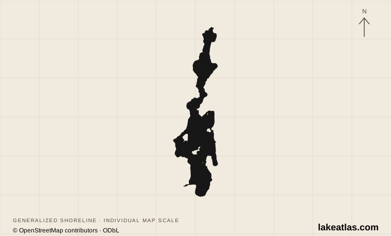
Where is Priest Lake?
Priest Lake is in Bonner County at the northern end of Idaho’s Panhandle. Priest River is the southern highway gateway, while Coolin serves the southeastern lake and Nordman the northwestern approach. The Selkirk Mountains rise along the broader eastern and northern landscape.
The main lake extends north toward a narrow connection called the Thorofare, also spelled Thoroughfare in visitor material. Beyond it lies Upper Priest Lake. Those names describe two connected water bodies: reserving a cabin or campsite on Priest Lake does not place you at Upper Priest’s remote shoreline.
The state-park units and federal campgrounds are also separate destinations. Indian Creek and Lionhead are on the eastern side, while Beaver Creek is reached from the northwest. Pick the correct unit before starting the drive; the lake itself is not a single entrance address.
Match the numbered places to the list below. Open the full-size map for labels and detail.
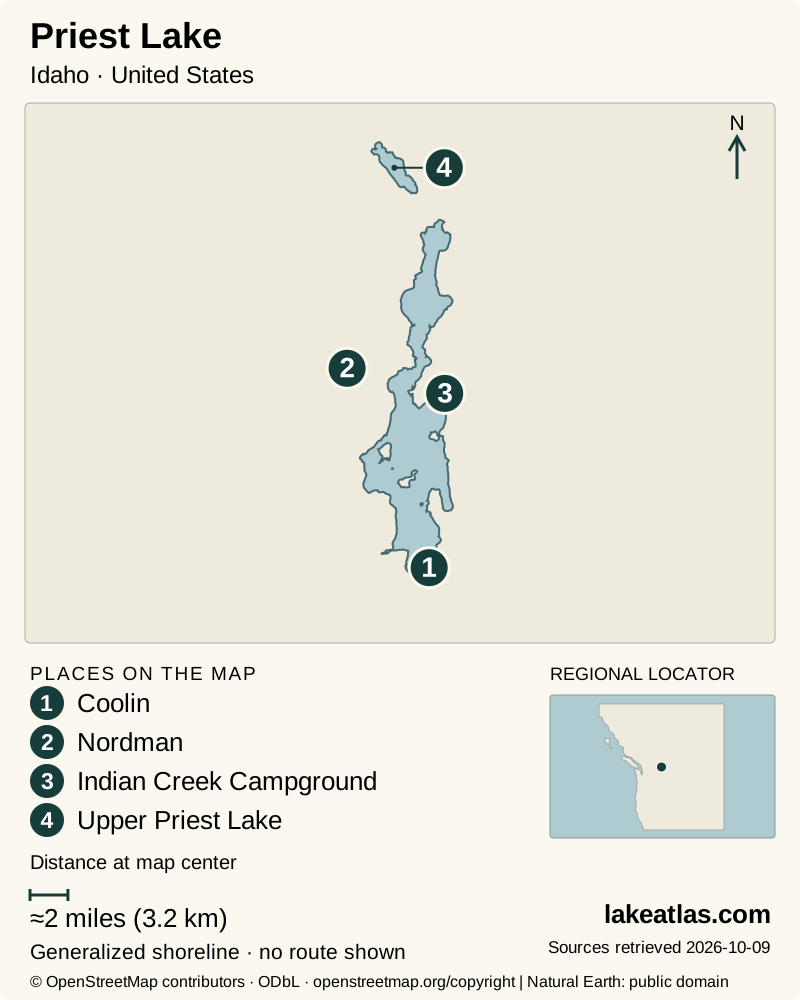
- 1Coolin
- 2Nordman
- 3Indian Creek Campground
- 4Upper Priest Lake
Map design: LakeAtlas. Shoreline and place sources: Natural Earth (public domain) and © OpenStreetMap contributors (ODbL). Locator: Natural Earth. Retrieved October 9, 2026. Individual source links are in the downloadable GeoJSON. Map data (GeoJSON).
Glacial history, clear water and a regulated outlet
The basin’s landscape records an Ice Age shaped by glaciers, glacial lakes and flood deposits. USGS research describes an earlier glacial Priest Lake held behind ice, with layers that record floods from Lake Missoula. Today’s forested lake occupies part of that inherited mountain-and-valley setting.
The Forest Service describes the Priest region as a bowl enclosed by high ridges, with cool moist conditions, persistent low-elevation snow and extensive cedar and hemlock forest. That setting helps explain the different feel from drier inland lake districts: shade and dense forest are central parts of the shoreline experience.
Water leaves the main lake through the Priest River. The lake is natural, but an outlet dam controls seasonal levels; Idaho’s water agency dates the first outlet dam to 1950 and the present structure to 1978. A regulated natural lake is different from a reservoir created by flooding a previously dry valley.
How large and deep is Priest Lake?
The current state fisheries plan gives the main lake an area equivalent to about 36.5 sq mi (94.5 km²) and a maximum depth of 369 ft (112.5 m). Maximum depth is the deepest basin point, not an average across beaches, bays or the connecting channel.
Upper Priest Lake has its own dimensions and fisheries management. Combining the two would misrepresent the main-lake figures used in comparison tools. The main lake’s area is also approximate: Idaho’s Fishing Planner uses a slightly different mapped acreage than the fisheries plan.
Water depth in the Thorofare is much more immediately useful to a boat trip than the deepest sounding in Priest Lake. The fisheries plan describes restricted clearance when water is low. A channel shown as connected on a map is not a promise that every boat can pass at every season.
Indian Creek, Lionhead and Beaver Creek
Indian Creek is a developed state-park base for camping, cabins and lake access. The park map separates day-use areas, the boat launch and campground loops. It is a useful choice when a public shoreline visit and established facilities are the priority, rather than an expedition into the upper basin.
Lionhead is a separate northeastern unit, with its own campground and group arrangements. Do not assume a booking at one state-park unit gives you accommodation at the other. Check the exact reservation and facility location before loading a car or arranging a boat pickup.
Beaver Creek provides a federal alternative on the northwestern main lake. Recreation.gov lists reservable camping, water and vault toilets, with a boat ramp outside the campground entrance limited to boats no longer than 20 ft (6.1 m). The access road comes from Nordman via Reeder Bay Road. It is a useful starting area for the northern lake, but campground availability and boat suitability need separate checks.
Reaching Upper Priest Lake
Upper Priest is reached by water or trail rather than a road along its shore. Idaho Parks identifies access on foot, by mountain bike or by boat. A boat journey uses the Thorofare; a land journey requires an actual trail plan. Neither should be reduced to a generic “easy lake” label.
The Forest Service’s recreation sheet identifies public shore-camping sites around Upper Priest, including Navigation, Plowboy, Trapper and Geisinger. Use current manager information for the intended site and carry what the route requires. A symbol on a regional map does not establish available space, drinking water or accessible facilities.
For a first visit, a main-lake shoreline day is a sound starting point. Add an Upper Priest excursion only after confirming channel conditions or the trail route, return transport and the current rules for the selected public site. It offers a quieter landscape, but that comes from limited access rather than from resort-style services hidden out of view.
Paddling, camping and the fish community
Paddling and boating reveal coves, islands and the contrast between developed and forested shores. Choose the named launch that suits the vessel and forecast; avoid treating a private cabin beach or dock as a public landing. For a land-based trip, use the public day-use areas and trails within the unit you selected.
The state fisheries plan distinguishes management of lake trout in the main lake from efforts to protect native bull trout and westslope cutthroat trout in the larger drainage. Upper Priest has its own conservation measures, including removal of nonnative lake trout. Clear water does not mean the two fisheries are interchangeable.
Camping can put more of the shore within reach, but state and federal bookings use different systems. Reserve the actual campground rather than a generic Priest Lake destination, and check whether water, toilets and launch facilities will operate during your stay.
Summer lake visits and winter forest access
Summer is the most direct season for combining a campground stay with boating and a public beach. The lake’s mountain setting still requires attention to wind and weather, while shallow-channel passage varies with lake level independently of a warm day.
Autumn changes both services and access: the fisheries plan describes seasonal lake-level regulation, and low water can restrict the Thorofare. Confirm the campground and launch, rather than assuming an available road means every facility remains open.
Winter turns the surrounding forest into a Nordic-ski and snowmobile region. Indian Creek offers winter recreation, and Idaho Parks directs winter travelers to current road, grooming, weather and avalanche information. Snow on a forest road can change how a summer trailhead is reached; use current access information instead of following a summer driving description uncritically.
Planning a first visit
Choose one side of the main lake. An Indian Creek day can combine the designated lakefront with a short outing on the park’s marked trails; a Beaver Creek stay places you closer to the northwestern shore. Confirm the specific trail or beach route with staff if surface, grade or steps affect your visit.
A car is useful for reaching those established facilities, but it cannot carry you around Upper Priest Lake. Boat transfers and trail travel require their own time and equipment. Keeping that distinction clear makes Priest Lake’s appeal easier to understand: public recreation areas give access to a much larger forest-and-water landscape without making all of it equally reachable.
What did we learn about Priest Lake?
Priest Lake’s public campgrounds and state parks are gateways into a much larger forested basin. The main lake and Upper Priest share water but offer different access: one has road-based recreation areas, while the other requires a trail or boat journey. Choose that experience first, then match the route to water levels and season.
Sources & data notes11 references · Checked October 9, 2026
Data notes
Quick facts use Idaho Fish and Game’s 2025–2030 fisheries plan: approximately 36.5 sq mi (94.5 km²) of surface area and a maximum depth of 369 ft (112.5 m). The Fishing Planner instead maps 36.5 sq mi (94.4 km²); the small area difference is retained as a source-method distinction rather than averaged. Original acreages remain in the measurement registry.
- Quick facts use Idaho Fish and Game’s 2025–2030 fisheries plan: approximately 36.5 sq mi (94.5 km²) of surface area and a maximum depth of 369 ft (112.5 m). The Fishing Planner instead maps 36.5 sq mi (94.4 km²); the small area difference is retained as a source-method distinction rather than averaged. Original acreages remain in the measurement registry.
- Upper Priest Lake is a separate connected lake and is excluded from the main-lake area/depth comparison. Official sources give different approximate lengths for the Thorofare, so this profile does not turn a general description into a precise paddling distance.
- The natural lake’s seasonal level is regulated at the outlet. Maximum basin depth does not indicate clearance in the shallow Thorofare; verify present water levels before taking a boat through.
- The lake locator follows the USGS outlet station near Coolin. Its listed gage/land-surface altitude is not a verified surface elevation and is not used as one.
Suggested visits are researched planning guidance, not firsthand travel reports.
References
- Idaho Fish and Game — Idaho Fisheries Management Plan 2025–2030
- Idaho Department of Water Resources — Frequently Asked Questions
- Idaho Parks and Recreation — Priest Lake State Park
- Recreation.gov — Beaver Creek (Idaho)
- US Forest Service — Priest Lake Water—Accessed Public Recreation Facilities
- US Forest Service — Idaho Panhandle National Forests geographic area descriptions
- USGS — Periodic jökulhlaups from Pleistocene glacial Lake Missoula-New evidence from varved sediment in northern Idaho and Washington
- Idaho Parks and Recreation — Priest Lake State Park campground map
- Idaho Parks and Recreation — Snowmobiling
- USGS — Priest Lake at Outlet NR Coolin ID
- Idaho Fish and Game — Priest Lake
Source selection & methodology. Image credits appear beside each image.