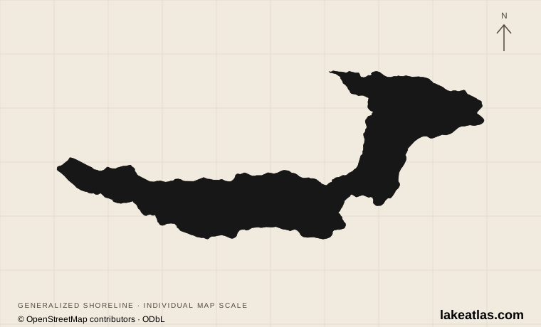
Where Lake Crescent sits in Olympic National Park
Lake Crescent lies in the northern Olympic Peninsula, between Port Angeles and the western park destinations. US 101 runs beside the lake rather than around every shore. The steep terrain channels access into a few places; the lake is not a waterfront town with a continuous public promenade.
Barnes Point is the main south-shore cluster, with Lake Crescent Lodge, Storm King Ranger Station and nearby walks. Fairholme lies at the west end, while East Beach Road serves the eastern and northeastern approaches, including Log Cabin Resort and the Spruce Railroad Trail. Choose the particular entrance before setting a navigation destination.
Match the numbered places to the list below. Open the full-size map for labels and detail.
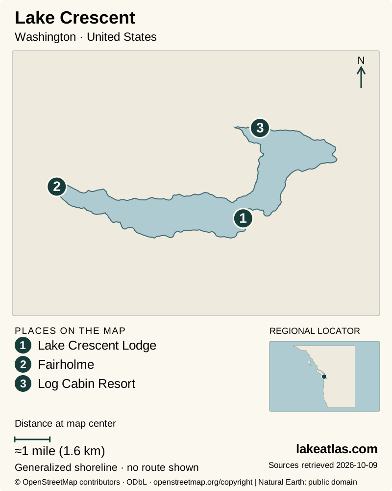
- 1Lake Crescent Lodge
- 2Fairholme
- 3Log Cabin Resort
Map design: LakeAtlas. Shoreline and place sources: Natural Earth (public domain) and © OpenStreetMap contributors (ODbL). Locator: Natural Earth. Retrieved October 9, 2026. Individual source links are in the downloadable GeoJSON. Map data (GeoJSON).
Ice, a landslide, and a deep freshwater basin
NPS publishes a maximum depth of 624 ft (190 m), while Washington’s lake inventory gives an area of 7.9 sq mi (20.33 km²). Depth describes the deepest point; area measures the surface footprint. Neither tells you how deep a particular beach or launch becomes just offshore.
Ice carved the valley before it filled with water. Around 7,000 years ago, a major landslide separated Lake Crescent from neighboring Lake Sutherland. The landscape therefore records both glacial erosion and a later event that altered the lake’s connections.
Low nitrogen availability limits the growth of much of the lake’s phytoplankton, helping explain its clarity. Deep water and the way light travels through it contribute to the blue appearance. Water that looks transparent from shore can still be cold and deep; clarity is not a swimming-safety rating.
Choose a shore for the visit you want
Barnes Point works well for a first visit combining water, forest and historic park lodging. Bovee’s Meadow provides a public picnic and beach setting nearby. Staying at a lodge is a separate reservation from using a public recreation area; confirm the facilities you intend to use.
Fairholme offers a campground at the western end. The NPS visitor page identifies boat launches at both ends of the lake, but launching a boat and following a shoreline trail are different plans. For an outing on the north side, head to a named Spruce Railroad trailhead instead of searching for an informal pullout on US 101.
Lake Crescent Lodge and Log Cabin Resort are seasonal concessions. Their rooms, restaurants and boat rentals should not be assumed available through winter. Port Angeles is the stronger service base for visitors who need alternatives when park facilities close.
Three walks with different demands
Moments in Time is a 0.6 miles (0.97 km) nature loop near the lodge. It follows forest and lakeside surroundings with no elevation gain listed in the park brochure. NPS describes it as accessible with assistance; that specific qualification is more useful than calling every nearby trail easy.
Marymere Falls is 0.9 miles (1.45 km) one way, with 400 ft (122 m) of elevation gain in the park’s route description. The return retraces the approach. This is a forest-and-waterfall walk rather than a path around Lake Crescent, and the final climb makes it a different choice from a short stop at the lakefront.
The Spruce Railroad Trail follows an old railway grade on the north shore for 4 miles (6.4 km) one way. NPS completed paving and tunnel restoration in 2020; bicycles and leashed pets are permitted. You can turn around earlier, but a full out-and-back doubles the distance. Check the current trail report for storm damage or closures before setting out.
Trout, boating, and protection of the lake
The Crescenti and Beardslee trout populations are part of what makes this lake ecologically distinctive. Their isolation developed after the landslide changed the basin. Fishing here follows park-specific protection rules rather than an assumption that ordinary statewide lake rules are enough.
For 2026, NPS lists Lake Crescent fishing from June 1 through October 31, catch-and-release, with specified artificial-lure and hook restrictions. Those dates describe the published 2026 season checked on October 9, not a promise for future years. Read the current regulations before bringing fishing equipment.
Boating offers another view of the mountain walls, but choose a launch or rental point and assess wind before leaving shore. NPS emphasizes cold-water conditions and life jackets. Rentals, weather and personal ability determine the suitable outing; a calm photograph cannot establish current conditions.
Best time to visit Lake Crescent
Late spring through early fall brings the broadest choice of lodging, camping and concession services. Summer is convenient for combining a walk with a lake outing, while fall can still support shore visits when weather cooperates. Check the particular lodge or campground’s operating season before reserving the rest of a trip.
Outside that period, US 101 remains the main road corridor, but weather and road notices matter. Rain, wind, fallen branches and slippery trail surfaces can change a modest walk. Seasonal ranger-station staffing is separate from access to nearby restrooms. Bring a plan that still works if a rental counter or indoor stop is closed.
A practical first visit from Barnes Point
Start at the Barnes Point area, spend time at the lake and take the Moments in Time loop if its surface and assistance requirements suit your group. Add Marymere Falls only if you want the extra walking and climb. This gives the visit a clear progression from shoreline to forest without requiring a long drive between separate entrances.
A car is useful for reaching the different public access areas and continuing around the Olympic Peninsula. This review did not establish a dependable transit connection to every trailhead; check a specific service before relying on it. NPS verifies an accessible main lodge and nearby accessible restrooms, but those features do not establish universal access to the beach or every trail.
What did we learn about Lake Crescent?
Lake Crescent’s clear surface hides a deep glacial basin, while its accessible road corridor leads to several very different kinds of outing. Barnes Point suits an introduction to the shore and forest; the north-shore railway trail gives more distance, and waterfall walks add climbing. Choose the access point and route first, then check the season’s facilities and conditions.
Sources & data notes9 references · Checked October 9, 2026
Data notes
Maximum depth retains the NPS source-published pair 624 ft (190 m). Area uses WDFW’s original acreage through the shared conversion utility: 7.9 sq mi (20.33 km²). These are reference dimensions, not a new bathymetric survey. Trail lengths identify loop or one-way routes. A one-way figure does not include the return.
- Maximum depth retains the NPS source-published pair 624 ft (190 m). Area uses WDFW’s original acreage through the shared conversion utility: 7.9 sq mi (20.33 km²). These are reference dimensions, not a new bathymetric survey.
- Trail lengths identify loop or one-way routes. A one-way figure does not include the return.
- NPS trail-condition reports take precedence over older brochure wording; seasonal facilities and 2026 fishing rules were checked October 9, 2026.
Suggested visits are researched planning guidance, not firsthand travel reports.
References
- National Park Service — Geology of Olympic
- National Park Service — Visiting Lake Crescent
- National Park Service — Lake Crescent Area Brochure
- National Park Service — Accessible Facilities
- National Park Service — Spruce Railroad Trailhead East
- National Park Service — Fishing
- National Park Service — Spruce Railroad Trail Project Complete
- National Park Service — Trail Conditions
- Washington Department of Fish & Wildlife — Lake Crescent
Source selection & methodology. Image credits appear beside each image.