Geneva Lake and the city of Lake Geneva
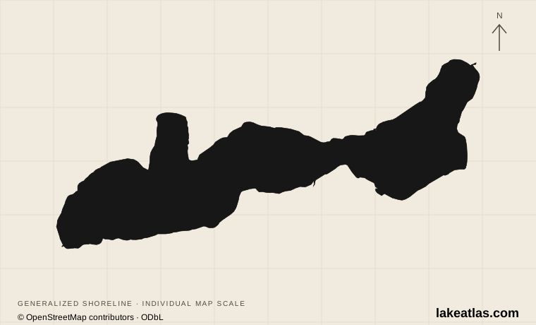
Geneva Lake is a natural freshwater lake in Walworth County, southeastern Wisconsin. Lake Geneva is the city at its eastern end; Williams Bay is on the northern shore, and Fontana occupies the western end. The names are often reversed in everyday use, but this is the Wisconsin lake, not the much larger Lake Geneva between Switzerland and France.
The towns provide different starting points. Downtown Lake Geneva puts the waterfront beside shops, restaurants, the public library and cruise docks. Williams Bay and Fontana offer other shore-path entrances, so a visit need not begin and end in the busiest eastern bay. The continuous-looking waterfront includes extensive private grounds; being able to walk past an estate does not make its lawn, pier or beach public.
Match the numbered places to the list below. Open the full-size map for labels and detail.
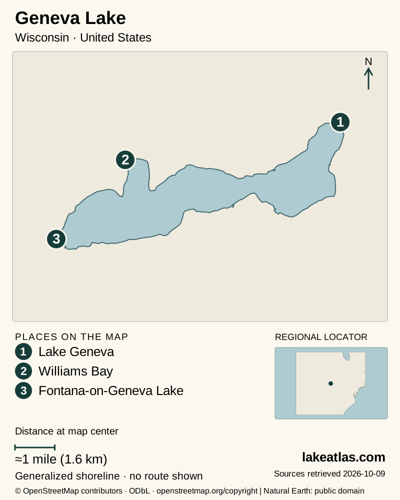
- 1Lake Geneva
- 2Williams Bay
- 3Fontana-on-Geneva Lake
Map design: LakeAtlas. Shoreline and place sources: Natural Earth (public domain) and © OpenStreetMap contributors (ODbL). Locator: Natural Earth. Retrieved October 9, 2026. Individual source links are in the downloadable GeoJSON. Map data (GeoJSON).
A glacial basin with deep water
Wisconsin DNR lists 8.4 sq mi (21.9 km²) of surface water, a maximum depth of 135 ft (41.1 m) and a mean depth of 61 ft (18.6 m). The maximum is the deepest surveyed part of the basin; the mean describes the lake as a whole. Neither figure tells you the depth beside an individual beach or dock.
The basin occupies a glacially shaped valley. Ice, meltwater and accumulated sediment changed older drainage routes, while moraine deposits helped define the lake’s ends. Its outlet runs east through the White River toward the Fox River system. Sediment research records a much longer lake history than the simplified claim that the lake appeared at one moment when the last ice melted. Published depths and areas also differ slightly; LakeAtlas uses the DNR lake inventory consistently rather than blending values from different accounts.
Walking the Geneva Lake Shore Path
The Shore Path is the lake’s most distinctive public experience: a route beside grand homes, gardens, wooded stretches and open views. It is a walking route maintained differently from property to property, with changes in surface, grade and steps. Treat the entire circuit as a substantial outing, not a paved urban promenade.
For a first walk, Visit Lake Geneva identifies the public-library waterfront downtown as a practical start and describes roughly 1 mile (1.6 km) in either direction as paved. Choose an out-and-back section that fits your group, remembering that the return adds the same distance. Public entry points also exist in Fontana, Williams Bay and Big Foot Beach State Park. Stay on the established path and use public entrances to leave it; a convenient-looking driveway through an estate is not a public shortcut.
The paved downtown section is a better starting question for a visitor with mobility needs than a claim that the whole Shore Path is accessible. Exact slopes and step-free continuity have not been independently verified for every segment. Check the intended stretch, and turn back before a surface change makes the return difficult.
Beaches, cruises and the state park
Riviera Beach is on Wrigley Drive near the downtown businesses and Riviera building. It is a municipal swimming beach with seasonal charged admission and water-quality notices. The city’s reviewed 2026 season ended on Labor Day; future dates, facilities and swimming advisories should be checked before a beach-centered trip. Clear-looking water is not a substitute for the current notice.
Big Foot Beach State Park on the southeastern shore combines a campground, picnic areas, a beach and 5 miles (8 km) of hiking trails. This is a useful alternative when your group wants time on land as well as at the lake. Vehicle admission is required. Snowshoeing and cross-country skiing are listed winter activities, while beach and camping plans need their own seasonal checks.
Boat tours offer another perspective on the shoreline estates and the lake’s long resort history. Lake Geneva Cruise Line normally uses the Riviera Docks for its main-season tours; its winter cruises depart from Williams Bay. A cruise booking therefore needs an exact dock, not simply the name of the lake. Narrated estate tours and the mailboat are distinct products with different schedules.
Choosing a season and planning access
Summer makes it easiest to combine a swim, shore walk and cruise, but the operator specifically warns about downtown traffic and parking pressure on summer days and weekends. Allow time to reach the dock on foot after parking. Spring and fall can suit a shorter shore walk or a scheduled cruise; they do not guarantee that all beaches or lake services are operating.
A car is useful for moving among the eastern city, Williams Bay, Fontana and the state park. Once parked downtown, the beach, library-side path and Riviera Docks can be combined without driving between each stop. For a simple first visit, walk a short public-library section and return, then choose either the beach or a prebooked cruise rather than committing to the full shoreline circuit.
Accessibility on a cruise depends on the vessel. The operator identifies the main levels of Lady of the Lake and Grand Belle as wheelchair accessible, but their onboard restrooms cannot accommodate a wheelchair; accessible restrooms are available at the Riviera Docks. Other vessels have different limits. Confirm the actual assigned boat and boarding arrangements when booking.
What did we learn about Geneva Lake?
Geneva Lake’s appeal comes from how much of its resort history can be understood from the water’s edge. The Shore Path connects that story, but varied surfaces and private properties make a short, deliberate section more useful than an unplanned circuit. Pair it with one beach or cruise departure and the lake becomes an easy place to explore at a human pace.
Sources & data notes9 references · Checked October 9, 2026
Data notes
Area, maximum depth and mean depth follow Wisconsin DNR’s Geneva Lake inventory. Original source acreage is retained in the measurement registry before conversion; maximum and mean depth describe different properties.
- Area, maximum depth and mean depth follow Wisconsin DNR’s Geneva Lake inventory. Original source acreage is retained in the measurement registry before conversion; maximum and mean depth describe different properties.
- Historical and scientific descriptions use other rounded depths and areas. These are not silently substituted for the DNR inventory values.
- Shore Path distances describe the identified section, not a surveyed, uniformly accessible full-lake loop. Cruise accessibility is vessel-specific.
- Lake reference coordinates come from Wisconsin DNR’s lake record; they do not identify a public entrance.
Suggested visits are researched planning guidance, not firsthand travel reports.
References
- Wisconsin DNR — Geneva Lake Facts & Figures
- Geneva Lake Level Corporation — History
- Visit Lake Geneva — Geneva Lake Shore Path
- City of Lake Geneva — The Beach
- Wisconsin DNR — Big Foot Beach State Park
- Lake Geneva Cruise Line — Frequently Asked Questions
- Lake Geneva Cruise Line — About Us
- Quaternary Science Reviews — Late glacial and Holocene paleoenvironments in the midcontinent United States, inferred from Geneva Lake leaf wax, ostracode valve, and bulk sediment chemistry
- Wisconsin Department of Tourism — Geneva Lake Shore Path
Source selection & methodology. Image credits appear beside each image.