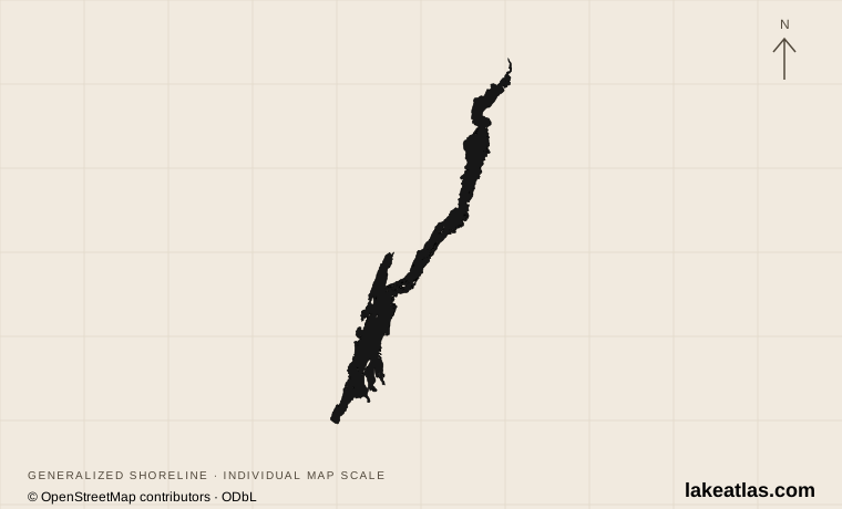
Where is Lake George?
Lake George lies in the eastern Adirondacks of New York, with Lake George village at its southern end and the outlet toward Ticonderoga at the north. It belongs to the Lake Champlain drainage basin: water leaves through the La Chute River and reaches Champlain. These are connected waters, but they are distinct lakes with different shorelines and visitor areas.
The southern village, the islands near Bolton Landing and the northern outlet make useful reference points. A southern beach visit and a stay on an island are different trips, even though both carry the Lake George name. Choose your part of the shore before booking accommodation or a campsite.
Match the numbered places to the list below. Open the full-size map for labels and detail.
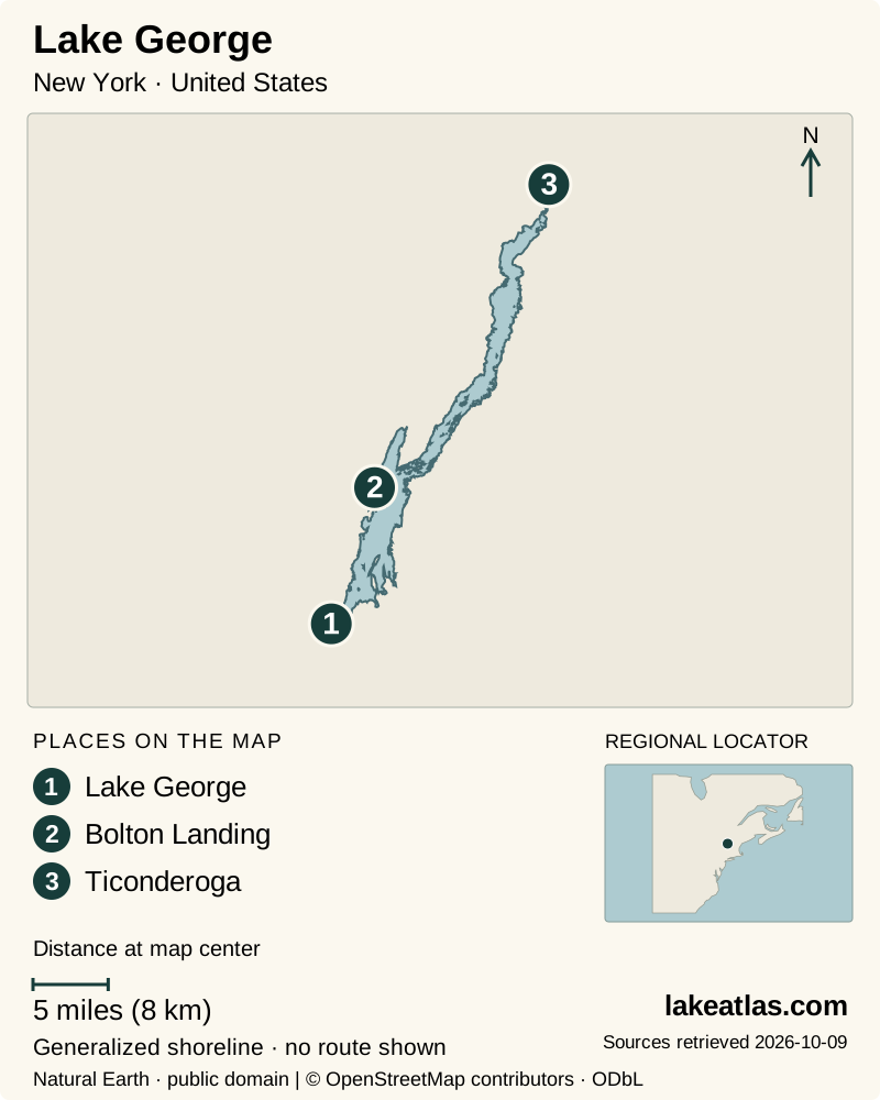
- 1Lake George
- 2Bolton Landing
- 3Ticonderoga
Map design: LakeAtlas. Shoreline and place sources: Natural Earth (public domain) and © OpenStreetMap contributors (ODbL). Locator: Natural Earth. Retrieved October 9, 2026. Individual source links are in the downloadable GeoJSON. Map data (GeoJSON).
Size, depth and a forested watershed
The Lake George Park Commission’s 2025 recreation study gives a surface area of 42.45 sq mi (110 km²) and a maximum depth of 196 ft (59.7 m). The lake extends about 32 miles (51.5 km) along a narrow mountain valley. Length describes the water body, not the mileage of a drive around its irregular shore.
Glacial deposits helped impound the lake at the end of the last ice age. Today, a largely forested watershed feeds it through mountain streams. Much of that forest is protected land, but the lake also supports shoreline communities and supplies drinking water. Clear water is a resource maintained through land and water management, not a reason to ignore runoff or invasive species.
Beach, village or island?
Million Dollar Beach, officially Lake George Beach Day Use Area, is on the southern shore within walking distance of Lake George village. It is a practical place to begin if you want to approach the water without arranging a boat. The beach has changing facilities and a designated swimming area; DEC also lists an accessible beach route and a beach wheelchair when lifeguards are on duty.
Bolton Landing offers a smaller west-shore base with public water access at Rogers Memorial Park and Veterans Memorial Park. These designated town parks matter: a long stretch of scenic shoreline is not automatically a public beach, and private docks, resorts and island property do not provide general landing permission. Decide on a park or booked facility before driving to the shore.
The island campgrounds have a different rhythm. The Long Island group is in the south, Glen Island is in the Narrows east of Bolton Landing, and the Narrow Island group lies farther north. Access is by boat, including the associated mainland sites that have no road access. A campsite reservation therefore needs a separate, workable transport plan; it does not supply a boat transfer.
A mountain walk above the lake
Prospect Mountain provides a land-based way to understand the southern basin from above. DEC describes the trail from Smith Street in Lake George village as 1.7 miles (2.7 km) to the summit, with 1,570 ft (479 m) of ascent. Those figures are one way and uphill: the return adds the same trail distance and a sustained descent.
This is a mountain hike, rather than an extension of an easy waterfront stroll. Allow time for the climb, bring suitable footwear and use DEC’s trail information for navigation. A group looking for a gentler day can stay with the southern waterfront and beach area instead of treating the summit as compulsory.
Fort William Henry and a lake cruise
Fort William Henry Museum, beside the southern village, interprets the struggle between British and French forces in 1757. It gives the resort waterfront a historical setting: Lake George was part of a strategic route toward Champlain, not an isolated mountain retreat. Check the museum’s current tour program for demonstrations and admission arrangements.
A scheduled cruise is an alternative to launching your own boat. The Lake George Steamboat Company operates several vessels, including Mohican II and Minne Ha Ha, with different departures and itineraries. Choose by the part of the lake covered and the sailing time; a short southern-basin cruise is not a full-lake journey. Reserve the particular trip and check boarding arrangements with the operator.
When to visit and what to check
Summer is the straightforward choice for a swimming-led visit because the beach operates seasonally. Swimming at the DEC beach is allowed only in designated areas while a lifeguard is on duty. A sunny day outside that operating period does not make the beach a supervised swimming facility.
Island camping also has a defined season, and the three island groups do not necessarily close on the same date. Check the specific group and launch before planning a late-season stay. On the water, DEC warns that wind and storms can develop quickly along the long basin. Stay within the capabilities of your boat and group, and use a nautical chart rather than a general visitor map.
Getting there and launching a boat
I-87, the Adirondack Northway, is the main regional road approach, with local roads leading to the different shores. Keep the chosen launch or beach as the destination in your route plan; arriving in Lake George village does not place you at every island departure point.
For a summer village visit, choose parking before adding timed activities. Beach traffic, tour departures and a walkable waterfront concentrate visitors in the same southern area. Staying near the village can reduce repeated driving for a beach-and-museum day; visiting Bolton Landing or the northern shore still requires a separate transport plan. This is itinerary guidance, not a prediction of journey time.
If you bring a trailered vessel, the Park Commission requires inspection and a seal before launching. Clean, drain and dry the boat before arrival. A boat returning with its intact Lake George seal can follow the commission’s re-entry process without another inspection; cartop canoes and kayaks are outside the mandatory trailered-boat inspection program. Read the current instructions because inspection-site hours are separate from launch access.
For a first visit, a southern-shore day offers a manageable introduction: start at the waterfront, use the beach when open, and decide separately whether the Prospect Mountain climb suits your party. Reserve an island stay for a trip with boat transport and weather flexibility already arranged.
What did we learn about Lake George?
Lake George combines a protected mountain watershed with varied public access. The southern shore works well for an easy introduction, the surrounding slopes give the lake perspective, and island camping adds a separate boating commitment. Matching the place to the kind of day you want is more useful than trying to cover the whole shoreline.
Sources & data notes12 references · Checked October 9, 2026
Data notes
Surface area follows the Park Commission’s published pair 42.45 sq mi (110 km²). Its 2025 recreation study repeats the US figure; some general descriptions use a larger rounded area.
- Surface area follows the Park Commission’s published pair 42.45 sq mi (110 km²). Its 2025 recreation study repeats the US figure; some general descriptions use a larger rounded area.
- Maximum depth follows the 2025 Park Commission study. Other visitor pages use slightly different rounded depth values.
- Prospect Mountain distance is one way; ascent is vertical gain. The location marker follows the USGS Narrows station, not a calculated lake centroid.
Suggested visits are researched planning guidance, not firsthand travel reports.
References
- Lake George Park Commission — 2025 Recreation Study
- Lake George Park Commission — 2001 lake study
- Lake George Park Commission — Aquatic Invasive Species Prevention Plan
- NYSDEC — Lake George Beach Day Use Area
- NYSDEC — Lake George Islands Campgrounds
- NYSDEC — Lake George Wild Forest
- Lake George Park Commission — Boat Inspection FAQs
- Lake George Association — About Lake George
- USGS — Lake George at the Narrows
- Fort William Henry Museum — Visit Fort William Henry Museum
- Lake George Steamboat Company
- Warren County Tourism — A Local’s Guide to the Best Beaches in the Lake George Area
Source selection & methodology. Image credits appear beside each image.