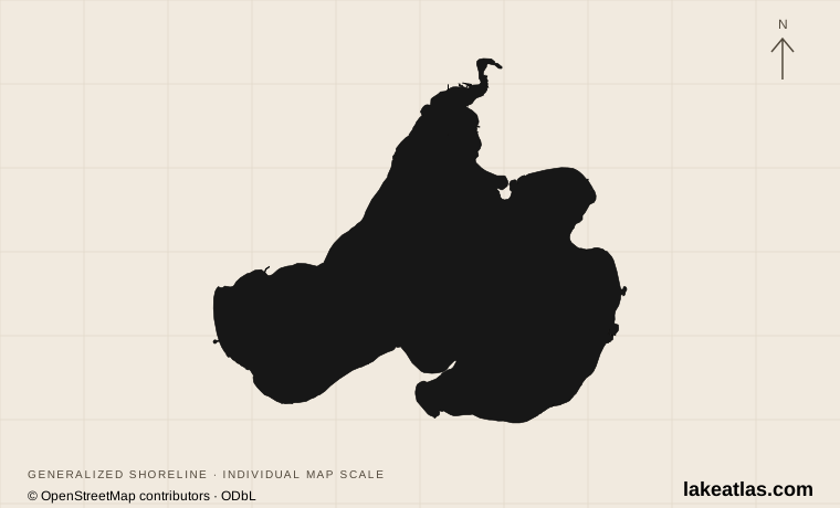
Madison’s lake north of the isthmus
Lake Mendota forms the northern edge of central Madison in Dane County, Wisconsin. Lake Monona lies on the other side of the city’s isthmus; the two are separate lakes in the Yahara drainage system. UW–Madison’s campus meets Mendota’s southern shore, while other city, county and residential shorelines extend around the basin.
That setting changes the kind of visit the lake offers. A campus-side walk, a downtown park stop and a boat launch do not require a remote-lake expedition, but they are not interchangeable access points. Start with the stretch of shore you want to use: the university waterfront and Picnic Point for walking, James Madison Park for a downtown lake stop, or a designated beach or launch for getting onto the water.
Match the numbered places to the list below. Open the full-size map for labels and detail.
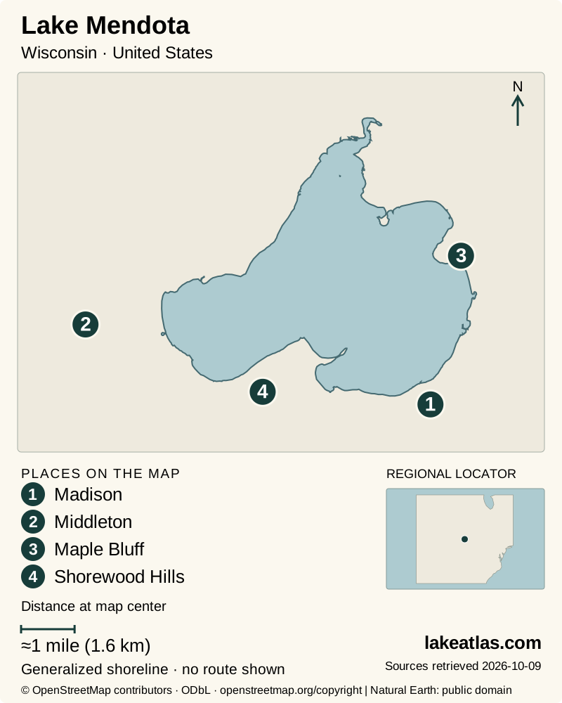
- 1Madison
- 2Middleton
- 3Maple Bluff
- 4Shorewood Hills
Map design: LakeAtlas. Shoreline and place sources: Natural Earth (public domain) and © OpenStreetMap contributors (ODbL). Locator: Natural Earth. Retrieved October 9, 2026. Individual source links are in the downloadable GeoJSON. Map data (GeoJSON).
How the lake formed, and what its depth means
Mendota’s basin developed in a landscape reshaped by the last glaciation. Glacial sediment interrupted older drainage, and meltwater surrounded features such as the sandstone ridge now known as Picnic Point. Later human control of the outlet altered lake levels. It remains a natural lake with regulated water, rather than an excavated urban pond.
The DNR inventory gives a surface area of 15.3 sq mi (39.6 km²), a maximum depth of 83 ft (25.3 m) and a mean depth of 42 ft (12.8 m). This combination describes a broad lake with substantial deep water, not a uniformly shallow swimming basin. University research tables give a slightly different area because they use a different underlying dataset; the quick facts consistently follow the DNR inventory.
The lake also serves as a long-running field laboratory. UW–Madison researchers study water temperature, oxygen, plankton and other conditions through seasonal sampling and instruments. A whole-lake research average is useful for understanding the ecosystem, but it cannot tell a visitor whether one beach is suitable for swimming today.
Three ways to reach the shore
James Madison Park is a downtown choice with a beach and a canoe/kayak launch. It works well for a short waterfront break without first arranging a boat. The city identifies the swimming area as unguarded, so an open park should never be read as a supervised swimming facility.
Picnic Point offers a different landscape: a narrow wooded peninsula projecting into the lake from the university’s Lakeshore Nature Preserve. The preserve lists about 0.75 miles (1.2 km) from its entrance to fire circle 6 near the tip, one way. Return by the same route for a longer outing, and reserve a fire circle separately if you intend to use one. The route’s published distance does not establish step-free access or a particular gradient.
Tenney and Warner beaches are useful options to investigate when mobility access matters. Madison lists a paved path and beach mat at both; its July 22, 2026 project update confirmed completed sidewalks while crews were still installing remaining mats as conditions allowed. The path improvement is verified, but mat availability should be checked for the visit date. These are features at named beaches, not a claim that all Mendota shoreline is wheelchair accessible.
Paddling, sailing and water quality
The university waterfront supports paddling rentals and sailing, but the programs apply weather-based rules. Hoofer sailing uses a qualification and flag system; it is not an unrestricted walk-up boat hire. Outdoor UW’s paddlecraft rules require life jackets and allow rentals to be suspended for temperature, wind or other conditions. Ask about the day’s permitted area before launching.
Public Health Madison & Dane County tests designated beaches for E. coli and blue-green algae and their toxins during the main summer season. A closure applies to water entry even when the surrounding park remains open. Conditions can change after a sample, especially after rain or when visible blooms develop, so use both the current advisory and what is happening at the shore.
For a visitor choosing between a walk and a paddle, the practical advantage of Mendota is flexibility. A closed rental operation or unsuitable water does not remove the university, parks or lake views from the day. Keep the land-based visit as a complete experience rather than treating it as waiting time for a boat.
Summer water, autumn walks and variable winter ice
Summer brings the broadest choice of beach facilities and water-based programs, together with the need to monitor storms and water-quality closures. Spring and fall can be rewarding for shoreline walking, but a bright day does not guarantee that a rental desk is operating or that the water meets its rental-temperature rules.
Winter is part of Madison’s lake culture, but it has become less predictable. The Center for Limnology’s January 2026 account reported a January 1 freeze for that season and described the long trend toward shorter ice cover. An official ice-on date records a lake-wide seasonal milestone, not a safe route for a walker, skater or vehicle. A shoreline visit remains the straightforward choice when local ice conditions are uncertain.
A first visit without circling the whole lake
A downtown or campus-based visit can be organized around walking and local transport instead of driving from shore to shore. UW event information identifies the Picnic Point entrance on University Bay Drive and campus-bus access; verify the current route and parking rules rather than relying on an old timetable. A car is more useful for combining distant county and municipal access sites.
Choose either James Madison Park for a short central-city stop or the Picnic Point out-and-back for a longer walk. Add a water activity only after checking its operating conditions. This keeps the visit focused on a real public destination and leaves time to understand the contrast between the open lake, the university shore and Madison’s compact urban setting.
What did we learn about Lake Mendota?
Mendota is most rewarding when the lake and the city are treated as one landscape. Its deep glacial basin supports research, boating and winter traditions, while specific public parks make the shore easy to reach. Choose a named access point and let current water or ice conditions determine whether the day stays on land.
Sources & data notes13 references · Checked October 9, 2026
Data notes
Area, maximum depth and mean depth follow the DNR inventory; source acreage is retained before conversion.
- Area, maximum depth and mean depth follow the DNR inventory; source acreage is retained before conversion.
- The UW core-lake table uses a slightly different source area from the DNR inventory. This is a dataset difference, not a claim of measured recent shoreline change.
- Picnic Point’s approximately 0.75 miles (1.2 km) published pair is one way. Route gradient and full-route mobility accessibility remain unverified.
- Ice dates describe seasonal observations, not safety certification; beach condition information must be checked for the travel date.
- The July 2026 beach-access project update confirms finished sidewalks, but does not independently confirm every mat is installed or available year-round.
Suggested visits are researched planning guidance, not firsthand travel reports.
References
- Wisconsin DNR — Lake Mendota Facts & Figures
- UW–Madison NTL-LTER — Core Study Lakes
- UW–Madison — Picnic Point archaeological survey
- City of Madison — James Madison Park
- City of Madison — Beaches
- Public Health Madison & Dane County — Beach & Lake Water Quality
- UW–Madison Lakeshore Nature Preserve — Reserve a Fire Circle
- UW–Madison Police — Lake Rescue & Safety
- Wisconsin Union — Outdoor UW Paddlecraft Rentals Safety Rules and Regulations
- UW–Madison Center for Limnology — Where Does Lake Mendota’s 2025 Freeze Date Rank in the 170-Year Record?
- Wisconsin Union — Fall Colors Hike with Outdoor UW
- City of Madison — Tenney Park
- City of Madison — Accessible Beach Improvements
Source selection & methodology. Image credits appear beside each image.