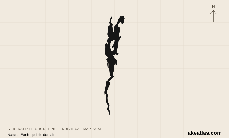
Where is Lake Champlain?
Lake Champlain stretches between New York and Vermont into Quebec, Canada. Its waters move north toward the Richelieu River and then the St. Lawrence system. The Adirondacks rise to the west and the Green Mountain region lies to the east; the valley between them has long carried people as well as water.
The lake is not one uniform open basin. The South Lake, Main Lake, Malletts Bay, Inland Sea and Missisquoi Bay have different physical and water-quality characteristics. A beach report or weather impression from one bay should not be treated as a description of every shore.
The Champlain Valley is the broader lowland region around the lake, including farms, towns and tributaries. The Lake Champlain Basin is the still larger drainage area. A destination advertised as being in the valley can therefore be inland rather than on the water; use a named waterfront park, marina or historic site when planning lake access.
Match the numbered places to the list below. Open the full-size map for labels and detail.
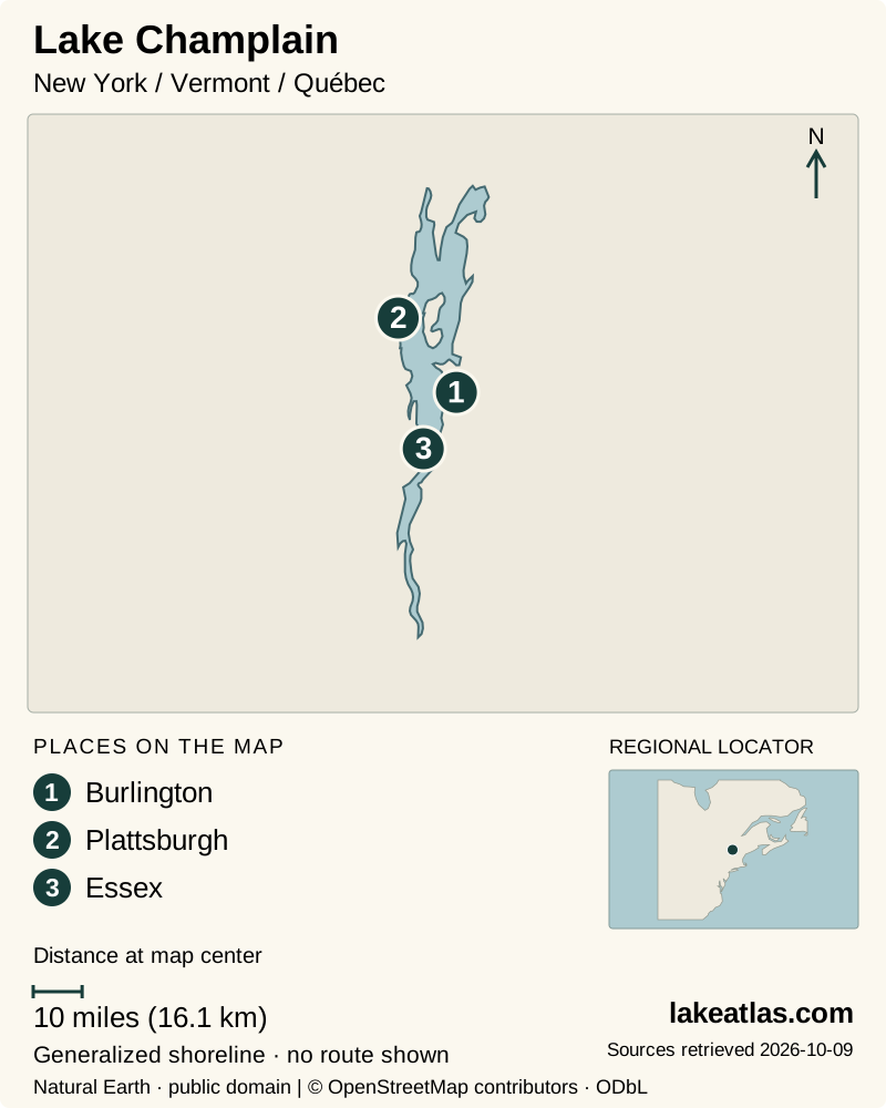
- 1Burlington
- 2Plattsburgh
- 3Essex
Map design: LakeAtlas. Shoreline and place sources: Natural Earth (public domain) and © OpenStreetMap contributors (ODbL). Locator: Natural Earth. Retrieved October 9, 2026. Individual source links are in the downloadable GeoJSON. Map data (GeoJSON).
How large and deep is Champlain?
The Basin Program’s current facts page reports approximately 455 sq mi (1,179 km²) of surface area, a length of 120 miles (193 km) and a maximum depth of 400 ft (122 m). The deepest area lies between Charlotte, Vermont, and Essex, New York. Average depth is much smaller, at 64 ft (19.5 m), reflecting the shallower arms and bays around the main basin.
Published area figures need a qualification. The same program’s basin atlas uses 435 sq mi (1,127 km²). This profile follows the current facts page and preserves its paired US and metric values; the disagreement is disclosed rather than hidden by converting between rounded numbers. Neither figure is a live measurement of today’s shoreline.
From inland sea to freshwater corridor
Retreating glaciers first left a large freshwater basin. Later, seawater entered the depressed Champlain and St. Lawrence valleys, creating the Champlain Sea. As the land rebounded after the weight of the ice disappeared, that marine connection was cut off and the basin returned to freshwater.
Human history here predates Samuel de Champlain’s arrival in 1609 by thousands of years. Later forts, naval battles and commercial shipping reflect the lake’s value as a north–south corridor. Crown Point makes that strategic geography tangible: its peninsula holds the remains of French and British fortifications overlooking a narrow part of the lake.
Fort Ticonderoga adds another southern-lake history stop. Its museum landscape and scheduled Carillon cruises connect land defenses with the water corridor. The operator’s published 2026 cruise season runs from late May into mid-October, with specific sailing days; book the chosen departure and check the next season before building a future itinerary around it.
Choosing a shore for a first visit
Burlington offers an urban Vermont base with a public waterfront, beaches and marina facilities. It works well for a first view of the broad lake without committing to a long drive between rural stops. Check the city’s waterfront information for the particular beach, parking area or activity you intend to use.
Farther south on the Vermont shore, Button Bay State Park in Ferrisburgh combines a bluff-top setting, camping and a walk toward the Button Point Natural Area. Its views face toward the Adirondacks. It suits a day centered on a park and shoreline walk rather than a city waterfront.
On the New York side, Crown Point is a stronger choice for history. Paths around the fort ruins and beside the Lake Champlain Bridge put the narrow crossing in context. Museum access and guided activities are seasonal even though the grounds have broader opening arrangements. These places are alternatives for a focused day; combining all of them changes the outing into a regional road trip.
The northern Vermont islands are lived-in communities, not simply scattered offshore campsites. Grand Isle State Park is on South Hero Island, also called Grand Isle, and gives registered campers access to the lake and a boat ramp. It is explicitly not a day-use park. A traveler crossing the islands should choose a public day-use destination rather than assume the campground beach is open to everyone.
Across the lake near Plattsburgh, Valcour Island has a different pattern: protected land reached by boat, with trails and designated primitive campsites. Its bay was the setting for a Revolutionary War naval battle. Peru Dock provides a verified mainland launch nearby; the state lists an accessible launch dock and restroom, but that does not establish an accessible landing or trail on Valcour.
Crossing the lake
The ferry operator currently lists Grand Isle–Plattsburgh and Charlotte–Essex as its two vehicle crossings. Choose the crossing that matches your destination rather than assuming there is a ferry from every waterfront town. Burlington’s marina address, for example, is not a promise of a Burlington vehicle crossing.
Grand Isle–Plattsburgh is advertised as a year-round, round-the-clock service; Charlotte–Essex operates year-round as conditions permit and can be disrupted by winter wind or ice. Check the live schedule and service alerts before relying on either crossing. A ferry can simplify a route across the lake, but it still adds a departure point and operating conditions to a driving plan.
The Canadian end is part of the same lake, not part of the same domestic trip. Anyone extending a U.S. itinerary into Quebec should check the applicable border-entry requirements before traveling.
Seasons and swimming conditions
Summer provides the simplest starting point for a park-and-waterfront visit. Button Bay’s published season extends from Memorial Day weekend into October, offering a fall option as well. Opening a park season does not guarantee every service or water activity, so review the specific facility before arrival.
For swimming, consult the local beach notice and Vermont’s cyanobacteria tracker where coverage is available. Reports describe a particular site and observation date; conditions can change between observations. Stay out if you see suspected cyanobacteria, even if an earlier report looked reassuring.
A land-based first visit can stay useful when swimming or boating does not fit the conditions: choose Burlington for waterfront access, Button Bay for a park walk, or Crown Point for the historic landscape. The lake’s winter appearance likewise needs local interpretation; do not infer safe ice access from frozen water near a shore.
What did we learn about Lake Champlain?
Champlain is both a varied freshwater ecosystem and a historic travel corridor. Its broad central waters differ from its smaller bays, and its shore destinations reward a focused itinerary. A waterfront day, a park walk or a fort visit can each reveal the lake without requiring a complete circuit.
Sources & data notes15 references · Checked October 9, 2026
Data notes
The Lake Champlain Basin Program facts page gives 455 sq mi (1,179 km²), while its basin atlas gives 435 sq mi (1,127 km²). The pages do not explain the difference; this profile consistently follows the facts-page pair.
- The Lake Champlain Basin Program facts page gives 455 sq mi (1,179 km²), while its basin atlas gives 435 sq mi (1,127 km²). The pages do not explain the difference; this profile consistently follows the facts-page pair.
- Depth and length preserve the source’s independently rounded US/metric pairs. The marker is the verified USGS Burlington shoreline station, not the lake’s centroid.
Suggested visits are researched planning guidance, not firsthand travel reports.
References
- Lake Champlain Basin Program — Lake and Basin Facts
- Lake Champlain Basin Atlas — Lake Champlain
- Lake Champlain Basin Program — History
- Burlington — Waterfront
- Vermont State Parks — Button Bay
- New York State Parks — Crown Point State Historic Site
- Lake Champlain Ferries — Routes
- Vermont Department of Health — Cyanobacteria Tracker
- USGS — Lake Champlain at Burlington
- Lake Champlain Basin Program — A Vibrant Region
- Vermont State Parks — Grand Isle
- NYSDEC — Lake Champlain Islands Complex
- NYSDEC — Boat Launch Sites for Clinton County
- Fort Ticonderoga — Daily Boat Tours
- Fort Ticonderoga — Frequently Asked Questions
Source selection & methodology. Image credits appear beside each image.