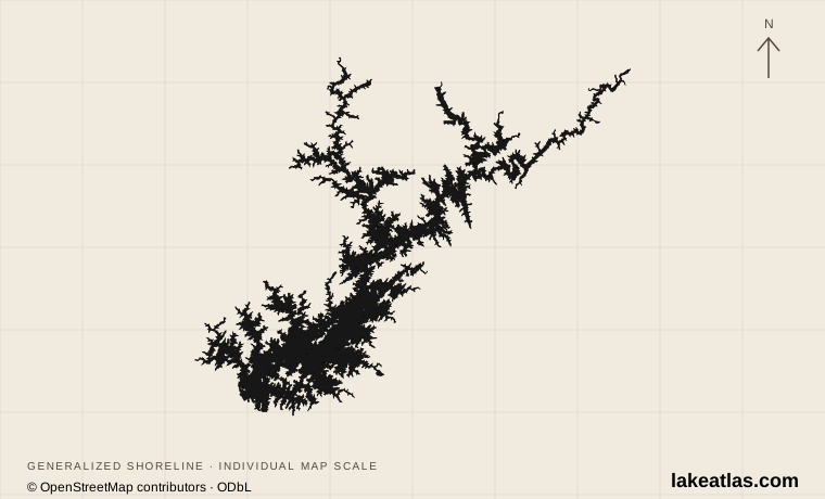
Two river arms above Buford Dam
The US Army Corps of Engineers built Buford Dam and Lake Lanier in the 1950s. The Chattahoochee enters from the north and northeast, while the Chestatee forms another long northern arm. Narrow upper reaches open toward the broader lower reservoir at the dam. This branching structure explains why visitors encounter both riverlike channels and wide expanses dotted with islands.
The master plan gives a reference surface area of 61 sq mi (158 km²). Its average depth is 60 ft (18.3 m), while the deepest point reaches 160 ft (48.8 m) at full pool. The deepest water lies in the old river channel near Buford Dam. These numbers answer different questions: a mean summarizes the basin, a maximum identifies one deep location, and neither is a promise of water depth at a ramp or beach today.
Small islands are part of the flooded landscape, not evidence that every visible landing is available to visitors. The Corps manages the reservoir together with state, local and private recreation partners. Shoreline homes, leased facilities and public parks are interspersed, so access needs to be tied to a named facility.
Match the numbered places to the list below. Open the full-size map for labels and detail.
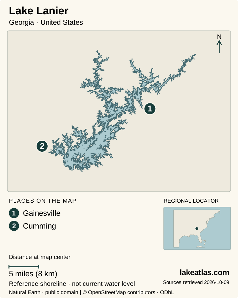
- 1Gainesville
- 2Cumming
Map design: LakeAtlas. Shoreline and place sources: Natural Earth (public domain) and © OpenStreetMap contributors (ODbL). Locator: Natural Earth. Retrieved October 9, 2026. Individual source links are in the downloadable GeoJSON. Map data (GeoJSON).
The lower lake and the upper arms
The Buford Dam end is useful for understanding the reservoir’s engineering and the transition back to the Chattahoochee River. Public recreation sites cluster around this end of the lake, but the lake-facing shore and the downstream river are different environments. Select the particular park entrance and activity before setting out; “Buford Dam” alone is too broad a destination for a beach or trail plan.
Gainesville makes a useful regional base for the eastern and northern lake, while Buford and Cumming orient travelers toward different sides of the lower reservoir. Choose among them by the park or launch you intend to use. Roads around branching water are not equivalent to a lakeside promenade, and crossing between arms can consume more time than a small-scale map suggests.
Don Carter State Park sits on the northern Chattahoochee arm. Its wooded setting and river-to-reservoir transition offer a different experience from the open lower lake. A visitor interested in forest walks and paddling access can sensibly spend an entire day here rather than treating it as a brief stop on a drive around all of Lanier.
Public parks make access concrete
Don Carter provides trails, boat ramps and a designated sandy beach area. The state park’s own notices are essential: at review, its page distinguished an open beach from swimming access affected by low water. That distinction illustrates why an amenity listed on a regional guide does not establish that the associated activity is available today.
USACE lists named day-use sites around the reservoir, including Little Ridge, West Bank and Old Federal. Little Ridge has a named walking trail, while other parks emphasize picnic areas, launching or designated swimming. Use the Corps’ park information to match the facility to the activity instead of assuming each site offers every service.
The Corps also publishes a separate operating schedule because a boat ramp, campground and adjacent day-use area can have different seasons. This matters especially for trips outside peak warm-weather recreation. A facility being visible from a road, or a campground being open nearby, does not establish that its beach or day-use gate is operating.
A working water-supply lake
Lanier stores water for communities around the lake and supports supplies taken from the Chattahoochee downstream. Hydropower, flood protection, navigation, recreation and fish and wildlife are also authorized project purposes. The water seen from a picnic table is therefore part of a wider managed river system, not a recreational pool maintained solely for visitors.
Changing storage affects the physical shoreline. Coves, ramps and beaches respond differently as levels rise or fall, and islands can look unlike their high-water photographs. Check current lake information and the specific access operator before bringing a boat. On foot, stay with designated paths and park boundaries rather than interpreting an exposed strip of shore as a new public trail.
Warm-weather days support the familiar beach-and-boating version of Lanier, but a cool-season trip can focus on woodland trails, overlooks and the river setting. The relevant planning question is which facilities are operating and what weather fits the chosen activity. No season removes the need to check those local details.
A first day on one side of the lake
For an upper-lake introduction, use Don Carter as the day’s main destination. Start with the park map, choose a forest walk, then visit its designated shore area if conditions and notices allow. Keeping walking and water activities in one managed park reduces the amount of road travel and makes a change of plan easier.
For a lower-lake introduction, choose an operating Corps park and pair it with a dam-area viewpoint or another nearby designated site. Avoid making a complete circuit the goal: the reservoir’s arms and scattered facilities reward a focused visit. Add a boat excursion only after confirming its departure point, operating conditions and whether it serves the part of the lake you want to see.
What did we learn about Lake Lanier?
Lake Lanier is both a branching recreation landscape and a working reservoir for a much larger river system. Its full-pool maximum belongs to the former channel near the dam; the upper arms offer a different setting. Choosing a specific public park and checking its current operating status is the key to turning the regional map into a useful visit.
Sources & data notes8 references · Checked October 9, 2026
Data notes
Area follows the USACE master-plan reference figure. Maximum depth is the deepest former channel at full pool, not today’s depth; the mean is a separate measure. The approximate locator uses the USGS station above Buford Dam.
- The USACE master plan supplies the area of 61 sq mi (158 km²) and average of 60 ft (18.3 m). Some visitor sources round the area differently.
- The maximum of 160 ft (48.8 m) is explicitly conditional on full-pool level; it is not a current measurement.
- Coordinate is a verified USGS lake-monitoring location, not a geographic centroid.
Suggested visits are researched planning guidance, not firsthand travel reports.
References
- USACE — Lake Sidney Lanier master plan
- USACE — Lake Lanier questions
- USACE — Lake Sidney Lanier
- Georgia State Parks — Don Carter
- USACE — Lake Lanier day use
- USACE — Lake Lanier operating schedules
- USACE — Lake Lanier purposes
- USGS — Lake Sidney Lanier above Buford Dam
Source selection & methodology. Image credits appear beside each image.