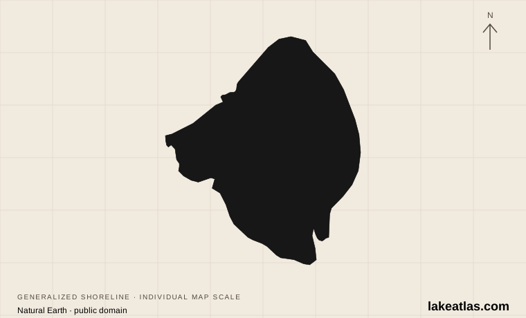
A broad natural lake, not a flooded valley
Okeechobee occupies a shallow natural basin on the Florida peninsula. This origin distinguishes it from reservoirs created by damming steep-sided river valleys. Its reference area is 730 sq mi (1,890.7 km²), yet its average depth is only 9 ft (2.7 m). A large surface does not imply a deep basin, and the average should never be relabeled as the deepest point.
The Kissimmee River, Fisheating Creek and Taylor Creek are among the lake’s natural tributaries. Historically, water spread southward across the lake’s rim toward the Everglades. Dikes and canals changed that connection, confining the water and routing flows through engineered structures. Okeechobee remains a natural lake even though its present-day water movement is extensively controlled.
This geography produces a very different shoreline experience from a mountain lake. Marshes, shallow vegetated margins and broad open water are central to the scene. The open-water edge may lie beyond wetlands rather than directly beside a town street, making the dike and designated access points important places to understand the basin.
Match the numbered places to the list below. Open the full-size map for labels and detail.
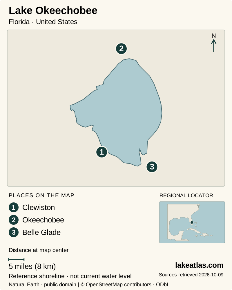
- 1Clewiston
- 2Okeechobee
- 3Belle Glade
Map design: LakeAtlas. Shoreline and place sources: Natural Earth (public domain) and © OpenStreetMap contributors (ODbL). Locator: Natural Earth. Retrieved October 9, 2026. Individual source links are in the downloadable GeoJSON. Map data (GeoJSON).
The lake within the Greater Everglades
Okeechobee sits within a connected watershed extending from the Kissimmee system toward the Everglades and Florida Bay. It supplies water for people, agriculture and the environment while playing a major role in flood management. Those purposes can pull operations in different directions: a level useful for storage is not automatically ideal for shoreline vegetation, boating or every downstream habitat.
Excess nutrients, unsuitable high or low levels and invasive vegetation have affected the lake’s ecological condition. Marsh plants provide habitat and help structure the food web, so changes in the shallow margin influence fish and birds as well as the appearance of the shore. Restoration concerns therefore extend beyond keeping the central water surface visually attractive.
The dike is part of this managed landscape, while navigation locks connect recreational movement with water-control infrastructure. A lake trip and a through-waterway trip are different plans. The latter depends on the relevant lock notices as well as lake conditions; it cannot be inferred from the lake’s surface-area figure or from an old cruising account.
Towns and public access around the basin
Okeechobee on the north side, Clewiston on the south and Belle Glade toward the southeast are useful regional reference points. Moore Haven lies to the southwest, while Port Mayaca provides an eastern waterway connection. These communities orient a visit to different parts of the lake; choosing one base reduces unnecessary travel around a very large basin.
USACE identifies specific recreation locations including Jaycee Park near Okeechobee, Clewiston City Park, Torry Island at Belle Glade and Port Mayaca recreation areas. Facilities are managed by different agencies, so verify the selected site directly. The presence of a park or marina does not make every adjoining bank, agricultural road or canal a public access.
Torry Island and the vegetated southern lake margin also show why islands here should not be imagined as resort beaches scattered across clear deep water. Shoreline land, marsh and channels form an ecological and working landscape. Use a named public recreation site to approach it rather than attempting to find an informal route through the wetland edge.
Seeing the lake from the dike
The Lake Okeechobee Scenic Trail follows the Herbert Hoover Dike and forms part of the Florida National Scenic Trail. Its elevated position offers a view across a notably flat landscape. Surface types vary, and road crossings, water-control structures and access arrangements make it more complicated than a single uninterrupted lakeside sidewalk.
USACE provides mapped entry points at places such as Port Mayaca, Clewiston, Pahokee and Okeechobee. For a first visit, choose one confirmed-open access and make a short out-and-back walk or ride. An access-point map establishes where to investigate a visit; current trail notices establish whether the intended segment is available.
The exposed setting makes the forecast and time of day central to comfort. A cool-season walking trip can emphasize the dike and wildlife, while warm-weather outings need a plan that can change with heat and storms. Carry what you need for the chosen segment instead of assuming town services will be immediately beside the trail.
Boating and fishing need local checks
Okeechobee supports well-known largemouth bass and black crappie fisheries, but extensive shallows limit what its huge area tells a boater. FWC highlights rock hazards and access difficulties in shallow marsh areas. Use local navigation information and a suitable launch; the word “lake” should not be taken to mean uniformly open, deep water.
SFWMD publishes lock notices and directs visitors to public boat-ramp information. At review, its notices included closures affecting northern navigation locks, illustrating why a general description must not promise a particular passage. Check the current notice for the actual lock on your route, rather than assuming a published normal operating schedule means it is open.
For a first boating visit, a locally arranged trip with a clearly identified departure site can provide a more coherent introduction than attempting an ambitious crossing. For a land-based day, pair one dike access with a named nearby recreation area and time to explore the associated town. Both approaches reveal the lake without requiring a complete circuit.
What did we learn about Lake Okeechobee?
Okeechobee’s defining combination is great breadth and shallow water. It is a natural lake whose connections now depend heavily on dikes, canals and operating decisions. A visit works best when it begins with one regional base and a verified public access, with average depth kept separate from maximum depth and current navigation conditions checked locally.
Sources & data notes8 references · Checked October 9, 2026
Data notes
730 sq mi (1,890.7 km²) is a rounded reference area, not a live inundation measurement. The widely cited 9 ft (2.7 m) depth is an average and must not be entered as maximum depth. A primary-source maximum was not established. USGS lake-station coordinates provide the locator.
- The SFWMD figure of 730 sq mi (1,890.7 km²) is rounded; its converted metric value should not be treated as a new survey.
- The figure of 9 ft (2.7 m) is average depth. Maximum depth is left unknown rather than replacing it with an average or an unsourced estimate.
- The locator is a USGS lake-monitoring location, not a surveyed center.
Suggested visits are researched planning guidance, not firsthand travel reports.
References
- South Florida Water Management District — Lake Okeechobee
- Florida Fish and Wildlife Conservation Commission — Lake Okeechobee fishing
- USACE — Lake Okeechobee Scenic Trail
- USACE — South Florida recreation
- SFWMD — Navigation
- FWC — Lake Okeechobee conservation and restoration
- USACE — Okeechobee Waterway
- USGS — Lake Okeechobee
Source selection & methodology. Image credits appear beside each image.