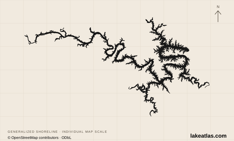
A reservoir shaped by river valleys
Bagnell Dam impounded the Osage River in 1931 to generate hydroelectric power. Water backed into tributary valleys, creating the lake’s long, irregular outline. The commonly published surface area is approximately 84.4 sq mi (218.5 km²). That figure describes the reservoir at a reference condition; rainfall and operating decisions change the waterline.
The main Osage arm provides the organizing spine. Branches associated with the Niangua River, Grand Glaize Creek and Gravois Creek create separate local landscapes. A cove on a map may belong to a different arm from a nearby-looking hotel or park. Roads must work around these drowned valleys, so a short straight-line separation can mean a much longer drive.
Depth also changes along the river system. Missouri’s conservation assessment distinguishes streamlike upper reaches, shallower depositional areas and more open lake habitat downstream. It describes deep channels without establishing a precise lake-wide maximum. LakeAtlas therefore leaves the maximum-depth comparison unfilled rather than presenting a popular but unverified number as a survey result.
Match the numbered places to the list below. Open the full-size map for labels and detail.
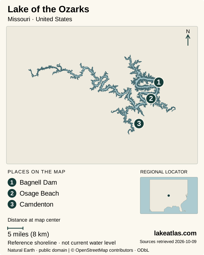
- 1Bagnell Dam
- 2Osage Beach
- 3Camdenton
Map design: LakeAtlas. Shoreline and place sources: Natural Earth (public domain) and © OpenStreetMap contributors (ODbL). Locator: Natural Earth. Retrieved October 9, 2026. Individual source links are in the downloadable GeoJSON. Map data (GeoJSON).
Choose a shore before a base
Lake Ozark and the Bagnell Dam area make sense for a first look at how the reservoir was built. Ameren identifies an overlook with interpretive information, a downstream fish-and-bird observation area and the historic Willmore Lodge visitor center. These are specific places to visit; the dam’s working infrastructure and surrounding shoreline are not an unrestricted walking route.
Osage Beach is a useful planning base for the Grand Glaize side, where Lake of the Ozarks State Park provides designated beaches, marinas, launch sites and trails. Farther toward Camdenton, Ha Ha Tonka State Park gives access to a very different landscape on the Niangua side. Select lodging around the park or arm you actually intend to use, then add cross-lake excursions as separate outings.
The distinction between a shoreline view and public access matters here. Resort frontage, residential docks and commercial marinas do not become public simply because they face the reservoir. State-park maps and the operator’s shoreline information identify more reliable starting points than following an arbitrary road toward blue water.
Two parks, two ways to read the landscape
Lake of the Ozarks State Park is the natural choice for a day combining water and woodland. Its Grand Glaize Beach area is reached from Highway 54 near the Grand Glaize Bridge. Trails reveal oak-hickory forest, glades and small streams that can disappear from view when the lake is experienced only from a boat. Check the specific beach, marina or trail page because these are separate facilities within a large park.
Ha Ha Tonka emphasizes the geology behind that scenery. Sinkholes, a natural bridge, bluffs and a large spring expose a karst landscape developed in soluble bedrock. The stone mansion ruins sit above the spring and lake, providing a legible connection between the upland hills and the flooded valley below. Trails and boardwalks offer several ways to explore, but a viewpoint visit and a descent toward the spring are different walking commitments.
Boat visitors can approach the Ha Ha Tonka cove on the Big Niangua arm using the park’s designated docks. The park publishes docking limits and launch details; check those before choosing this as a boat stop. Coming by road remains a straightforward option for travelers whose main interest is the ruins and geology.
Water, seasons and access
This is an operating hydropower reservoir, not a fixed water surface. Ameren publishes lake-level reports and shoreline guidance. For a boating day, pair those reports with the forecast and the actual launch operator’s information. A regional lake description cannot confirm that a particular ramp, dock or swimming area is usable on your date.
A warm-weather trip can revolve around designated swimming areas and boat access. A walking-focused trip can instead use the two parks as its main destinations, making the lake enjoyable even without taking to the water. In any season, give wooded trails, open overlooks and on-water plans different weather contingencies; they do not offer the same exposure or shelter.
A useful first visit
For a first day, choose either the dam and Grand Glaize area or the Camdenton and Ha Ha Tonka area. At the dam end, begin with the overlook or Willmore Lodge, then use a named state-park access for a shore walk or picnic. At Ha Ha Tonka, make the ruins and a trail selected from the park map the core of the day. Neither plan depends on buying a boat excursion.
With a second day, visit the other district to see how much the reservoir changes between developed shoreline and protected hills. Keep the car as the link between public sites and regard any boat outing as a separate, locally arranged activity. This leaves time to experience a place rather than spending the visit trying to complete an informal circuit of a highly indented lake.
What did we learn about Lake of the Ozarks?
Lake of the Ozarks is best understood as a set of flooded river valleys with distinct visitor districts. Bagnell Dam explains its origin; Grand Glaize provides broad public recreation; Ha Ha Tonka reveals the spring and karst country beside the Niangua arm. Picking one district at a time makes both the geography and a first visit easier to understand.
Sources & data notes7 references · Checked October 9, 2026
Data notes
Surface area is an approximate reference reservoir figure, not today’s inundated area. A defensible maximum depth was not established from the primary sources reviewed. Locator is the USGS lake station near Bagnell, not the lake center.
- The area is a rounded Missouri DNR reference figure. The current shoreline is level-dependent.
- Maximum depth remains unknown in this profile: channel-depth descriptions are not a verified maximum.
Suggested visits are researched planning guidance, not firsthand travel reports.
References
- Missouri DNR — Lake of the Ozarks watershed
- Ameren — Lake of the Ozarks
- Missouri State Parks — Lake of the Ozarks region
- Missouri State Parks — Ha Ha Tonka State Park
- Missouri Department of Conservation — East Osage watershed assessment
- Missouri State Parks — Ha Ha Tonka boating
- USGS — Lake of the Ozarks near Bagnell
Source selection & methodology. Image credits appear beside each image.