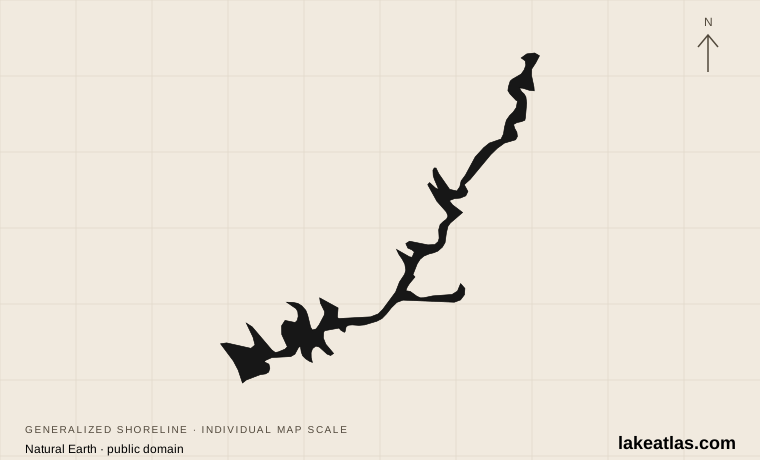
Where is Lake Powell?
Glen Canyon Dam stands near Page, Arizona, at the reservoir’s downstream end. Upstream, Lake Powell spreads through the main Colorado River canyon and into side canyons in Utah. It is part of Glen Canyon National Recreation Area, but that protected area also includes places outside the reservoir itself.
The most useful distinction is between the Page-area access points in the south and Bullfrog and Halls Crossing farther uplake in Utah. They are different starting regions. A short separation across water can correspond to a long road journey around the surrounding canyon country.
Match the numbered places to the list below. Open the full-size map for labels and detail.
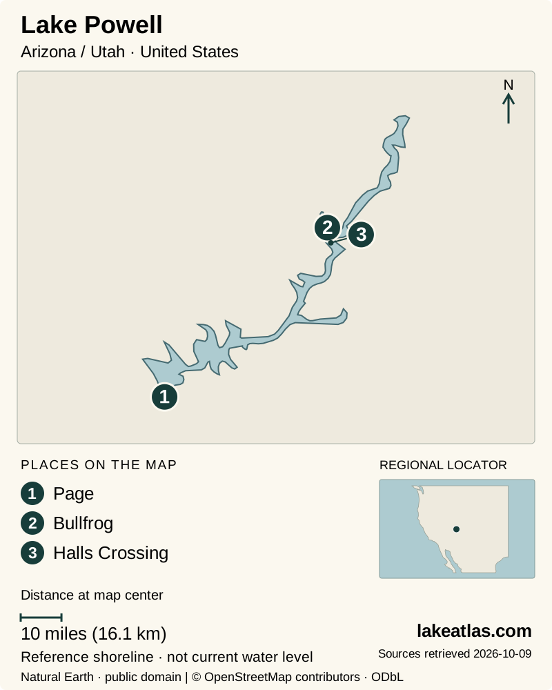
- 1Page
- 2Bullfrog
- 3Halls Crossing
Map design: LakeAtlas. Shoreline and place sources: Natural Earth (public domain) and © OpenStreetMap contributors (ODbL). Locator: Natural Earth. Retrieved October 9, 2026. Individual source links are in the downloadable GeoJSON. Map data (GeoJSON).
A canyon river turned into a reservoir
Storage began behind Glen Canyon Dam in 1963, with the initial filling completed in 1980. The flooded landscape retains the branching shape of the river and its tributary canyons. Cliffs, narrow passages and open reaches are parts of that older drainage network.
The reservoir stores Colorado River water and supports hydropower generation as part of the Colorado River Storage Project. It also created a major recreation destination. Those uses share a water system affected by inflows, releases and long dry periods; recreation infrastructure must adapt to the resulting changes in lake elevation.
What do its area and depth figures mean?
Reclamation gives a full-pool area equivalent to 266 sq mi (689 km²) and a water depth at the dam of 560 ft (171 m). These are reference conditions for a full reservoir. They are not measurements of Lake Powell on the day you read this article.
A dam’s structural height is different from the depth of water behind it, so it should not replace the lake-depth figure. Likewise, a reservoir’s full-pool area should not be presented as a live outline. Falling water exposes canyon walls and changes the length and shape of sheltered arms; the map and launch information for an actual trip need more recent evidence.
Choosing a base on the lake
Wahweap and Antelope Point serve the southern end near Page. NPS lists marina-based services, rentals and tours, with access to Antelope Point from the Highway 98 side. These are useful starting points for visitors who want a land base and a separately arranged water outing.
Bullfrog and Halls Crossing form another pair of access areas farther north, reached by different Utah road approaches. Do not build a road itinerary around an assumed ferry crossing: NPS explicitly directs visitors to confirm whether the ferry is operating. Marina services also differ and change with lake levels, so choose a base by confirmed services rather than by a dot on a map.
Boating and Rainbow Bridge
A boat outing reveals canyon walls and branches that cannot be followed by a continuous shoreline road. NPS links to concessioners offering rentals and tours; select an outing by its departure marina and confirmed route. A rental boat still requires navigation planning, suitable equipment and an understanding of the weather.
Rainbow Bridge is a separate remote destination reached through a boat-and-walk trip or a long overland approach across Navajo Nation land. As checked October 9, 2026, the NPS operating-hours page says boat access is unavailable; its newer directions page says the courtesy dock does not reach land. Neither supports treating this as a routine connected dock-to-trail outing. Confirm the actual status with the park and operator before booking.
Heat, wind and the changing shoreline
Summer brings intense desert heat and little shade. Spring can be windy, winter nights can fall below freezing, and fall is generally milder. Heavy rainfall and flash flooding remain possible, including when an outing begins under clear skies. Check both land weather and the marine forecast appropriate to your departure area.
In an April 2026 notice, NPS describes newly exposed shoreline, submerged obstacles and shifting navigation channels caused by low water. Marked routes cannot identify every hazard. A route that worked on an earlier trip may no longer work in the same way, and relocated marinas can bring relocated no-wake zones.
Federal recreation land and Navajo Nation are different jurisdictions
A Glen Canyon recreation visit does not provide unrestricted access to neighboring Navajo Nation lands. Navajo Parks requires advance permits for authorized backcountry routes and lists areas closed to hiking and camping. Check the particular destination rather than assuming that a marina rental or federal entrance payment covers a landing and walk anywhere in a side canyon.
The overland trails toward Rainbow Bridge are long backcountry routes on Navajo lands, separate from the shorter trail inside the national monument. Arrange permission, route information and any pickup before departure. A boat connection dependent on present water level must be confirmed independently; the land and water portions cannot be treated as interchangeable escape routes.
Getting there and preparing a first visit
Page is the main southern gateway. Roads reach Wahweap and Antelope Point separately, while Bullfrog and Halls Crossing require their own approaches from Utah. Pick the region before reserving accommodation or a boat. The lake is too branched and the surrounding terrain too complex for an improvised drive around its edge.
A manageable first visit combines a land base near a confirmed marina with one planned lake excursion. Check launch conditions, the marine forecast, water advisories and operator instructions shortly before departure. Boaters should also follow cleaning, draining, drying and any required decontamination procedures when leaving Lake Powell to avoid carrying invasive mussels elsewhere.
What did we learn about Lake Powell?
Lake Powell is best understood as a changing reservoir inside a canyon network. Full-pool dimensions explain its designed scale; current launch and navigation information explain how to visit. Choose the right access region first, then confirm the water-based part of the trip.
Sources & data notes13 references · Checked October 9, 2026
Data notes
Area and depth are full-pool reference values, not current conditions. Depth is the published water depth at Glen Canyon Dam when full. The location pin marks the dam end.
- Reclamation’s full-pool table omits the square qualifier from its U.S. area column. LakeAtlas interprets the value as square miles using the paired hectare figure; the source values remain recorded with their original units.
- The depth of 560 ft (171 m) is the published full-pool water depth at the dam, not dam height or a current sounding.
- No current reservoir elevation, volume, ferry timetable or launch-ramp status is inferred from these reference dimensions. NPS marina pages differ in their headline count; this article avoids asserting a fixed count.
- Rainbow Bridge official access notices are not fully aligned: the operating-hours page says inaccessible by boat, while newer directions describe a disconnected dock. This profile does not imply that a normal boat-to-trail visit is available.
Suggested visits are researched planning guidance, not firsthand travel reports.
References
- Bureau of Reclamation — Glen Canyon Unit
- National Park Service — Glen Canyon directions
- National Park Service — Lake Powell marinas
- National Park Service — Boating
- National Park Service — Plan ahead for changing water levels
- National Park Service — Rainbow Bridge directions
- National Park Service — Rainbow Bridge weather
- National Park Service — Glen Canyon current conditions
- USGS — Lake Powell at Glen Canyon Dam
- National Park Service — Bullfrog main launch ramp
- Navajo Nation Parks & Recreation — Rules and Regulations
- National Park Service — Rainbow Bridge Operating Hours and Seasons
- National Park Service — Rainbow Bridge Hiking
Source selection & methodology. Image credits appear beside each image.