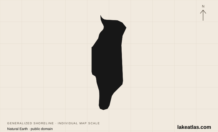
Where is Lake Winnebago?
The lake lies in east-central Wisconsin across Winnebago, Calumet and Fond du Lac counties. Oshkosh is the major western-shore city; Fond du Lac anchors the southern end. Neenah and Menasha occupy the northern outlet region, while High Cliff State Park provides a contrasting wooded escarpment setting on the northeastern shore.
“Largest inland lake” is the useful ranking. Wisconsin also borders Lake Michigan and Lake Superior, which are vastly larger. Winnebago is one lake within the broader Winnebago Pool, alongside Butte des Morts, Winneconne and Poygan; the area of the entire connected system should not be presented as the area of Winnebago alone.
Match the numbered places to the list below. Open the full-size map for labels and detail.
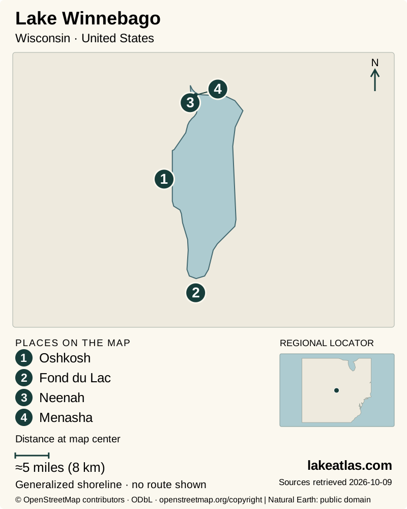
- 1Oshkosh
- 2Fond du Lac
- 3Neenah
- 4Menasha
Map design: LakeAtlas. Shoreline and place sources: Natural Earth (public domain) and © OpenStreetMap contributors (ODbL). Locator: Natural Earth. Retrieved October 9, 2026. Individual source links are in the downloadable GeoJSON. Map data (GeoJSON).
Large surface, shallow basin
Wisconsin DNR’s lake inventory gives a surface area of 206.2 sq mi (533.9 km²) and a maximum depth of 21 ft (6.4 m). The lake therefore has a large footprint without the deep central water found in many glacial mountain lakes. Maximum depth is a basin measurement, not a guarantee of adequate clearance on a boat route.
The surrounding terrain records glacial deposition and the changing shores of ancient Lake Oshkosh. At High Cliff, the Niagara Escarpment makes the bedrock visible above the water. Seeing both a low city waterfront and the raised eastern shore helps explain the contrast between the broad basin and its edge.
The Fox–Wolf connection and managed water levels
The Fox and Wolf watersheds feed the connected lake system, and water exits Winnebago through the Lower Fox River toward Green Bay on Lake Michigan. The cities at the north end are therefore part of an outlet landscape, not merely additional beach towns.
Winnebago is a natural lake whose water levels are regulated. The Army Corps of Engineers and local operators manage outflow at Neenah and Menasha; heavy upstream runoff can still raise levels even when gates are opened. A water-level reading is an elevation relative to a stated datum, not the lake’s depth. Use current operating information for conditions rather than treating the inventory’s maximum depth as today’s water level.
Oshkosh and Fond du Lac for waterfront visits
Oshkosh supplies several public boat launches, including Menominee Park. Check the named ramp and the city’s launch-permit rules before towing a boat there. The city’s access inventory also includes river and connected-lake sites, so a generic “Oshkosh launch” may not enter Winnebago directly.
At the south end, Fond du Lac’s Lakeside Park combines a lighthouse, lagoon and fishing-pier landscape with a marina and boat launches. It is a useful choice for a mixed group: some can stay on land while boaters use a proper launch. The city distinguishes the marina launch, Lakeside Park West and Harbor View Drive, with different ramp and parking arrangements.
Neenah and Menasha make sense as service bases for the northern end and Lower Fox corridor. Choose the actual shoreline or river destination before setting a route; the neighboring water bodies and channels make place names more useful than simply following a lake-center pin.
High Cliff: lake views and different walking routes
High Cliff is the state-park option for combining the lake with woodland and escarpment scenery. Its routes vary considerably: Butterfly Pond’s paved east loop is 0.4 miles (0.64 km) and its west loop 0.7 miles (1.13 km), while the Lime-Kiln trail’s escarpment section includes steep climbs, descents and stairs. A paved wetland loop should not be described as the same outing as climbing toward an overlook.
The park also documents an accessible fishing platform and a boat launch with an accessible boarding pier. Those are destination-specific features, not a statement that every trail or tower is accessible. Vehicle admission and camping arrangements are separate.
Checked October 9, 2026: the park lists the entire Lime Kiln and Indian Mound trails and part of Red Bird Trail closed October 5–November 15, 2026 for rehabilitation. Entrance-area work is scheduled into spring 2027 while the road and office remain open. Consult the live park notice before choosing a walk; do not route around work barriers.
Fishing seasons, summer water and winter ice
The fishery includes walleye, panfish and lake sturgeon, and the winter sturgeon-spearing tradition is a distinctive part of the wider system. Fishing and spearing seasons, licensing and harvest requirements need to be checked for the relevant year and water; a visitor article cannot substitute for current regulations.
Summer favors boat access and city-park outings, but a broad shallow lake still demands attention to wind and local water notices. Spring runoff can change the outlet and shoreline situation, making the river-system forecast relevant even when a planned stop is on the lake.
Winter is not one continuous safe-access season. Pressure ridges can move or open with temperature and wind changes; currents near narrows, inlets and outlets can thin ice. DNR does not monitor ice conditions throughout the state and directs users to current local information. A visible trail of vehicles or shanties is not evidence that a new route is safe.
A first visit without circling the entire lake
Choose a gateway that matches the outing. Fond du Lac’s Lakeside Park gives a south-shore introduction with nearby city services; Oshkosh works for a west-shore stay or an organized boating day. High Cliff is the better choice when the landforms and a permitted walking route are the main interest.
A car is useful for traveling between these separated regions. For a short visit, stay with one park and its immediate waterfront, check facility or trail notices, and leave a full lake circuit for a trip with time to stop. A named public access point makes the plan clearer than a single lake-wide difficulty rating.
What did we learn about Lake Winnebago?
Winnebago is best understood as a broad, shallow lake within a moving river system. Its city waterfronts and eastern escarpment offer different ways to see that landscape, while managed outflow and variable ice make current conditions especially important. Pick one gateway and a named public destination for a useful first visit.
Sources & data notes14 references · Checked October 9, 2026
Data notes
Area and maximum depth use Wisconsin DNR’s lake inventory. The Winnebago Pool and Fox–Wolf drainage basin are larger systems, not alternate lake-area measurements. Water levels are regulated.
- The lake inventory gives an area of 206.2 sq mi (533.9 km²); its original acreage is retained for conversion. Other DNR summaries round area differently; the Pool’s combined area is not used.
- The USACE lake-level datum is not lake elevation itself and is not maximum depth. No instantaneous level or ice condition is claimed.
- Current High Cliff restrictions were checked October 9, 2026 and are explicitly dated in the article.
Suggested visits are researched planning guidance, not firsthand travel reports.
References
- Wisconsin DNR — Lake Winnebago Facts & Figures
- Wisconsin DNR — Lake Winnebago water detail
- Wisconsin DNR — Central Lake Michigan Coastal ecological landscape
- Wisconsin DNR — High Cliff State Park
- Wisconsin DNR — Hiking at High Cliff State Park
- Wisconsin DNR — Recreation at High Cliff State Park
- City of Oshkosh — Boat Launch Locations
- City of Fond du Lac — Parks
- City of Fond du Lac — Boating
- Wisconsin DNR — Rapidly Changing Weather Brings Unsafe Ice Conditions Statewide
- Wisconsin DNR — Sturgeon Spearers Reminded To Be Careful On Frozen Waterbodies
- US Army Corps of Engineers — Lake Winnebago
- US Army Corps of Engineers — Water management activities at Lake Winnebago
- Wisconsin DNR — New Winnebago System Fisheries Biologists
Source selection & methodology. Image credits appear beside each image.