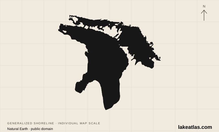
Where is Lake Huron?
Lake Huron lies between Michigan in the United States and Ontario in Canada. The Bruce Peninsula separates much of Georgian Bay from the main lake, while islands and channels complicate the northern shore. A destination described simply as “on Huron” might face a broad open horizon, a bay or an island channel.
Superior feeds the system through the St. Marys River. Michigan joins Huron through the Straits of Mackinac, and the downstream route leaves Huron through the St. Clair River toward Lake St. Clair and Lake Erie. Michigan and Huron are a single hydraulic unit because their open connection allows their water levels to remain nearly equal; NOAA reports their lake-wide levels together.
Like the other Great Lakes, Huron occupies a basin shaped by the movement and retreat of the Laurentide ice sheet. Glacial erosion and deposits help explain why its shores alternate between exposed rock, islands, forest and sandy points. The present lake belongs to a connected drainage system rather than an isolated bowl.
Match the numbered places to the list below. Open the full-size map for labels and detail.
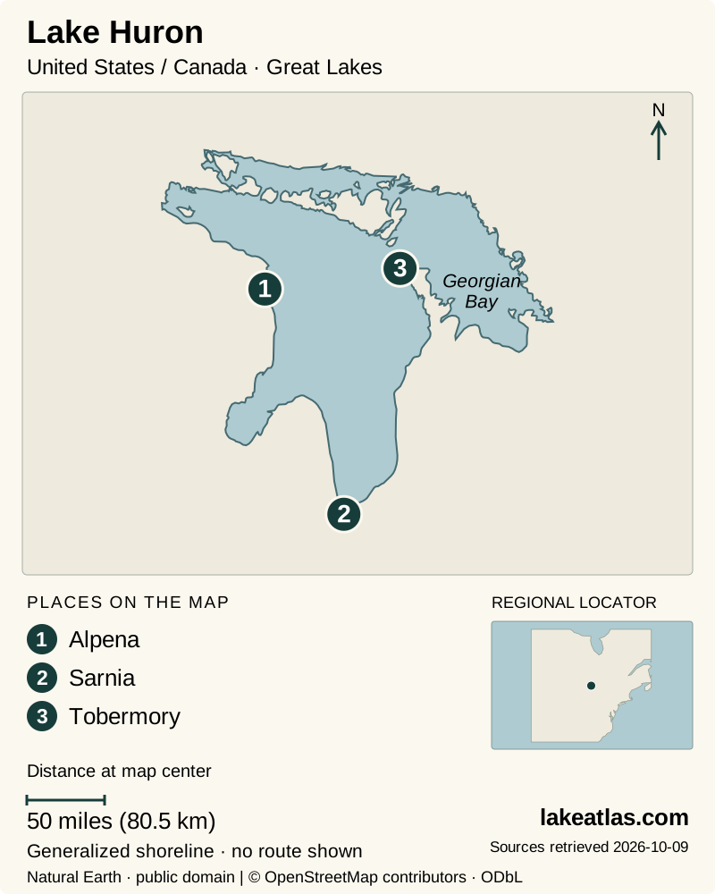
- 1Alpena
- 2Sarnia
- 3Tobermory
Map design: LakeAtlas. Shoreline and place sources: Natural Earth (public domain) and © OpenStreetMap contributors (ODbL). Locator: Natural Earth. Retrieved October 9, 2026. Individual source links are in the downloadable GeoJSON. Map data (GeoJSON).
How large and deep is Lake Huron?
Huron has a water area of 23,000 sq mi (59,600 km²). Its maximum depth is 750 ft (229 m) and its mean depth is 195 ft (59 m); its reference volume is 850 cu mi (3,540 km³). The maximum belongs to the deepest part of the basin, not to the typical depth beside a beach or harbor.
The bays matter as much as the headline dimensions when planning a visit. Georgian Bay is part of Huron, even though it has a strong identity of its own. Driving around the lake requires following these indentations and peninsulas, so a straight line across the map is not a useful estimate of how easily two shore destinations connect.
Which part of Lake Huron should you visit?
Alpena on Michigan’s northeastern coast is the clearest starting point for maritime history. The Great Lakes Maritime Heritage Center interprets ships and shipwrecks in Thunder Bay through indoor exhibits, including a recreated schooner environment. It provides a way to understand the lake even when wind prevents a water outing.
Farther south, Tawas Point State Park occupies a sand spit at Tawas Bay. Its beach, nature trail and lighthouse setting support a visit centered on shore walking and birdwatching. The point attracts migrants in spring and fall; a birding visit and a midsummer beach trip are different uses of the same place.
On the Canadian side, Bruce Peninsula National Park combines forest walks with limestone cliff scenery above Georgian Bay. The Grotto and Indian Head Cove are the famous draws, but the coast is rugged and access is managed. This is a deliberate hiking destination, not a roadside beach that can absorb unlimited arriving cars.
A boat-based visit to Georgian Bay’s islands
Georgian Bay Islands National Park offers an island-focused alternative to the Bruce Peninsula. Beausoleil Island combines forest, exposed rock and shoreline walking, and it requires boat transport. Honey Harbour is the mainland starting area identified by Parks Canada; reaching the harbor does not complete the journey to the park.
As checked October 9, 2026, Parks Canada directs day visitors to Landmark Cruises and overnight campers to licensed private water taxis; some reserved roofed accommodations have their own park transport arrangements. Reserve the appropriate service and confirm its landing and return instructions before planning the walk or stay. A road-based day at the Bruce Peninsula and a boat-based island visit are different outings, even though both explore Georgian Bay.
Exploring Thunder Bay from Alpena
Start at the heritage center in downtown Alpena beside the Thunder Bay River. The exhibits explain why navigation, storms and shipping left so many stories beneath the surface. The center is open year-round and includes accessible entrances, circulation routes and an elevator, making it a useful anchor for mixed-ability groups.
Glass-bottom boat tour ticketing is available there, but treat a sailing as a separate booking with its own timetable and weather dependence. An indoor visit is meaningful on its own; seeing a wreck from a boat is an addition rather than a prerequisite for understanding the sanctuary. Do not mistake a tourism map of wreck locations for a navigation or diving plan.
Planning the Grotto without an access surprise
The Grotto is approached from the Cyprus Lake area. Parks Canada requires a parking reservation during its stated reservation season, with a timed stay rather than unrestricted all-day arrival. Check the current booking calendar before choosing a departure time or committing to accommodation specifically for this hike.
A full Grotto lot cannot be solved by leaving passengers at the entrance: Parks Canada prohibits drop-offs, and parking at the visitor center or Singing Sands does not provide Grotto access. Little Cove is also not an easy overflow trailhead; the park explicitly warns against treating it as a safe alternative route to the Grotto.
Once there, give the shoreline terrain the time it requires. The appeal is the meeting of clear-looking water, rock and forest, but an attractive cove is not evidence of easy swimming or an accessible path. Choose a route that suits the least confident member of the group and follow the park’s current trail and visitor-safety information.
When to visit and how to connect the shores
Summer is the simplest season for combining shore walks with boat excursions, while the Bruce Peninsula is particularly busy from mid-June through mid-September and on many spring and fall weekends. Booking access early is more useful than assuming a quieter hour will bypass the reservation system. Early spring or late fall may reduce crowds but calls for a fresh check of available services and conditions.
For migration, Tawas Point gives the trip a different focus in spring and fall. For a visit less dependent on beach weather, Alpena’s year-round heritage center offers an indoor base. These choices show why there is no single best month for the whole lake: the best timing follows the activity.
Choose the American or Canadian shore before building a short itinerary. Alpena and the Bruce Peninsula are not neighboring stops across a bridge; the open water between them does not provide an ordinary road connection. A trip that crosses the international boundary needs the traveler’s appropriate border documents as well as a realistic land or independently arranged transport route.
What did we learn about Lake Huron?
Huron is easiest to understand through its connections and its varied edges. It shares a hydraulic level with Michigan, receives water from Superior and sends it toward Erie, yet its own bays and peninsulas create distinct destinations. A focused visit to Alpena, Tawas Point or the Bruce Peninsula reveals more than a hurried attempt to collect widely separated shoreline stops.
Sources & data notes12 references · Checked October 9, 2026
Data notes
Rounded NOAA GLERL reference statistics. Depths and volume are measured at Low Water Datum; present water levels vary. Comparisons use maximum depth, not mean depth.
- Area is water surface area, not the surrounding drainage basin. Maximum depth and mean depth describe different properties. Depths and volume use the source’s Low Water Datum, not today’s water level.
- NOAA’s published US and metric figures are independently rounded; both are retained instead of converting one rounded value into the other. ILEC uses a different source series for lake areas; its coordinates alone are used for the overview marker.
Suggested visits are researched planning guidance, not firsthand travel reports.
References
- NOAA GLERL — Physical Characteristics of the Great Lakes
- ILEC — United States lake inventory
- ILEC — Lake Huron
- NOAA — Great Lakes ecosystem region
- NOAA — Great Lakes water levels
- NOAA Sanctuaries — Great Lakes Maritime Heritage Center
- Michigan DNR — Tawas Point State Park
- Parks Canada — Bruce Peninsula National Park
- Parks Canada — Grotto and shoreline trip planning
- NOAA — Technical Memorandum NOS CS 42
- NOAA — Great Lakes ecoregion and formation
- Parks Canada — Georgian Bay Islands trip planning
Source selection & methodology. Image credits appear beside each image.