Lake Placid, Mirror Lake and the village
Lake Placid lies in Essex County in the Adirondacks of northern New York, beside the village of the same name. Main Street faces Mirror Lake, immediately south of the larger Lake Placid. They are distinct water bodies connected for paddlers by an overland carry, not an unrestricted boat passage. The familiar downtown waterfront photograph is therefore usually a view of Mirror Lake.
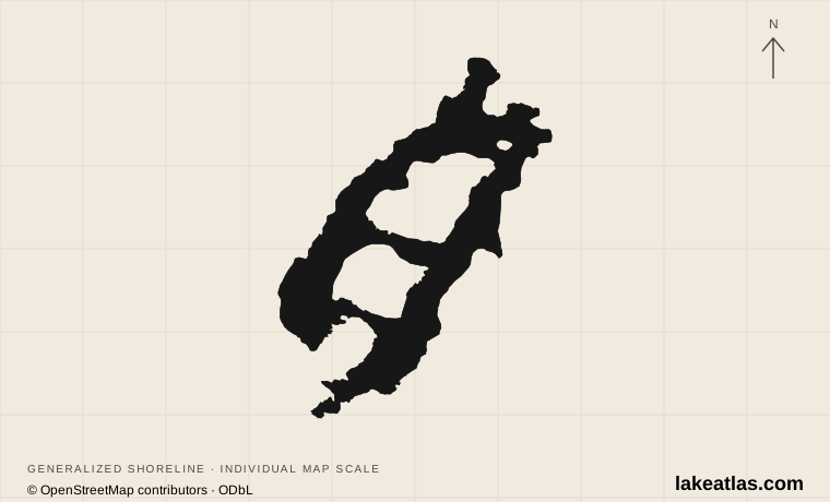
Lake Placid itself divides into East Lake and West Lake around a peninsula and Buck, Moose and Hawk islands. Whiteface Mountain and the surrounding forested slopes give it a mountain-basin setting, while the narrow southern approach is close to village services. There is no public road circuit around its entire shoreline.
Match the numbered places to the list below. Open the full-size map for labels and detail.
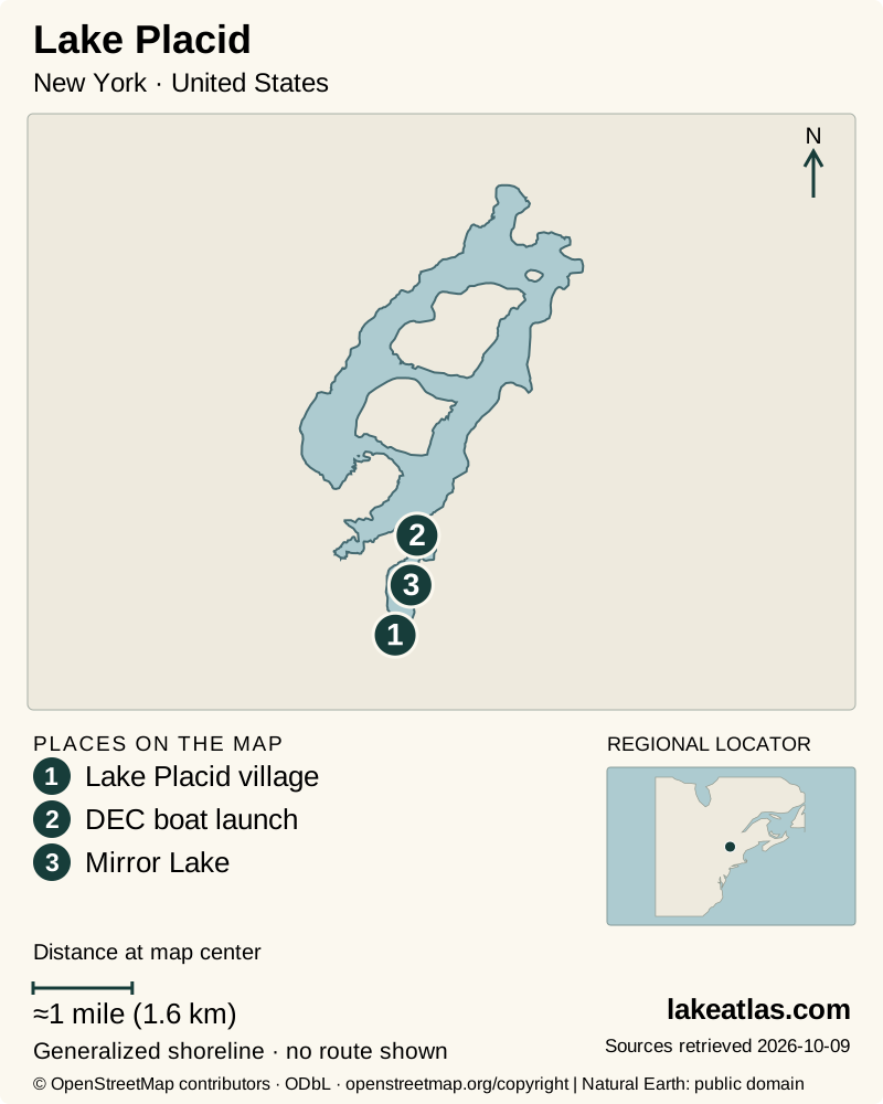
- 1Lake Placid village
- 2DEC boat launch
- 3Mirror Lake
Map design: LakeAtlas. Shoreline and place sources: Natural Earth (public domain) and © OpenStreetMap contributors (ODbL). Locator: Natural Earth. Retrieved October 9, 2026. Individual source links are in the downloadable GeoJSON. DEC launch location: New York State DEC. Map data (GeoJSON).
A glacial landscape with a managed outlet
Ice sheets scoured the Adirondacks’ older bedrock and left the irregular deposits that shaped many of the region’s lakes. Lake Placid occupies a natural basin fed from the surrounding mountain slopes. Its islands and opposing shorelines make the view from a southern launch only a small part of the whole lake.
Natural origin does not mean an unmodified water level. A spillway at the southern end of West Lake feeds Outlet Brook, and smaller eastern outlets join that drainage. Lake Placid is described here as a natural lake with a managed outlet, rather than a reservoir created by flooding an entirely new valley.
DEC’s 2023 lake report classified the lake as oligotrophic, meaning relatively low biological productivity, while also recording harmful algal blooms. Those findings can coexist. A reputation for clear water does not establish safe swimming at a particular site or date; use posted local notices and avoid suspected blooms.
How large and deep is Lake Placid?
The DEC contour map gives a surface area of 3.4 sq mi (8.79 km²) and a mean depth of 52 ft (15.8 m). The Shore Owners’ Association publishes a maximum depth of 151 ft (46 m) and a reference elevation of 1,858 ft (566 m). Maximum depth describes the deepest point, not the depth beside the launch or around the islands.
A separate DEC waterbody-assessment record gives 3.05 sq mi (7.91 km²). These source areas are not interchangeable, and neither page explains the difference. LakeAtlas uses the contour-map figure for a consistent whole-lake comparison and records the alternative in the data notes.
Reaching Lake Placid’s actual shoreline
The DEC Lake Placid Boat Launch is off Route 86 on Mirror Lake Drive. Despite that street name, it launches onto Lake Placid, not Mirror Lake. DEC lists a hard-surface ramp, an accessible launch dock and an accessible restroom. Those are verified facilities at this entrance; they do not establish accessible landings elsewhere around the lake.
For time beside the water without a boat, the Brewster Peninsula trail network reaches Lake Placid’s western shore through gently rolling forest. The paths include roots and rocks, so a short shoreline outing still needs footwear and a route chosen from the trail map. Public forest access here should not be generalized to privately occupied shoreline and docks.
Boating opens more of the lake, but motorboats, wind and distances across open water distinguish it from a sheltered village paddle. Pick a route and turnaround appropriate to conditions, and confirm permission before landing at a dock or island property. A rental or tour operator can supply current launch and route advice.
Mirror Lake for a village-based day
Mirror Lake is the more direct choice for combining a paddle, a waterfront walk and Main Street. The tourism office describes a 2.7 miles (4.3 km) circuit around the lake. That is the village walking route, not a trail around Lake Placid. Hand launches and the public beach provide designated access, while gasoline-powered motors are prohibited on Mirror Lake; electric motors are permitted.
The public beach is at Mirror Lake’s southern end. It can work as the center of a relaxed day with food and services close by, but events and supervised-swimming arrangements affect access. The lake is used for the Ironman swim and is unavailable for normal recreation during that race; check the event calendar before committing to a particular day.
Olympic history beyond the waterfront
The village hosted the Winter Olympics in 1932 and 1980. The Olympic Center and its museum are downtown, close to Main Street and Mirror Lake, and provide a weather-independent way to understand that history. Museum entry and event access follow their own operating arrangements rather than a general village admission.
The other Legacy Sites are separate destinations: the Olympic Jumping Complex, Mt. Van Hoevenberg and Whiteface Mountain. An itinerary that includes them needs transport between venues. Do not treat an Olympic Center visit as access to every mountain attraction; select the venue and activity first, then check the operator’s current availability.
Summer paddling and winter village visits
Summer favors open-water trips and the village beach; fall can suit a shoreline walk and museum visit without depending on swimming. Boat businesses and specific facilities have seasonal schedules. Check them before choosing accommodation on the assumption that a launch, rental or cruise will be operating.
Winter changes the destination rather than simply freezing a summer itinerary. Mirror Lake can host skating, sledding and other organized activities only when conditions allow. Confirm that a managed activity is operating; visible ice is not permission to walk or skate onto it. Forest trails can be snowy or icy even when Main Street is straightforward to navigate.
A practical first visit
For a village-based introduction, start at the Olympic Museum, walk to Mirror Lake and choose part or all of its 2.7 miles (4.3 km) circuit. Add the public beach only when swimming is officially available. This keeps the first day geographically coherent and avoids mistaking downtown access for a complete visit to the larger lake.
To see Lake Placid itself, make a separate stop at Brewster Peninsula for a forest-and-shore walk or arrange a trip from the DEC launch. A car is useful when combining those locations with the outer Olympic venues; walking works for the central museum, shops and Mirror Lake. Check parking and activity bookings individually during major sporting events.
What did we learn about Lake Placid?
The name covers two different visitor experiences: the Olympic village around Mirror Lake and the larger, island-divided Lake Placid to its north. A village walk is easy to organize around public places; exploring Lake Placid demands a named trailhead or launch and respect for mixed shoreline ownership. Choosing which water body you mean is the most useful first planning decision.
Sources & data notes11 references · Checked October 9, 2026
Data notes
Surface area follows DEC’s contour map at 3.4 sq mi (8.79 km²). Its waterbody assessment separately reports 3.05 sq mi (7.91 km²); the source pages do not reconcile the difference.
- Surface area follows DEC’s contour map at 3.4 sq mi (8.79 km²). Its waterbody assessment separately reports 3.05 sq mi (7.91 km²); the source pages do not reconcile the difference.
- Mean depth follows the contour map; maximum depth and reference elevation follow the local Shore Owners’ Association and agree with the regional tourism office. Elevation is not a current gauge reading.
- The location marker is DEC’s verified public boat-launch coordinate, not a calculated centroid. Mirror Lake has a separate shoreline and its walking circuit must not be confused with Lake Placid’s dimensions.
Suggested visits are researched planning guidance, not firsthand travel reports.
References
- NYSDEC — Lake Placid Contour Map
- Shore Owners’ Association of Lake Placid — Facts About Lake Placid
- NYSDEC — Saranac Lakes Wild Forest
- Regional Office of Sustainable Tourism — Mirror Lake
- Lake Placid Legacy Sites — About Us
- Lake Placid Olympic Museum — Visit
- Regional Office of Sustainable Tourism — Mirror Lake – Winter
- NYSDEC — Remsen–Lake Placid Travel Corridor Unit Management Plan
- NYSDEC — 2023 Lake Report: Lake Placid
- NYSDEC — Lake Placid Waterbody Assessment
- Regional Office of Sustainable Tourism — Boating and Launch Information
Source selection & methodology. Image credits appear beside each image.