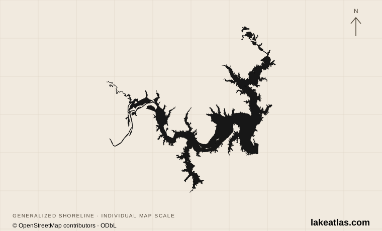
A border lake with branching arms
Impounded in 1944, Lake Texoma is a Red River reservoir northwest of the Sherman–Denison area. The dam and broad southern basin connect with long river and creek arms. The Red River and Washita portions give the lake its branching regional shape; islands and smaller coves complicate any impression of a simple open-water bowl.
The reference surface area used here is 116.7 sq mi (302.2 km²), with a published maximum depth of 100 ft (30.5 m). Maximum depth describes the deepest water under the source’s reference conditions, not the usual depth beneath a boat or along a swimming shore. A reservoir level change alters both depth and the extent of inundated land.
Visitors will also encounter a surface-area figure of 139.1 sq mi (360.2 km²). The USACE shoreline plan explains that the older conservation-pool footprint included islands and areas subsequently affected by sediment accumulation. It adopts the Texas Water Development Board’s smaller surveyed water-surface figure. This is a difference in survey and accounting, not evidence that today’s lake level can be inferred from either number.
Match the numbered places to the list below. Open the full-size map for labels and detail.
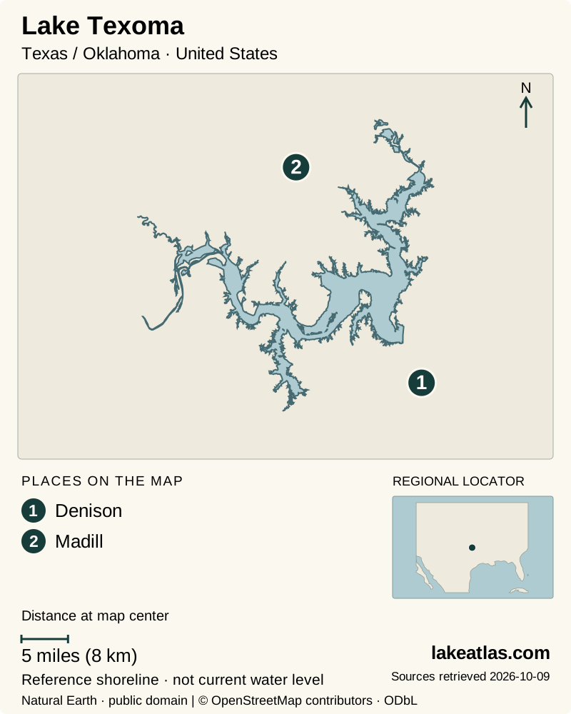
- 1Denison
- 2Madill
Map design: LakeAtlas. Shoreline and place sources: Natural Earth (public domain) and © OpenStreetMap contributors (ODbL). Locator: Natural Earth. Retrieved October 9, 2026. Individual source links are in the downloadable GeoJSON. Map data (GeoJSON).
Choose Texas or Oklahoma as your starting shore
Denison and Pottsboro provide useful Texas-side bases for the southern lake. Eisenhower State Park makes the shoreline accessible through an organized park, with high bluffs, a sandy swimming cove and trails. Its combination of land and water activities suits a first visit that does not depend entirely on boat rental or a fishing charter.
On the Oklahoma side, the Kingston area connects travelers with another group of marinas, resorts and public recreation sites. USACE identifies East and West Burns Run among the lake’s day-use destinations. These are individual sites with their own access arrangements, rather than interchangeable entry points to a continuous public beach.
Choose a base by the launch, park or refuge you intend to visit. Moving between lake arms by road involves going around water and finding the appropriate crossing. A lodging address described simply as “Lake Texoma” may be inconvenient for an activity on the other side, even when both addresses appear close on a regional map.
Hagerman reveals a different Texoma
Hagerman National Wildlife Refuge occupies the upper Big Mineral Creek arm, where shallow water, marshes and uplands create a quieter counterpoint to the broad boating basin. Wildlife Drive and named walking trails provide access for observing birds and the changing shoreline. This is a managed wildlife refuge, so its activity rules differ from those of a recreation park or commercial marina.
The visitor center is a useful first stop for trail information and recent wildlife observations. Spring through fall can bring activity around the pollinator garden, while winter attracts large numbers of geese to the refuge’s fields. Those seasonal differences make the refuge worth considering outside the usual swimming season.
Refuge roads and trails can flood when the reservoir rises. Hagerman also sets different rules for motorized and nonmotorized boating and for particular waters. A lake-wide boating description is therefore insufficient for planning access inside the refuge; consult the refuge’s own activity and closure information.
Fishing and an operating reservoir
Texoma is well known for striped bass, including a naturally reproducing population described by USACE. Catfish, crappie and several other bass species add to its fishing appeal. The state line is a practical detail for anglers: licensing and species rules need to be checked for the planned fishing area before departure, rather than assuming that one state’s ordinary license covers the entire lake.
TPWD also identifies zebra mussels and occasional harmful algal blooms as relevant lake issues. Use the agency and USACE notices for current conditions. An attractive cove, a blue patch on a map or a photograph taken at a higher level cannot establish present water quality, navigation depth or whether a launch is operating.
For summer water activities, plan around a specific managed access and the day’s weather. In cooler months, the bluff trails and refuge can anchor a visit even when swimming is not part of the plan. Wind, water level and park operations remain local checks in every season.
A first visit from the Texas side
A practical introductory day pairs Eisenhower State Park with a separate visit to Hagerman, using a car between the two. At Eisenhower, select a trail or shoreline activity from the park’s current map and alerts. At Hagerman, begin with the visitor information and choose Wildlife Drive or a short out-and-back walk rather than assuming every trail must be completed.
If boating is the main purpose, replace the second stop with a prearranged departure from a named marina or launch. Confirm which arm the operator serves and where to park. For an Oklahoma-based stay, build the same kind of compact day around one Burns Run or other verified public site instead of commuting repeatedly across the whole reservoir region.
What did we learn about Lake Texoma?
Lake Texoma combines a large, branching interstate reservoir with very different shore experiences. Its surveyed reference area needs care, and its maximum depth does not describe shallow coves. A park day at Eisenhower, wildlife visit at Hagerman or outing from an Oklahoma access becomes easier to plan once the chosen lake arm and state are clear.
Sources & data notes7 references · Checked October 9, 2026
Data notes
Canonical surface area follows the 116.7 sq mi (302.2 km²) TWDB survey value adopted by the 2021 USACE shoreline plan, not the older 89,000-acre figure. Maximum depth is the TPWD reference maximum; both depend on water level. Locator is the USGS station near Denison.
- The 2021 USACE shoreline plan explicitly uses 116.7 sq mi (302.2 km²) at conservation pool, reconciling the older 89,000-acre figure still present on some recreation pages.
- The TPWD figure of 100 ft (30.5 m) is maximum depth, not average depth or a current sounding.
Suggested visits are researched planning guidance, not firsthand travel reports.
References
- Texas Parks and Wildlife — Fishing Lake Texoma
- USACE — Texoma Shoreline Management Plan, 2021
- USACE — Lake Texoma recreation
- Texas Parks and Wildlife — Eisenhower State Park
- US Fish and Wildlife Service — Hagerman visit
- US Fish and Wildlife Service — Hagerman activities
- USGS — Lake Texoma near Denison
Source selection & methodology. Image credits appear beside each image.