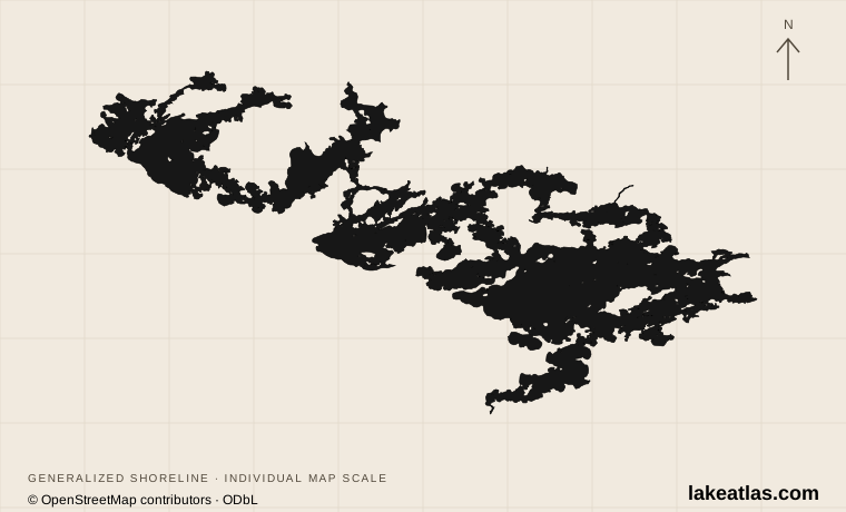
Tower, Cook and a long island-filled lake
Lake Vermilion lies in St. Louis County in northeastern Minnesota. Tower, Soudan and the Bois Forte community provide eastern reference points, while Cook is a gateway to the western side. This is the large Northwoods lake usually spelled Vermilion, with one l, not a similarly named lake elsewhere in the state.
Bays, islands and narrow passages interrupt the shoreline in every direction. A resort described simply as being on Lake Vermilion may be far from the launch, cabin or fishing area you intended to use. Choose the eastern, central or western part first and put a specific public landing or booked property into the route plan.
Match the numbered places to the list below. Open the full-size map for labels and detail.
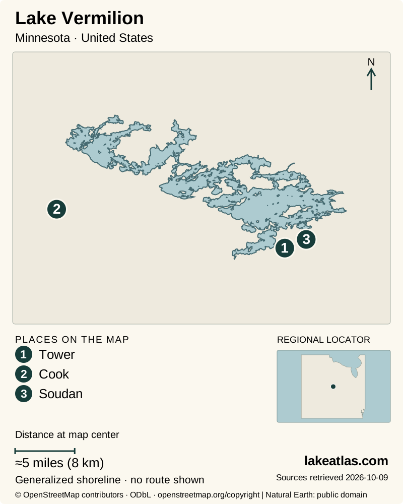
- 1Tower
- 2Cook
- 3Soudan
Map design: LakeAtlas. Shoreline and place sources: Natural Earth (public domain) and © OpenStreetMap contributors (ODbL). Locator: Natural Earth. Retrieved October 9, 2026. Individual source links are in the downloadable GeoJSON. Map data (GeoJSON).
Rock, glacial deposits and shallow bays
The lake belongs to the Canadian Shield landscape, where old bedrock, boulder-strewn shores and glacial deposits shape the water. DNR’s ecological account describes the surrounding transition from bedrock-controlled terrain to sediment-filled lowlands. This helps explain the combination of exposed rocky points, islands and vegetated bays rather than a single steep-sided basin.
The DNR’s dedicated Vermilion page gives 61.4 sq mi (158.9 km²) of surface area and a maximum depth of 76 ft (23.2 m). Its statewide facts table instead lists 63.4 sq mi (164.1 km²). LakeAtlas uses the dedicated page for the comparison area and records the disagreement; neither figure should be mistaken for a live water-level measurement.
Rocky and vegetated habitats support different fish communities. Walleye, muskellunge, northern pike, bass and panfish are part of the lake’s recreational importance, but a large maximum depth does not locate a fishing spot or define the conditions in every bay. The very irregular shore also makes a single shoreline-length statistic sensitive to survey detail and whether island coasts are included.
Stuntz Bay and the state park
Stuntz Bay Boat Access is a named public gateway near Soudan on the eastern lake. Its historic boathouses connect the waterfront with the mining community above it. The Lake Vermilion-Soudan Underground Mine State Park combines water access with hiking, camping and a historic mine, so it can support a land-based visit as well as a boat trip.
The mine tour is a separate destination, not a shore-access route. DNR lists the tour as accessible and describes the confined cage ride underground; visitors should consider that experience independently of walking ability. An accessible mine tour also says nothing about boarding a boat at a nearby landing.
Moccasin Point, a mid-lake access site, has been undergoing substantial reconstruction. The DNR page reviewed on October 9, 2026 still discusses closures and a tentative construction schedule ending in September 2026. A planned completion date is not confirmation of reopening: check the live notice before relying on that launch.
Island camping, paddling and houseboats
Public islands offer a more remote experience, but ownership and facilities differ. BLM-managed Lake Vermilion islands are reached only by boat, with natural mooring and no docks. The agency allows day use and first-come camping where not posted otherwise; many islands have no facilities. Use the agency’s location information to identify a public island rather than assuming every wooded shore is open.
Other shore stops are day-use sites with a different purpose. The Vermilion Lake Association’s shore-lunch docks are not for overnight camping or houseboat mooring. A mapped picnic stop should therefore not become an improvised overnight destination. Paddlers also need to account for open-water crossings between sheltered areas instead of judging an entire route from a calm launch bay.
Houseboats provide a way to stay on the lake, but they require more planning than a cabin on land. The Lake Vermilion Houseboats operator, for example, requires a separate motorized boat in tow and supplies its own operating instructions. Confirm the actual rental’s requirements, permitted mooring and resupply arrangements. Commercial terms do not establish public access rights on every island.
Blue Heron Island Cabin is another boat-dependent option within the state park. DNR lists accessible features in the cabin and outhouse, but guests must arrange their own transport and bring potable water. Accessible accommodation on an island does not by itself verify a step-free transfer from your particular boat.
A Northwoods visit through the seasons
The open-water season supports fishing, boating, paddling and island stays. Lake services and accommodation operate on their own schedules; the state park’s island cabin is seasonal, while mainland activities have different availability. Autumn travel calls for more attention to daylight, weather and the return journey from a remote shore.
Winter fishing is part of the region’s recreation, but no lake-wide label establishes safe ice or a passable road. DNR does not measure ice thickness across Minnesota lakes, and bays, channels and current-affected places can differ. Arrange any winter access with current, site-specific information and keep a mainland alternative available.
Choose a base before a route
A car is useful for reaching the selected mainland access or resort; a boat becomes a separate requirement for island plans. Tower and Cook are regional gateways, not interchangeable launch points. Confirm fuel, food, parking and overnight storage with the property or land manager serving the actual shore you will use.
For a first day on the eastern side, combine Stuntz Bay’s waterfront context with a state-park walk or a separately booked mine tour. Add a boat outing only when you have a named landing, a realistic return route and current weather. An island camp or houseboat itinerary is better treated as the purpose of a separate, prepared stay.
What did we learn about Lake Vermilion?
Vermilion’s islands make the lake feel expansive, but they also divide it into very different trips. A mainland park day, a paddle to a public island and a houseboat stay each need their own access plan. Choose the shore and the landing first; the lake’s character becomes clearer once the route is concrete.
Sources & data notes12 references · Checked October 9, 2026
Data notes
Area follows the current dedicated Minnesota DNR lake page: 61.4 sq mi (158.9 km²). The same agency’s statewide table lists 63.4 sq mi (164.1 km²); the discrepancy is unresolved and is stated rather than averaged.
- Area follows the current dedicated Minnesota DNR lake page: 61.4 sq mi (158.9 km²). The same agency’s statewide table lists 63.4 sq mi (164.1 km²); the discrepancy is unresolved and is stated rather than averaged.
- Maximum depth is 76 ft (23.2 m) in both DNR sources. Island and shoreline counts vary among publications and are not used as precision comparison fields.
- Moccasin Point’s tentative 2026 completion date does not verify that construction restrictions have ended.
- Cabin and mine-tour accessibility claims apply only to the listed facilities, not to boating transfers or every state-park trail.
- The world-map marker is a representative interior point calculated from the credited map shoreline. It is a location reference, not a public access destination.
Suggested visits are researched planning guidance, not firsthand travel reports.
References
- Minnesota DNR — Lake Vermilion
- Minnesota DNR — Lakes, rivers, and wetlands facts
- Minnesota DNR — Littlefork-Vermilion Uplands Subsection
- Minnesota DNR — Lake Vermilion-Soudan Underground Mine State Park
- Minnesota DNR — Lake Vermilion-Soudan State Park virtual tour
- Bureau of Land Management — Lake Vermilion Public Islands
- Minnesota DNR — Soudan Underground Mine tours
- Minnesota DNR — Moccasin Point public access construction updates
- Lake Vermilion Houseboats — Frequently Asked Questions
- Vermilion Lake Association — Shore Lunch Sites
- Minnesota DNR — Blue Heron Island Cabin
- Minnesota DNR — Ice safety
Source selection & methodology. Image credits appear beside each image.