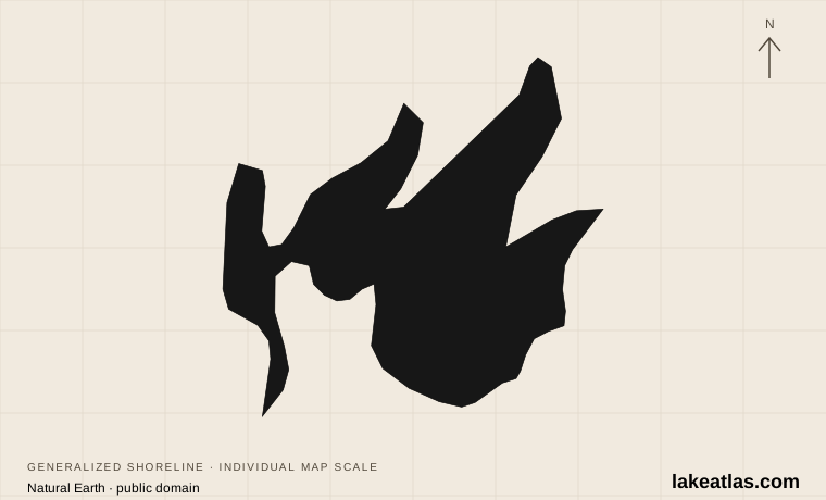
Walker, the bays and the Chippewa National Forest
Leech Lake lies in Cass County in north-central Minnesota, with Walker beside Walker Bay on the southwestern side and Federal Dam at the outlet on the northeastern side. It is part of the Mississippi headwaters region. The surrounding Chippewa National Forest and Leech Lake Reservation are essential to its setting, but their boundaries do not make every shoreline parcel public.
The lake has broad open water as well as large bays, wooded points and islands. Bear Island, Pelican Island, Portage Bay and the long Walker Bay help organize the map. A drive to Walker does not automatically put you near an eastern launch, while a campsite at Federal Dam serves a different part of the water. Choose a bay and named access before building the rest of the trip.
Match the numbered places to the list below. Open the full-size map for labels and detail.
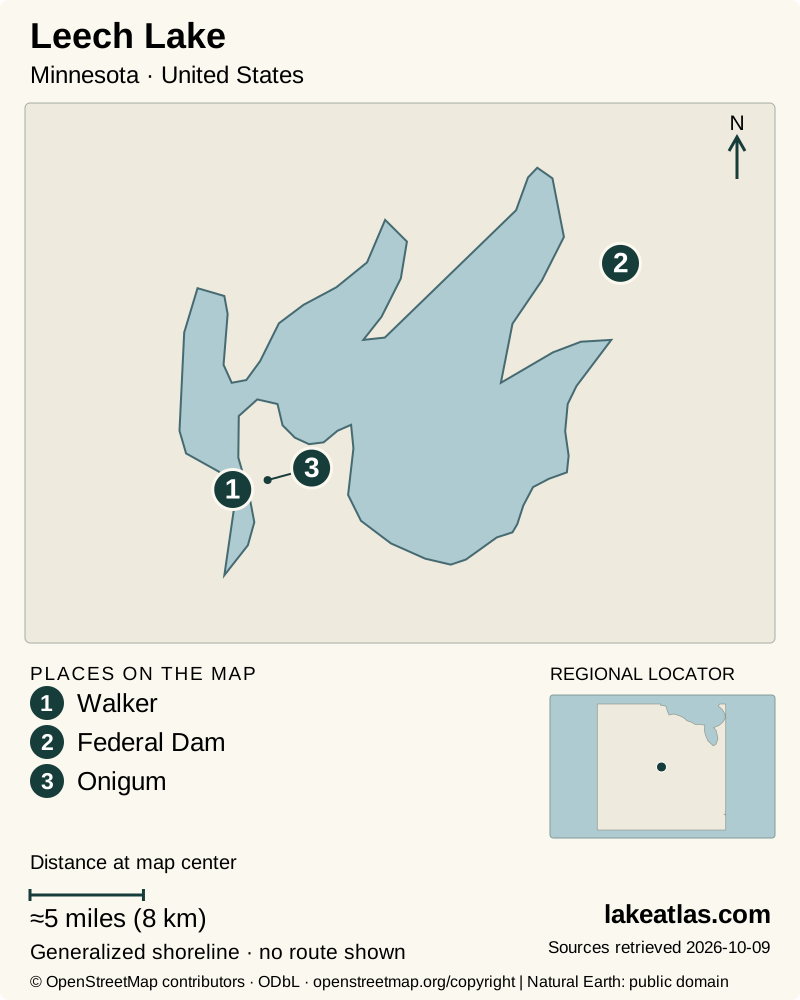
- 1Walker
- 2Federal Dam
- 3Onigum
Map design: LakeAtlas. Shoreline and place sources: Natural Earth (public domain) and © OpenStreetMap contributors (ODbL). Locator: Natural Earth. Retrieved October 9, 2026. Individual source links are in the downloadable GeoJSON. Map data (GeoJSON).
A natural lake enlarged by its outlet dam
The original basin formed in a glacial landscape and crosses several glacial terrain zones. Human engineering later changed it: the Leech Lake dam began operating in 1884 at the outlet river. The DNR management history describes a water-level rise of about 2 ft (0.6 m), expanding an existing lake. It is therefore best described as a natural lake enlarged and regulated by a dam, rather than a reservoir created in an otherwise dry valley.
The current DNR overview rounds surface area to about 175 sq mi (453 km²) and identifies Leech as the third-largest lake wholly within Minnesota. That qualification matters: shared-border lakes are a different ranking. A separate DNR statewide table gives a more precise acreage, but LakeAtlas uses the rounded current management figure and does not imply that it is today’s measured shoreline.
Maximum depth is 150 ft (45.7 m), while the management plan describes nearly four-fifths of the lake as shallower than 35 ft (10.7 m). Deep Walker Bay is therefore not representative of the entire basin. Broad shallow water and deep embayments create different habitats and different exposure to waves; the maximum depth alone says little about a particular launch or fishing ground.
Fish, forests and a living cultural landscape
Leech supports a varied fishery, including walleye, yellow perch, muskellunge, northern pike and bass. Its mix of bays, vegetation and deeper water is part of that diversity. Fishing rules and management decisions should be checked for the visit date, rather than inferred from a species list or an old fishing report.
The lake is also within the homeland and reservation landscape of the Leech Lake Band of Ojibwe. National-forest, tribal, state, county and private lands overlap across the region. A wooded bank, an island or an area inside a forest boundary is not automatic permission to land, camp or harvest. Use established public facilities or obtain the relevant permission, and respect local cultural and resource-management rules.
Three useful access areas
Walker is the practical choice for a town-based stay and access to Walker Bay. It offers services without requiring a remote campsite, and the DNR records a new city fishing pier completed for the spring 2025 opener in a location protected from prevailing wind and waves. That specific design purpose does not guarantee calm conditions across the bay.
Stony Point is a Chippewa National Forest campground on the lake, with a boat ramp and dock. It combines a developed camping base with forest and water access; it is not a dispersed-camping invitation for the entire nearby shore. The campground lists toilets, drinking water and other seasonal facilities. Reserve the actual site and confirm facility operation if visiting outside the main season.
At Federal Dam, the Corps of Engineers’ Leech Lake Recreation Area provides ramps, camping and an overnight boat-mooring area. Recreation.gov identifies its lake connection as Portage Bay. This is a useful northeastern base and a place to understand the managed outlet, but it is distinct from a resort on Walker Bay and should be entered separately into driving directions.
Boating, paddling and seasonal limits
Boating and fishing are central to an open-water visit. The lake’s scale means a sheltered launch can lead to a much more exposed crossing. For paddling, choose a route within the conditions and your group’s experience, with a feasible return to the same named access; an island visible on the map is not necessarily a suitable landing or short crossing.
Summer supports camping and the fullest range of resort services, while spring and fall bring different fishing opportunities and facility schedules. A campsite reservation and boat access are related but separate arrangements, so check both. Forest and resort shores also serve different needs: a developed resort may provide equipment or supplies by agreement, while a public campground may require you to arrive with your own boat and gear.
Winter fishing adds another kind of trip. Lake ice, plowed routes and access arrangements can change rapidly, and the DNR does not certify ice thickness across the lake. A functioning winter route to one area should not be extended into an assumed lake-wide road network. Use current local information and the rules of the specific access operator.
A first visit based in one part of the lake
A car is useful for reaching Walker, Stony Point or Federal Dam and carrying equipment to a chosen launch. A boat is optional for appreciating the shore, but essential for many fishing or island-based plans. Keep the land route, launch parking and on-water route as three separate parts of the day.
For a first visit, choose Walker for a town-and-waterfront introduction, or book Stony Point or Federal Dam as a camping base. Explore that area before attempting to connect distant bays. The more useful question is where you can reach the water with the equipment and time you have, not how many miles of shoreline you can claim to have covered.
What did we learn about Leech Lake?
Leech Lake is both a natural glacial basin and a managed part of the Mississippi headwaters. Its deepest bay, open shallows and varied shore ownership create different visitor experiences. Choosing one public base makes those differences manageable and prevents a large forested lake from being mistaken for unrestricted shoreline.
Sources & data notes12 references · Checked October 9, 2026
Data notes
Surface area follows the current DNR management overview’s rounded about 175 sq mi (453 km²). The statewide inventory gives 174.3 sq mi (451.3 km²); these are not treated as evidence of a recent measured change.
- Surface area follows the current DNR management overview’s rounded about 175 sq mi (453 km²). The statewide inventory gives 174.3 sq mi (451.3 km²); these are not treated as evidence of a recent measured change.
- Maximum depth is 150 ft (45.7 m). The management plan’s shallow-water proportion describes most of the lake, not mean depth.
- The 1884 outlet dam enlarged an existing natural lake; area is a managed-lake reference figure, not a current water-level observation.
- Land-manager and reservation boundaries overlap; public access is documented only for the named destinations. Modern destination-specific mobility details remain unverified.
- The world-map marker is a representative interior point calculated from the credited map shoreline. It is a location reference, not a public access destination.
Suggested visits are researched planning guidance, not firsthand travel reports.
References
- Minnesota DNR — Leech Lake management
- Minnesota DNR — Fisheries Management Plan for Leech Lake 2021–2025
- Minnesota DNR — Lakes, rivers, and wetlands facts
- US Army Corps of Engineers — Leech Lake
- Recreation.gov — Leech Lake Rec Area
- Recreation.gov — Stony Point, Chippewa National Forest
- Minnesota Indian Affairs — Gaa-zagaskwaajimekaag / Leech Lake Band of Ojibwe
- Leech Lake Tourism Bureau — Public Lake Access and Boat Landings
- Minnesota DNR — Enhancing fisheries and fishing infrastructure
- Minnesota DNR — Ice safety
- US Army Corps of Engineers — St. Paul District Recreation Sites brochure
- Minnesota Conservation Department — Leech Lake sounding map, hosted by Leech Lake Tourism Bureau
Source selection & methodology. Image credits appear beside each image.