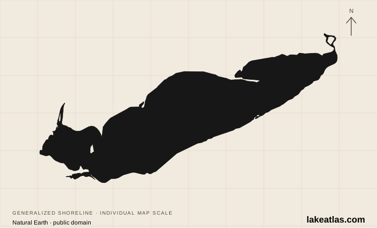
Where is Lake Erie?
Ontario forms the northern shore, while Michigan, Ohio, Pennsylvania and New York border the American side. Water arrives from the upper Great Lakes through the Detroit River at the western end and leaves toward Ontario through the Niagara River in the northeast. The Welland Canal provides a shipping route around Niagara Falls.
The lake’s shape creates distinct travel regions. The western end contains islands and shallow water; the southern shore includes cities and public beaches; the eastern end reaches New York. Point Pelee projects from the Canadian side, while Presque Isle forms a sandy peninsula beside the Pennsylvania city of Erie. Those peninsulas are useful places to see how land, open water and sheltered habitat meet.
Erie’s basin was shaped by the same continental ice sheet that formed the other Great Lakes. Melting and retreating ice left water in the excavated terrain. The shallowness of the western basin and the greater depth toward the east are important differences within that shared glacial landscape.
Match the numbered places to the list below. Open the full-size map for labels and detail.
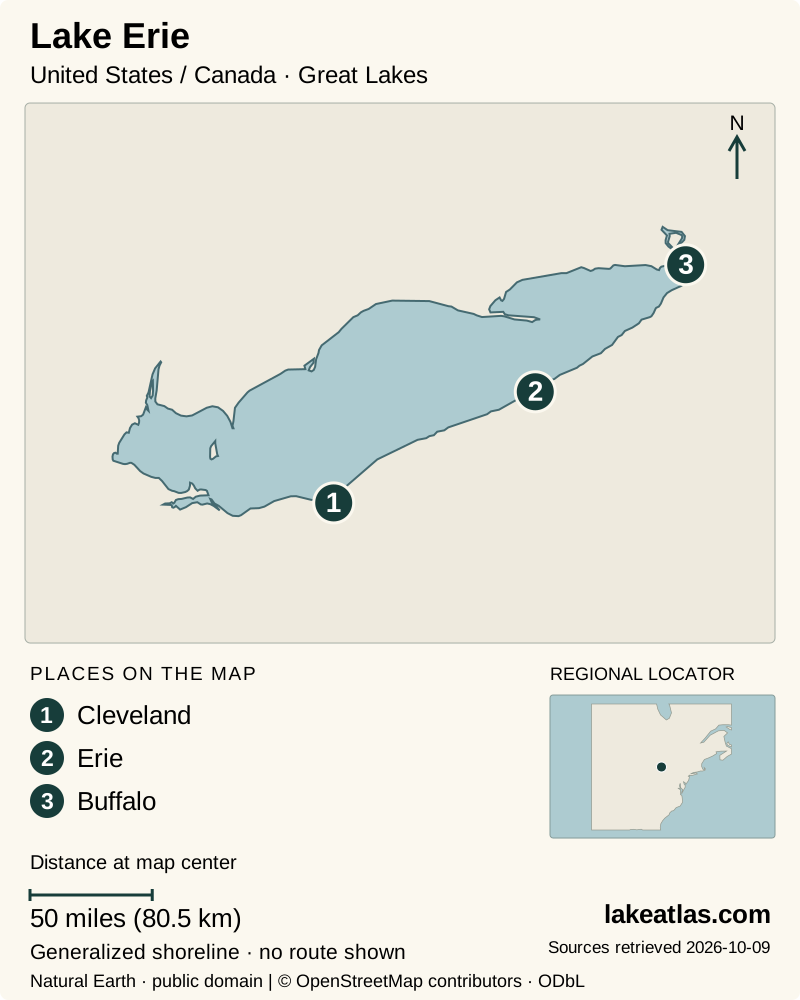
- 1Cleveland
- 2Erie
- 3Buffalo
Map design: LakeAtlas. Shoreline and place sources: Natural Earth (public domain) and © OpenStreetMap contributors (ODbL). Locator: Natural Earth. Retrieved October 9, 2026. Individual source links are in the downloadable GeoJSON. Map data (GeoJSON).
How large and deep is Lake Erie?
Erie covers 9,910 sq mi (25,700 km²), with a maximum depth of 210 ft (64 m) and a mean depth of 62 ft (19 m). Its reference volume is 116 cu mi (484 km³). It is the shallowest Great Lake, but “shallow” is a comparison between basins, not a description of every place where a person might swim or launch a boat.
The western basin is especially shallow; the eastern basin contains the deepest water. New York’s environmental agency describes the central and eastern basins as seasonally layered by temperature, while the western basin rarely maintains that layering for long. This difference helps explain why the same lake supports different conditions and habitats from west to east.
Warm-season water and algal blooms
Erie warms and cools more quickly than the deeper Great Lakes. That supports a productive aquatic system, but it does not make the lake uniformly warm or calm. Strong winds along its long axis can redistribute water and create substantial waves; a quiet-looking sheltered bay may say little about conditions outside it.
Harmful cyanobacterial blooms are a recurring concern, particularly in western Erie. NOAA emphasizes that bloom size is not the same as toxicity. A seasonal outlook describes the expected regional bloom, while a beach closure or current local notice answers the more immediate question of whether a particular outing should proceed.
Use the current beach information for the place you plan to enter the water and keep people and pets away from suspect scum. It is also misleading to describe the entire lake as closed whenever a bloom appears somewhere: location, wind and monitoring matter. Have a shore walk or birding option ready when a water activity is unsuitable.
Weather guidance should match the basin and the distance from shore. Consult current nearshore and open-water forecasts, including wind and waves, rather than using an inland city forecast alone. A western-basin bloom or wind map does not describe the deeper eastern basin at Buffalo.
The western islands offer a different kind of trip
Ohio’s Lake Erie islands include South Bass, Middle Bass and Kelleys Island. South Bass contains Put-in-Bay and public sites including South Bass Island State Park and Perry’s Victory and International Peace Memorial. Kelleys Island has its own state park, nature preserves and Inscription Rock. Choose an island by the places you want to explore, rather than treating every island arrival as the same experience.
South Bass also carries the history of the 1813 Battle of Lake Erie and its later peace memorial. Ferry choice changes the arrival: the Jet Express passenger dock is near Put-in-Bay village, while Miller’s passenger-and-vehicle service lands elsewhere on the island with onward local transport. Check the route, current sailing and final return before choosing whether to bring a vehicle. Memorial facilities have their own operating notices.
For Kelleys Island, the ferry operator lists a mainland departure in Marblehead and carries passengers and vehicles. Confirm the current schedule, return sailing and whether taking a car suits your day. An island stay requires a transport plan in addition to any lodging or campsite reservation; seasonal schedules and weather can affect the crossing.
For a first mainland trip, Presque Isle avoids that boat connection entirely. The choice is useful: plan the western islands when the crossing and island destinations are central to the visit, or use a mainland peninsula when flexibility and direct road access matter more.
City shores and a working shipping lake
Erie is also a working transportation corridor. Freighters use Presque Isle Bay beside the city of Erie, while the Welland Canal lets commercial vessels bypass Niagara Falls between Erie and Ontario. A beach, a protected harbor and a shipping approach may be close together geographically but are different places to swim or paddle.
Cleveland’s Edgewater Park supplies an urban central-basin option: a beach, park trails and the Lakefront Bikeway connect a lake outing with the city. Its marked paddling access follows the rock jetty away from the swimming area, with a temporary boat drop-off rather than permission to block the beach entrance.
At the eastern end, Buffalo’s Wilkeson Pointe offers a roller launch and paddlecraft drop-off on the Outer Harbor. Buffalo Blueway warns of wind and wave exposure and few emergency exits. A sheltered-looking launch therefore does not make the ensuing harbor route a beginner outing in every weather. Select the actual route and forecast before launching.
Presque Isle: an approachable first visit
Presque Isle State Park is connected to the mainland beside Erie, making a shoreline visit possible without booking a ferry. Its sandy peninsula encloses Presque Isle Bay and supports beaches, paths and varied habitats. The Tom Ridge Environmental Center is a sensible place to begin before choosing the day’s outdoor stops.
The park is for day use; arrange overnight accommodation separately. A useful visit combines a beach-facing stop with a walk or bicycle outing, rather than treating every part of the peninsula as the same landscape. The bay side and the open lake serve different interests, and birdwatchers should allow time to linger rather than rush between viewpoints.
Swimming is permitted only within the designated guarded zones. The published beach season generally runs from Memorial Day weekend to Labor Day, subject to notices. Beaches with access ramps and beach-wheelchair arrangements may suit visitors who need help reaching the sand, but confirm the facility and availability before arrival. The quieter Mill Road beaches allow shore walking and picnicking but prohibit swimming.
Point Pelee and the migration seasons
Point Pelee National Park offers a complementary view from Ontario. The Marsh Boardwalk provides a way into wetland scenery, while wooded trails and the Tip area show other habitats. The park is reachable by car; a shuttle trip to the Tip is an internal park activity with seasonal operation, not a substitute for checking how to reach the park itself.
Migration makes the timing of a visit especially important. At Presque Isle, spring and fall bring different groups of birds, with warblers particularly associated with mid-May and September. At Point Pelee, the north-shore position concentrates migrants and creates good opportunities within a compact range of habitats.
Protecting that habitat sometimes limits access. Presque Isle closes the sensitive easternmost Gull Point natural area from April through November, while allowing observation from the designated trail platform. A closure is part of the birding experience’s conservation context, not a suggestion to find an unmarked route around the boundary.
Choosing the season and a manageable itinerary
For swimming, use the individual park’s staffed beach season and daily status as the planning framework. For birds, choose spring or fall according to the species and habitats that interest you. A winter visit is a different kind of shore outing; do not infer that ice visible from a beach is a safe walking surface.
An Erie-based first visit can stay centered on Presque Isle: begin with orientation, choose an open-lake beach or walk, then add a bay-side or habitat-focused stop. That is a coherent introduction without crossing the lake or arranging an island sailing. Travelers based in southwestern Ontario can build a similarly focused day around Point Pelee.
If combining American and Canadian destinations, plan the border crossing and the actual road journey explicitly. A short distance drawn across water does not translate into a short drive. Check current park notices before departure, especially for swimming, conservation closures and the availability of seasonal services.
What did we learn about Lake Erie?
Lake Erie’s shallow west, deeper east and busy city shores create several different lake experiences. An island crossing, a mainland peninsula and an urban paddling launch each need their own access and weather plan. Choose the basin and named destination first, then use local beach, forecast and ferry information to make the day practical.
Sources & data notes20 references · Checked October 9, 2026
Data notes
Rounded NOAA GLERL reference statistics. Depths and volume are measured at Low Water Datum; present water levels vary. Comparisons use maximum depth, not mean depth.
- Area is water surface area, not the surrounding drainage basin. Maximum depth and mean depth describe different properties. Depths and volume use the source’s Low Water Datum, not today’s water level.
- NOAA’s published US and metric figures are independently rounded; both are retained instead of converting one rounded value into the other. ILEC uses a different source series for lake areas; its coordinates alone are used for the overview marker.
Suggested visits are researched planning guidance, not firsthand travel reports.
References
- NOAA GLERL — Physical Characteristics of the Great Lakes
- ILEC — United States lake inventory
- ILEC — Lake Erie
- Pennsylvania DCNR — Presque Isle State Park
- Parks Canada — Point Pelee visit planning
- New York DEC — Lake Erie Basin
- NOAA — Western Lake Erie bloom outlook
- Pennsylvania DCNR — Presque Isle swimming
- Pennsylvania DCNR — Presque Isle wildlife watching
- Parks Canada — Point Pelee birdwatching
- NOAA NCCOS — Lake Erie harmful algal bloom FAQs
- NOAA — Great Lakes ecoregion and formation
- Ohio DNR — Lake Erie Islands public access guide
- Kelleys Island Ferry — route and operating schedule
- Cleveland Metroparks — Edgewater Park
- Cleveland Metroparks — Beach Wheelchairs
- Buffalo Blueway — Plan Your Trip
- National Park Service — Perry’s Victory, Directions & Transportation
- National Weather Service — Lake Erie marine environmental forecasts
- National Park Service — Perry’s Victory & International Peace Memorial
Source selection & methodology. Image credits appear beside each image.