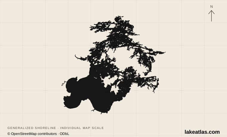
Where is Lake of the Woods?
The lake spans two countries and three jurisdictions: Minnesota in the United States, and Ontario and Manitoba in Canada. Warroad and Baudette serve the southern Minnesota region; Kenora is a northern Ontario gateway. The Northwest Angle is part of Minnesota north of the main body of the lake, but the ordinary road approach passes through Canada.
This geography makes the phrase “a Lake of the Woods vacation” unusually broad. A mainland beach day, a Canadian island stay and a Northwest Angle fishing trip can all use the same lake while requiring completely different travel arrangements. Plan around a named town, landing or accommodation rather than navigating to the lake’s center.
Match the numbered places to the list below. Open the full-size map for labels and detail.
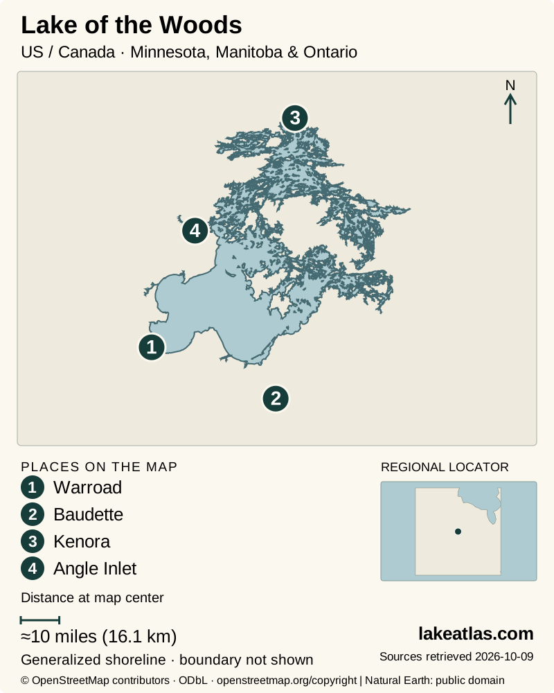
- 1Warroad
- 2Baudette
- 3Kenora
- 4Angle Inlet
Map design: LakeAtlas. Shoreline and place sources: Natural Earth (public domain) and © OpenStreetMap contributors (ODbL). Locator: Natural Earth. Retrieved October 9, 2026. Individual source links are in the downloadable GeoJSON. Map data (GeoJSON).
Open southern bays and an island-filled north
Lake of the Woods is a remnant of the much larger Glacial Lake Agassiz. The southern landscape includes low lake plains and sandy shore, while the lake’s northern reaches break into channels, islands and irregular bays. Glacial history helps explain why an open-water view from Zippel Bay looks so different from the shore around Kenora.
Rainy River brings water into the southeastern part of the system. The lake drains at its northern end into the Winnipeg River, eventually toward Lake Winnipeg and Hudson Bay. It is therefore outside the Great Lakes–St. Lawrence drainage even though both lake systems meet the Canada–US border.
The lake is natural, with regulated water levels. Binational arrangements connect its outflow decisions to downstream conditions. A map gives the enduring shape of the basin; it cannot establish the water depth at a dock or the navigability of a particular passage today.
How large and deep is Lake of the Woods?
LakeAtlas uses Minnesota DNR’s area, equivalent to 1,486.5 sq mi (3,849.9 km²). The 2009 digital bathymetry compilation identifies a deepest sounding of 216 ft (65.8 m) in Whitefish Bay. The same report describes much shallower southern bays, so that maximum is a poor description of the water off a south-shore beach.
Published area figures do not all match. A Canadian federal briefing gives 1,680 sq mi (4,350 km²), while DNR uses the smaller figure above. The sources do not supply enough matching boundary information to reconcile the difference here. Comparisons retain one identified source rather than quietly combining incompatible numbers. Surface area measures the water’s footprint; it does not tell you how much water is stored or how sheltered a boat route will be.
Choosing a shore: Zippel Bay, Kenora or the Angle
Zippel Bay State Park provides a practical Minnesota introduction: a sandy lakefront, picnic areas and a protected marina reached by road. Its beach and its boat ramp are separate destinations within the park. A walk beside the lake shows the breadth of the southern basin without requiring an island crossing.
Kenora offers a town-based visit among the northern channels. Anicinabe Park has a beach, boat launch and camping; Keewatin has another public lake beach. Coney Island beach requires a boat in summer, with transport arranged separately. Do not assume every beach advertised in Kenora is on Lake of the Woods: Garrow Park is on Rabbit Lake.
The Northwest Angle rewards a more deliberate plan. NASA’s account traces its unusual boundary to eighteenth-century mapping and later treaty adjustments. The result is a US community whose land access crosses Canada, rather than a convenient extension of the Minnesota south-shore road. Select an Angle destination and confirm the entire journey before treating it as a short side trip.
Border crossings, boats and public access
Road travel to Canadian shores or through Canada to the Northwest Angle requires the entry documents and reporting arrangements for that route. On water, the border remains a legal boundary even where it is invisible. Landing in another country, returning from a foreign visit and merely passing through water are not interchangeable situations.
Check both CBSA and US Customs and Border Protection guidance for the planned itinerary. Canadian remote-area reporting arrangements are changing, and official pages reviewed on October 9, 2026 give inconsistent transition dates. Ask the agencies which procedure applies before departure; an old permit description or a fishing operator’s map is not a substitute for current clearance requirements.
A car is useful for reaching the named mainland parks. Island accommodation and Coney Island add a boat transfer; reserve that transfer and the return journey together. Access to water does not make every island or dock public. Use identified public sites and obtain permission for private or community lands.
Fishing, shoreline walks and the lake’s ecology
Fishing is central to the lake’s visitor economy, with walleye, sauger, northern pike and other species identified by Minnesota DNR. Choose the relevant jurisdiction’s current license and regulations for the actual water fished. The Rainy River fishery and an open-lake trip are different outings, even when sold from the same gateway.
At Zippel Bay, visitors can combine a beach walk with birdwatching around marsh and bay habitat or use the named boat launch. Around Kenora, public parks and the harbourfront provide shorter land-based alternatives to a full boating day. A first visit can stay entirely ashore and still reveal the contrast between open basin and island channels.
The Canada Water Agency identifies harmful algal blooms linked to excess phosphorus as a major lake issue. Scenic water is not a water-quality test. Check local beach advisories before entering the water; Kenora directs visitors to the Northwestern Health Unit for closures.
Summer boating and winter travel require different plans
Warm-season visits support beach days, park camping and boat trips, but a calm bay does not establish conditions on the open lake. Choose a route that fits the vessel and forecast, and leave time to return before deteriorating weather changes the crossing.
Winter fishing and over-ice routes are seasonal activities, not permanent transportation links. Minnesota DNR warns that snow, current, wind and temperature changes all alter ice strength; Lake of the Woods can develop hazardous piled shelf ice. Confirm any maintained winter road with its operator and do not treat tracks or a previous crossing as proof that ice is safe.
For a straightforward first visit, base a day around Zippel Bay’s beach and marina or Kenora’s named public waterfront. Add a boat or border crossing only after its transport, access and weather arrangements are settled. Trying to sample the whole lake in one day sacrifices the very geographic differences that make it interesting.
What did we learn about Lake of the Woods?
Lake of the Woods connects a broad southern basin with a far more fragmented northern shore. The lake’s name alone does not describe the journey: choose the country, gateway and public landing first. That decision makes the geography, boat transfers and border requirements much easier to understand.
Sources & data notes14 references · Checked October 9, 2026
Data notes
Surface area follows Minnesota DNR: 1,486.5 sq mi (3,849.9 km²), converted directly from its original acreage without intermediate rounding. A Canada Water Agency briefing gives 1,680 sq mi (4,350 km²); its boundary and island treatment are not reconciled with the DNR figure, so LakeAtlas does not blend or average them. Maximum depth follows the 2009 digital bathymetry report: 216 ft (65.8 m) in Whitefish Bay, based on Canadian Hydrographic Service soundings and a stated reference water level. It is not a current depth at a launch. The report’s basin-wide average and area use a different compiled boundary and are not substituted for whole-lake averages.
- Surface area follows Minnesota DNR: 1,486.5 sq mi (3,849.9 km²), converted directly from its original acreage without intermediate rounding. A Canada Water Agency briefing gives 1,680 sq mi (4,350 km²); its boundary and island treatment are not reconciled with the DNR figure, so LakeAtlas does not blend or average them.
- Maximum depth follows the 2009 digital bathymetry report: 216 ft (65.8 m) in Whitefish Bay, based on Canadian Hydrographic Service soundings and a stated reference water level. It is not a current depth at a launch. The report’s basin-wide average and area use a different compiled boundary and are not substituted for whole-lake averages.
- Island and shoreline counts depend on mapping scale; this article uses “thousands” instead of implying that every rock and island has one definitive count. The locator is the USGS Warroad station, not the lake center.
- Border reporting guidance was checked October 9, 2026. The current RABC program page and earlier CBSA news notices give different transition dates. Confirm the rule for the exact journey with CBSA and CBP; no border clearance is implied by this article.
Suggested visits are researched planning guidance, not firsthand travel reports.
References
- Minnesota DNR — Lake of the Woods
- Canada Water Agency — Lake of the Woods overview
- Minnesota DNR — Agassiz Lowlands Subsection
- International Joint Commission — Lake of the Woods and Rainy River
- Lake of the Woods SWCD — Digital Bathymetry of Lake of the Woods
- Minnesota DNR — Zippel Bay State Park virtual tour
- City of Kenora — Beaches
- NASA Earth Observatory — Northwest Angle, Minnesota
- Canada Border Services Agency — Remote Area Border Crossing Program
- U.S. Customs and Border Protection — Pleasure Boats - Requirements for entering the United States
- Minnesota DNR — Ice formations and conditions
- USGS — Lake of the Woods at Warroad, MN
- Canada Water Agency — Section 3: Canada Water Agency Overview - What we do
- City of Kenora — Parks
Source selection & methodology. Image credits appear beside each image.