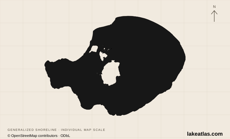
Mono Lake and the eastern Sierra
Lee Vining, on US 395, is the main gateway on the western side of the lake. The Sierra Nevada rises to the west; the open Mono Basin extends around the water. A visit here is separate from a visit to Yosemite, even though Tioga Road connects the regions when that mountain crossing is open.
Start with the Mono Basin Scenic Area Visitor Center at 1 Visitor Center Drive, north of Lee Vining. Its exhibits connect natural history, wildlife and human use. South Tufa lies on another approach, via State Route 120 east of US 395; it is not a short walk down from the visitor center.
Match the numbered places to the list below. Open the full-size map for labels and detail.
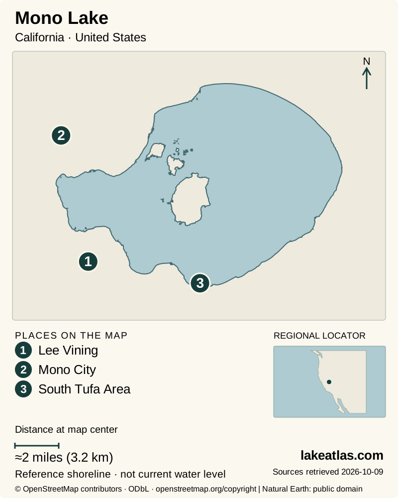
- 1Lee Vining
- 2Mono City
- 3South Tufa Area
Map design: LakeAtlas. Shoreline and place sources: Natural Earth (public domain) and © OpenStreetMap contributors (ODbL). Locator: Natural Earth. Retrieved October 9, 2026. Individual source links are in the downloadable GeoJSON. Map data (GeoJSON).
A saline terminal lake with a changing footprint
California State Parks gives an approximate area of ≈65 sq mi (168.3 km²). Treat that as a general reference extent, not a survey of today’s shore. Lake level, area and salinity change with inflow and evaporation. This profile does not publish a fixed maximum depth without a matching measurement date and water level.
Mono has no river outlet carrying salts away. Freshwater enters from the Sierra, then water evaporates while dissolved material remains. Its chemistry supports a different ecosystem from the freshwater lakes farther up the mountains. The lake is not an ordinary trout-fishing destination merely because nearby streams contain fish.
USGS describes the modern water body as a remnant of a much larger Ice Age lake, Lake Russell. The basin’s geological history is longer than the present shore suggests, and its islands also record volcanic activity. Paoha includes lake-bottom sediments pushed upward by magma; an island here need not be simply a pile of lava.
Why the tufa towers formed underwater
Freshwater springs carry calcium into carbonate-rich lake water. Where the waters mix, calcium carbonate precipitates and accumulates into tufa. The towers now standing above the lake formed underwater and became exposed as the surface fell; they were not carved into those shapes by wind.
Look for the relationship between the spring deposits, waterline and broader pale shoreline bands. Together they show a basin that has changed repeatedly. Stay on designated routes and leave the formations intact. The most useful photograph is one that preserves the setting as well as the tower, rather than requiring people to climb onto a fragile feature.
Water diversions changed the lake and its habitat
The State Water Board records a 45 ft (13.7 m) decline between 1941 and 1982 after diversion of tributary water toward Los Angeles. Falling water affected the lake’s environmental resources and the streams that feed it. The exposed shoreline is therefore part of a water-management history as well as a striking landscape.
Decision 1631, adopted in 1994, revised diversion conditions and set a long-term management level of 6,392 ft (1,948 m). That is a management objective, not the current surface elevation. Later orders address stream restoration and flows in Rush, Lee Vining, Walker and Parker creeks. Current conditions should be checked in dated monitoring, not inferred from that target.
South Tufa, Old Marina, and a closed boardwalk
The South Tufa Interpretive Trail is a 1 mile (1.6 km) loop through shoreline formations. State Parks identifies the first 0.25 miles (0.4 km) as accessible on hard-packed native soil; it does not give the entire loop the same assurance.
Old Marina, directly off US 395 north of Lee Vining, has the Mono Lake Trail with aggregate and wood surfaces, accessible parking, restrooms and a picnic table. Its shoreline and hillside branches differ, so use the detailed access description to choose a route.
As checked October 9, 2026, the State Reserve boardwalk at Mono Lake County Park remains closed after the Inn Fire. An older guide describing a north-shore bird walk there is not proof that the route has reopened. South Tufa and Old Marina are separate destinations, not substitutes with identical terrain.
Birds, open water, and seasonal constraints
The lake and adjacent wetlands support large numbers of feeding and resting birds. Boating needs to respect nesting protection: State Parks prohibits island access from April 1 through August 1 and requires distance from nesting osprey on offshore tufa during its specified protection season. Check those rules before launching; an island shown on the map is not an invitation to land.
This is a high, exposed basin where sun, wind and cold can affect the same outing. The South Tufa access road is not plowed in winter, and crossing the Sierra through Yosemite is a separate seasonal-road question. A shore walk remains worthwhile without going onto the water. If paddling, arrange a permitted launch and weather-appropriate outing rather than treating the lake as a sheltered marina basin.
A first visit focused on the lake’s story
Allow time at the visitor center, then choose South Tufa for an interpretive walk if the road and trail are open. Read the landscape in sequence: the basin and islands from a distance, spring-built towers at the shore, and the changing waterline between them. This plan does not require a boat or a long hike.
A car is useful because the main interpretation and shore access points are separated. Verify transport and facility opening for your date rather than assuming a public shuttle. For a mobility-focused visit, match the published route surface and distance to the individual traveler, then confirm that the chosen segment remains open.
What did we learn about Mono Lake?
Mono Lake shows how geology, chemistry and water allocation meet at one shoreline. Its towers grew below the surface, its salts remain because there is no outlet, and its exposed shore reflects changing water balance. A good visit connects those facts at a designated access point while giving nesting wildlife and fragile formations room.
Sources & data notes6 references · Checked October 9, 2026
Data notes
Area is California State Parks’ approximate reference ≈65 sq mi (168.3 km²), converted once from the original US source value to canonical metric. It is not a current shoreline survey. Maximum depth is not established for a dated water level; unknown is not zero. The management elevation is a target, not a present observation.
- Area is California State Parks’ approximate reference ≈65 sq mi (168.3 km²), converted once from the original US source value to canonical metric. It is not a current shoreline survey.
- Maximum depth is not established for a dated water level; unknown is not zero. The management elevation is a target, not a present observation.
- South Tufa accessibility applies to the stated first segment. The County Park boardwalk closure was checked October 9, 2026.
- LakeAtlas map geometry is a reference outline, not a live lake-level product.
- The world-map marker is a representative interior point calculated from the credited map shoreline. It is a location reference, not a public access destination.
Suggested visits are researched planning guidance, not firsthand travel reports.
References
- California State Parks — Mono Lake Tufa State Natural Reserve
- US Geological Survey — Long Valley Caldera Field Guide: Mono Lake
- California State Water Resources Control Board — Mono Lake Basin
- California State Parks — Accessible Features at Mono Lake Tufa SNR
- Mono County Tourism — Mono Basin Scenic Area Visitor Center
- US Geological Survey — Geology and History of Mono Lake Volcanic Field
Source selection & methodology. Image credits appear beside each image.