Where is Seneca Lake?
Seneca Lake lies in central-western New York’s Finger Lakes region, west of Cayuga Lake and east of Keuka Lake. Geneva anchors the north end and Watkins Glen the south. Roads along its two long shores connect smaller communities and wineries, but the lakefront is a mixture of public parks, working properties and private homes.
Choose an end or a shore before planning stops. Geneva gives direct access to a city waterfront and Seneca Lake State Park; Watkins Glen combines a southern public shore with a separate gorge attraction. Sampson State Park offers a longer stay on the eastern shore. These are complementary bases rather than neighboring stops on a compact resort lake.
Match the numbered places to the list below. Open the full-size map for labels and detail.
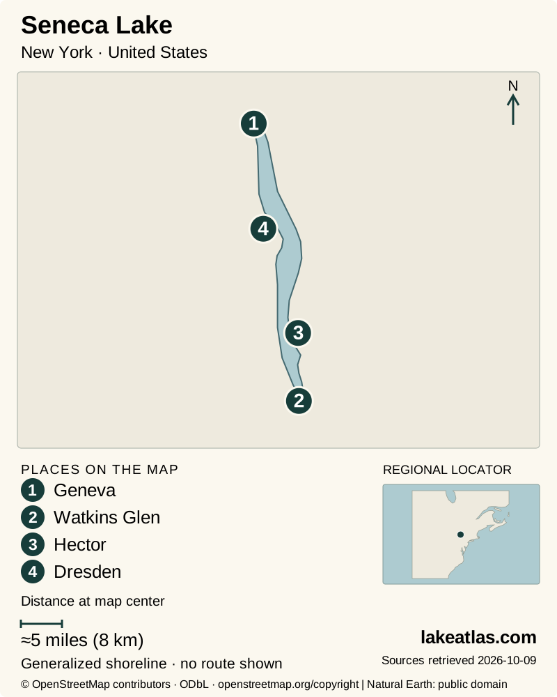
- 1Geneva
- 2Watkins Glen
- 3Hector
- 4Dresden
Map design: LakeAtlas. Shoreline and place sources: Natural Earth (public domain) and © OpenStreetMap contributors (ODbL). Locator: Natural Earth. Retrieved October 9, 2026. Individual source links are in the downloadable GeoJSON. Map data (GeoJSON).
Seneca’s size, depth and steep sides
DEC’s fisheries assessment gives a surface area of 67.7 sq mi (175.4 km²), a length of 38 miles (61.2 km), a maximum depth of 618 ft (188.4 m) and a mean depth of 291 ft (88.7 m). Seneca is the deepest Finger Lake and contains the group’s greatest volume of water. Area is the footprint seen on a map; volume includes the water held through that deep basin.
The large maximum is not typical of every near-shore location, but steep drop-offs are a defining feature. DEC describes relatively little shallow, vegetated habitat compared with the lake’s total area. A viewpoint above the water therefore says little about whether the adjacent shore provides a beach, an easy boat landing or a gradual swimming entry.
Glaciers, tributaries and a northward outlet
Repeated glaciation deepened the region’s pre-existing valleys. Retreating ice left long water-filled troughs, while streams cutting down the steepened sides formed gorges. Watkins Glen illustrates that later stream erosion; its waterfalls belong to a tributary landscape, not to a waterfall dropping out of Seneca Lake.
Keuka Lake drains into Seneca, adding a connection between two Finger Lakes. Seneca’s outlet at the north joins the canal and river system; lake and outlet management affect levels even though the basin is natural. Canal-era navigation helped connect the lakeside communities to wider markets, and the same water now supports drinking supplies, recreation and agriculture.
The lake’s large water mass moderates temperatures on nearby slopes, contributing to local grape-growing conditions. That is part of the geography behind the wineries, not a guarantee of mild weather for a visitor or identical conditions at every vineyard.
Geneva, Sampson and Watkins Glen
At the north end, Seneca Lake State Park provides a straightforward public destination with picnic areas, a swimming beach, a sprayground and marinas. The park is a day-use location: camping is not permitted. Its launch and marina operations are separate from the supervised-swimming season, so confirm the facility needed rather than relying on the park’s general opening.
Sampson State Park is a larger east-shore recreation base with camping, a marina, boat launching, a lake trail and a seasonally guarded beach. It can suit a trip centered on staying beside the lake rather than driving between tasting rooms. Book camping or a slip separately and check current beach staffing and water-quality notices.
Clute Park at the southern end gives Watkins Glen a public lakeside space, including a walking path, picnic areas and seasonal swimming when lifeguards are on duty. Its boat launch is across the road in the campground and connects through the canal at the lake’s south end. A beach visit and a trailer launch therefore use different parts of the site.
Watkins Glen is a separate walking commitment
Watkins Glen State Park follows a stream through a rocky gorge inland from the lake. Its waterfall route involves many stone steps, tunnels and wet surfaces. Treat it as a hike with a chosen entrance and return route, not an accessible extension of the lakefront promenade.
The Gorge Trail is seasonal, ordinarily opening in spring and closing in fall as conditions allow. The park’s rim trails have different opening arrangements, and open rim trails do not guarantee access to the gorge or waterfalls in winter. Check the live trail notice: the park page also carries construction information, so an older opening date should not substitute for a current entrance check.
Planning a winery day along the shores
Wineries are scattered along both sides of Seneca Lake, with individual opening hours, reservation policies and experiences. The Seneca Lake Wine Trail is an association of participating wineries rather than a continuous walking trail. Choose a small set of stops on the same shore and arrange a designated driver or booked transport.
A tasting-room view is not general permission to reach the water through the vineyard. Pair a winery visit with a named public park when shoreline time matters. Geneva and Watkins Glen supply restaurants and accommodation, while many rural stops require a deliberate plan for food and transport.
Best time to visit Seneca Lake
Summer gives the broadest combination of supervised swimming, boating and park services, but each beach can close because of staffing or water quality. Check the relevant park’s current notice. A deep, large lake should not be assumed uniformly calm or suitable for a small boat just because a launch area looks sheltered.
Fall can combine vineyard visits with lakeside walking and an open Gorge Trail, provided its seasonal closure has not begun. Winter is a different trip: some park grounds remain open, while restrooms, marinas, swimming facilities and the gorge route have reduced or closed operations. Do not infer safe ice access from weather or ice visible in a sheltered corner.
Choose one end for a first day
For a Geneva-based day, start at Seneca Lake State Park for the water and choose a nearby meal or tasting stop without attempting to drive both shores. Check beach operation if swimming is the reason for going. A car is useful for dispersed parks and wineries; a lake-length measurement is not a verified road-circuit distance.
For a Watkins Glen base, use Clute Park’s 1 mile (1.6 km) walking path to understand the southern shore, then visit the gorge as a separate outing if its trails are open and the steps suit your group. Keep a lakefront-only alternative for anyone who cannot manage the gorge terrain.
What did we learn about Seneca Lake?
Seneca’s depth explains much of its character, from steep shoreline edges to the climate around its vineyards. Public access is concentrated at specific parks rather than spread continuously along the roads. A visit works best when Geneva, Sampson or Watkins Glen becomes the anchor and the other activities fit that part of the lake.
Sources & data notes11 references · Checked October 9, 2026
Data notes
Area and depths use DEC’s 2020 forage assessment; metric equivalents are calculated from its original US values. Some other published tables contain inconsistent paired conversions, so those pairs are not copied into comparisons.
- Area and depths use DEC’s 2020 forage assessment; metric equivalents are calculated from its original US values. Some other published tables contain inconsistent paired conversions, so those pairs are not copied into comparisons.
- The quoted maximum depth is the deepest reported point, while mean depth averages the basin. The reference elevation 445 ft (136 m) is not today’s water level.
- The location marker follows the official Seneca Lake State Park marina destination, not a geometric centroid. The Clute Park path distance is a recreational route, not shoreline length.
Suggested visits are researched planning guidance, not firsthand travel reports.
References
- NYSDEC — Seneca Lake Forage Assessment 2020
- NYSDEC — Finger Lakes Watershed
- Seneca Lake Pure Waters Association — About Seneca Lake
- New York State Parks — Seneca Lake State Park
- New York State Parks — Sampson State Park
- Village of Watkins Glen Parks Department — Clute Park Campground
- New York State Parks — Watkins Glen State Park
- Seneca Lake Wine Trail
- New York State Parks reservations — Seneca Lake State Park marina
- Finger Lakes Tourism Alliance — Seneca Lake
- Seneca Lake Pure Waters Association — 2025 Pure Waters program
Source selection & methodology. Image credits appear beside each image.