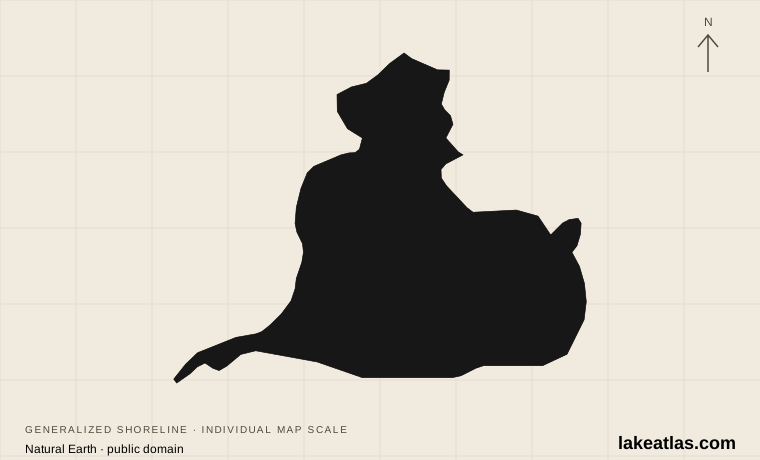
Where is Lake St. Clair?
The international boundary crosses the lake, with Michigan to the west and Ontario to the east and south. Harrison Township and St. Clair Shores provide Michigan-side gateways; Belle River in the Municipality of Lakeshore provides a Canadian shoreline base. Detroit and Windsor are the recognizable regional cities, but their central waterfronts face the Detroit River downstream of the lake.
Water enters from Lake Huron through the St. Clair River and its branching delta, then exits through the Detroit River toward Lake Erie. This makes St. Clair part of the Great Lakes connecting system, although it is not one of the five Great Lakes. The regional map separates the lake shore from the river corridors so you can choose the waterfront you actually want to visit.
Match the numbered places to the list below. Open the full-size map for labels and detail.
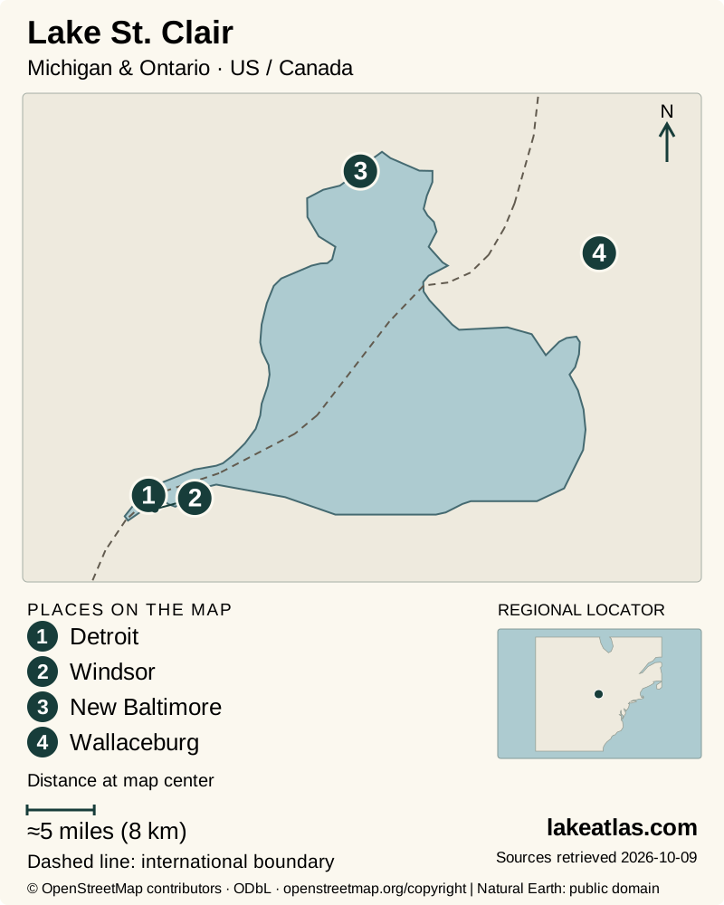
- 1Detroit
- 2Windsor
- 3New Baltimore
- 4Wallaceburg
Map design: LakeAtlas. Shoreline and place sources: Natural Earth (public domain) and © OpenStreetMap contributors (ODbL). Locator: Natural Earth. Retrieved October 9, 2026. Individual source links are in the downloadable GeoJSON. Map data (GeoJSON).
How shallow is Lake St. Clair?
Its surface area is 430 sq mi (1,114 km²), but its natural maximum depth is only 21 ft (6.4 m). The watershed authority lists a mean depth of 12.1 ft (3.7 m). Mean depth averages the whole basin; maximum depth identifies its deepest natural portion. Neither predicts the water beneath a particular beach or boat.
A dredged shipping route crosses this shallow basin. The same authority lists a reference channel depth of 27.2 ft (8.3 m), which explains why some descriptions give a deeper figure. LakeAtlas uses the natural maximum in comparisons and keeps the channel separate. That historical design/reference number is not clearance information for navigation.
A glacial landscape with a working delta
Ice sheets deposited and reshaped the sediments of this region. As the ice retreated and outlets changed, drainage from the upper lakes developed through the St. Clair River. Sediment delivered into the lake built a branching delta at its northern end; the modern channels also carry commercial and recreational traffic.
The ecological value extends well beyond open water. Marshes shelter young fish and feeding or resting waterfowl, while developed shorelines, dredging and intensive human use create management pressures. The lake is therefore both a through-route and a habitat in its own right. Treat wetland edges as habitat rather than spare landing places.
A first lake visit from metropolitan Detroit
Lake St. Clair Metropark in Harrison Township brings beach, shoreline recreation and wetland surroundings into one public destination. Its 3.8 miles (6.04 km) hike-bike trail is flat and paved; choose a short out-and-back portion if a full park circuit is more than you want. This is a practical land-based introduction without hiring a boat.
At Black Creek, the accessible fishing platform has concrete approaches and nearby accessible van parking. It faces a creek near the lake, not an open-lake swimming beach. That distinction helps match the destination to the outing. Check the park’s current beach status and launch requirements separately.
Belle River and the Ontario wetlands
Lakeview Park West Beach at Belle River offers a developed municipal waterfront on the southern shore. It suits a beach-and-town visit, while the St. Clair National Wildlife Area on the eastern side is a more habitat-focused outing. These are separate destinations, not neighboring stops that can be combined by walking along one continuous public beach.
At the wildlife area, stay on the authorized trails and viewing structures during day-use hours. The Bear Creek Unit has different restrictions, including a general prohibition on public access apart from specified boating waters. Spring and fall migration bring waterfowl through the region; observing from designated places protects the undisturbed space the birds need.
Boating, fishing and choosing the season
Fishing is a major use of St. Clair, but access to the lake and permission to fish across its international boundary are separate questions. Choose a public launch on the side where your trip is planned, check the applicable fishing rules, and keep small craft clear of commercial traffic. A lake-wide label such as “easy boating” would hide very different conditions between marsh channels and exposed water.
Summer favors beach and boating plans when facilities are operating. Spring and fall are useful for wetland visits, while winter requires an independent ice-condition decision rather than an assumption based on the lake’s shallow depth. No lake-wide water-quality statement replaces a notice for the named beach.
Checked October 9, 2026: the Windsor-Essex health unit says its 2026 beach sampling program has ended and is expected to resume in spring 2027. Historical results explain how conditions vary; they do not certify current swimming conditions.
Getting there and planning a first visit
A car is useful for moving between lake gateways and choosing a particular park entrance. Cycling or walking within a public park is a separate, much smaller-scale journey. Crossing from Michigan to Ontario also means planning an actual international border route, not following the straight line across the water.
Lakeshore ran a weekend and holiday Beach Bus pilot between the Atlas Tube Recreation Centre and West Beach from June 20 through September 7, 2026. That completed pilot should not be treated as a year-round service or a promise for 2027. Check a future operating announcement before building a car-free trip around it.
For a first visit, stay on one shore: choose a park, take a shoreline walk, then add either a beach stop or a wetland observation visit according to conditions. Visitors needing specific mobility features should choose the named facility, such as the Metropark’s Black Creek platform, rather than relying on a general description of the lake as accessible.
What did we learn about Lake St. Clair?
St. Clair’s importance comes from its connections: upper-lake water, commercial shipping and wildlife all pass through a remarkably shallow basin. For a visitor, the useful choice is between an open-lake park, a creekside facility and a protected wetland. Naming that destination makes the trip far clearer than simply heading toward the Detroit waterfront.
Sources & data notes10 references · Checked October 9, 2026
Data notes
Natural maximum depth excludes the deeper dredged navigation channel. Area and average-depth estimates differ slightly by source; the SCRCA series is used consistently.
- Natural depth and dredged shipping-channel depth are different measurements. Channel dimensions here are descriptive references, not a navigation chart.
- The locator coordinate is the Canadian official place-name point, not a public entrance. Mobility details apply only to the named facilities.
Suggested visits are researched planning guidance, not firsthand travel reports.
References
- Michigan EGLE — Lake St. Clair
- St. Clair Region Conservation Authority — Lake St. Clair Canadian Watershed Management Plan
- USGS — Quaternary Geologic Framework of the St. Clair River, Introduction
- Huron-Clinton Metroparks — Lake St. Clair Metropark
- Environment and Climate Change Canada — St. Clair National Wildlife Area
- Municipality of Lakeshore — Parks
- Municipality of Lakeshore — Beach Bus Pilot Project
- Windsor-Essex County Health Unit — Lakeshore Lakeview Park West Beach
- Natural Resources Canada — Lake St. Clair
- USGS — The St. Clair River and Lake St. Clair, Michigan: an ecological profile
Source selection & methodology. Image credits appear beside each image.