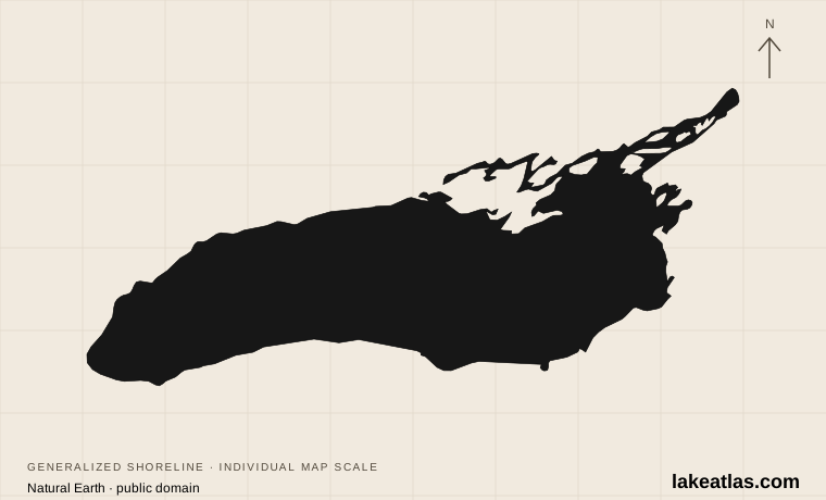
Where is Lake Ontario?
The Canadian shore lies to the north and west, and New York borders the south and east. The Niagara River brings water from Lake Erie; the St. Lawrence River carries it away from the northeastern end. Niagara Falls belongs to the connecting river, not to the open lake itself.
The lake is therefore the last major basin in the Great Lakes chain before the St. Lawrence. Toronto supplies an urban island-and-waterfront experience, Prince Edward County offers dune and beach country, and the New York shore provides public parks near bays and river mouths. These settings are useful itinerary choices rather than interchangeable descriptions of one resort area.
Ontario’s basin was shaped by the Laurentide ice sheet, with water filling the landscape left as the ice retreated. Its present connection to the Niagara and St. Lawrence rivers places that glacial basin within a much larger drainage system. Dunes and wetlands along its shores are distinct habitats within that lake region.
Match the numbered places to the list below. Open the full-size map for labels and detail.
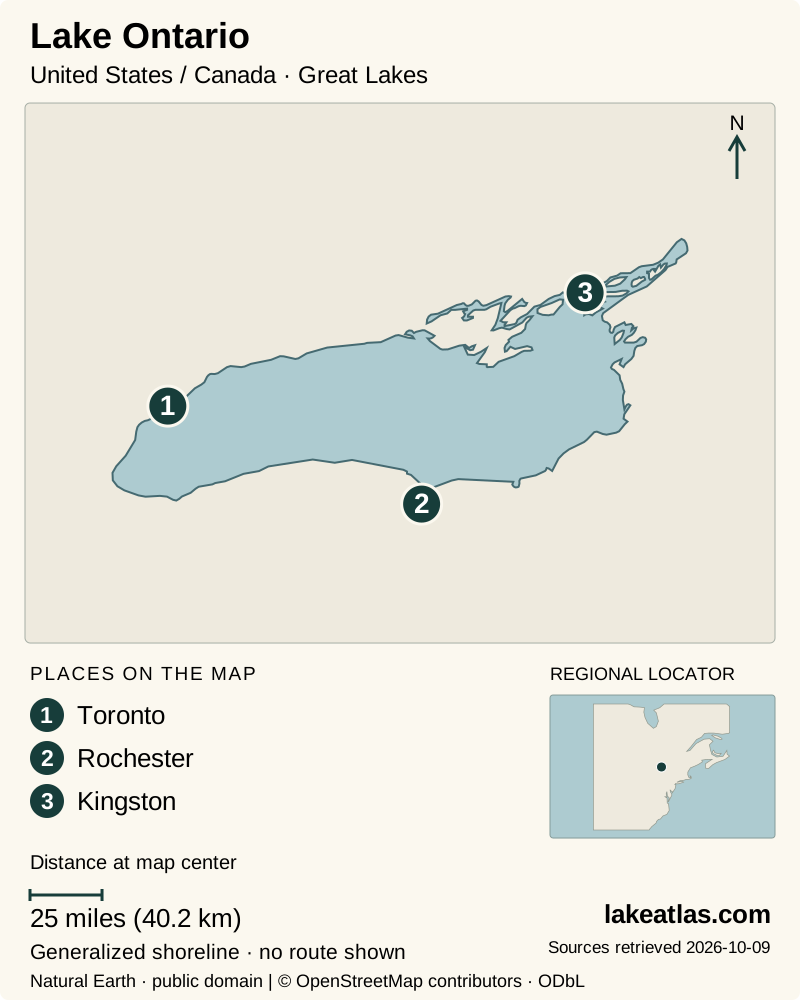
- 1Toronto
- 2Rochester
- 3Kingston
Map design: LakeAtlas. Shoreline and place sources: Natural Earth (public domain) and © OpenStreetMap contributors (ODbL). Locator: Natural Earth. Retrieved October 9, 2026. Individual source links are in the downloadable GeoJSON. Map data (GeoJSON).
How large and deep is Lake Ontario?
Ontario has a surface area of 7,340 sq mi (18,960 km²), a maximum depth of 802 ft (244 m) and a mean depth of 283 ft (86 m). Its reference volume is 393 cu mi (1,640 km³). Although it has the smallest surface area among the Great Lakes, it is substantially deeper than Erie.
That distinction is important when comparing lakes. The area number describes the footprint on a map; depth and volume describe a different kind of scale. Neither a small-looking map symbol nor a summer beach scene should suggest that Ontario is a shallow inland pond.
A New York base at Fair Haven Beach
Fair Haven Beach State Park is on the eastern part of New York’s Lake Ontario shore. Its combination of sand, bluffs and wooded terrain makes it a practical choice for a first park-based visit. Little Sodus Bay and inland Sterling Pond add sheltered-water settings beside the much larger lake.
The park supports swimming, walking, picnicking and camping, with cabins and other accommodation options subject to availability. A simple day can pair the public lakefront with a woodland or pond-side outing. For an overnight trip, reserve the accommodation itself rather than assuming that day-use access includes a place to stay.
Pay attention to which water an activity uses. The park’s rental canoes and kayaks are restricted to the inland Sterling Pond waterway, so a rental there is not permission to take the craft onto open Lake Ontario. Swimming also follows the posted guarded season and hours. Those distinctions make it easier to choose an activity that fits the group without confusing a sheltered facility with an open-lake expedition.
Sandbanks and Prince Edward County
Sandbanks Provincial Park lies in Prince Edward County, where dunes, wetlands and beaches offer a more rural counterpoint to Toronto. Choose the beach deliberately: the park’s facilities face different waters, and “Sandbanks beach” does not identify one uniform swimming spot.
Lakeshore Beach is on Lake Ontario, while Dunes Beach fronts West Lake. Ontario Parks describes a steeper drop-off at Dunes Beach than at the more gently shelving Outlet and Lakeshore beaches. There are no beach lifeguards. A family should choose by conditions and supervision needs rather than assuming that all sandbanks have shallow water extending far from shore.
The park’s walking routes make a useful alternative to a beach-only day. Stay on established trails through the dune and wetland habitats. Daily vehicle permits can be obtained in advance within the park’s booking window, which is worth checking before driving into a busy summer destination. Camping and a day-use vehicle permit are separate planning questions.
Seeing Lake Ontario from Toronto Island
Toronto Island offers walking, cycling and lake-facing beaches reached by passenger ferry. Paths and bridges connect the island areas, but the ferry dock you choose still shapes the outing. Select the beach or walking area first and then check which service gives the most useful arrival and return.
Public vehicles are not allowed on the islands. A personal bicycle can travel by ferry, while the city’s Bike Share bicycles must remain on their respective mainland or island side. For a simple visit, walking between a dock, a beach-facing view and a picnic stop can be enough; there is no need to turn the outing into a complete circuit.
The city supervises island beaches in summer, and some paths remain available year-round. Winter services and facilities differ: seasonal water-filling stations are not available then, even where washrooms remain open. Before departure, check the passenger schedule and return sailing rather than relying on a summer timetable.
Best time to visit and how to plan
Summer is the simplest starting point for a beach-focused visit, provided the chosen beach is open and conditions permit swimming. Spring and fall suit a different trip: Sandbanks and Toronto Island offer migration interest, and walking can become the main activity rather than a supplement to swimming.
For a first American-shore visit, Fair Haven provides a coherent park base with several activities close together. For a Canadian beach trip, stay focused on Sandbanks and the surrounding county. If already in Toronto, the island ferry creates a distinct lake outing within an urban stay. These are separate starting points; trying to include all of them on a short visit would replace time at the water with time in transit.
A journey between the United States and Canada requires a suitable border crossing and the traveler’s required documents. Check the current notices for the specific park or ferry as well. A lake-wide profile explains the choices, but it cannot guarantee that a beach, campground or sailing is available on the day you arrive.
What did we learn about Lake Ontario?
Ontario is a deep final basin in a connected freshwater system, with the Niagara River upstream and the St. Lawrence downstream. Its shore can mean a New York park, a Canadian dune landscape or a ferry ride from Toronto. Choosing one of those settings, and distinguishing open-lake activities from sheltered-water facilities, produces a clearer and more rewarding first visit.
Sources & data notes10 references · Checked October 9, 2026
Data notes
Rounded NOAA GLERL reference statistics. Depths and volume are measured at Low Water Datum; present water levels vary. Comparisons use maximum depth, not mean depth.
- Area is water surface area, not the surrounding drainage basin. Maximum depth and mean depth describe different properties. Depths and volume use the source’s Low Water Datum, not today’s water level.
- NOAA’s published US and metric figures are independently rounded; both are retained instead of converting one rounded value into the other. ILEC uses a different source series for lake areas; its coordinates alone are used for the overview marker.
- The NOAA table explicitly identifies Lake Ontario. The EPA companion page returned the same numbers under an anomalous “Lake America” column label when checked; the NOAA lake identification and source series are used here.
Suggested visits are researched planning guidance, not firsthand travel reports.
References
- NOAA GLERL — Physical Characteristics of the Great Lakes
- ILEC — United States lake inventory
- ILEC — Lake Ontario
- New York State Parks — Fair Haven Beach State Park
- Ontario Parks — Sandbanks Provincial Park
- City of Toronto — Things to do on Toronto Island
- Ontario Parks — Sandbanks activities
- Ontario Parks — Sandbanks facilities
- City of Toronto — Getting around Toronto Island
- NOAA — Great Lakes ecoregion and formation
Source selection & methodology. Image credits appear beside each image.