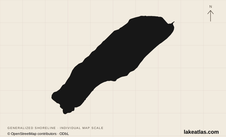
Lake, village and park-and-ride are different places
Lake Louise is an officially named lake in Alberta’s Banff National Park. The community of Lake Louise is a separate settlement, and the ski resort is another location again. This distinction matters when reserving transportation: arriving in the village does not mean you have reached the lakeshore.
The regular Parks Canada shuttles start at the Lake Louise Park and Ride at the ski resort. Reserve the correct trip and follow the check-in instructions for that departure point. Visitors staying in Banff can also consider Roam Public Transit, which Parks Canada identifies as an option for reaching the lake.
Match the numbered places to the list below. Open the full-size map for labels and detail.
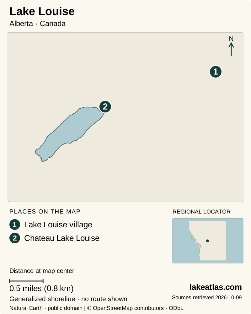
- 1Lake Louise village
- 2Chateau Lake Louise
Map design: LakeAtlas. Shoreline and place sources: Natural Earth (public domain) and © OpenStreetMap contributors (ODbL). Locator: Natural Earth. Retrieved October 9, 2026. Individual source links are in the downloadable GeoJSON. Chateau location: Banff & Lake Louise Tourism. Map data (GeoJSON).
Why does the water look turquoise?
The color is connected to glacial sediment. As glaciers grind rock, finely divided mineral material can travel in meltwater to the lake. This rock flour affects the light in the water, contributing to the turquoise appearance associated with the Canadian Rockies in summer.
The lake is part of a mountain environment that changes markedly with the seasons. A frozen surface, recent thaw, changing runoff and different light can produce a very different view from a summer photograph. Treat the famous color as a seasonal natural feature rather than an appearance guaranteed on a particular date.
Glacial creeks meet the lake at its far end. Walking along the shoreline gives more context than the first viewpoint alone: the mountain walls, incoming water and developed end of the lake become parts of the same landscape. The view is compelling without treating the surrounding glacier terrain as an accessible extension of a shoreline walk.
What is verified about the lake’s dimensions?
LakeAtlas has verified the lake’s identity and location against Canada’s official geographical names database. A sufficiently current, authoritative surface-area and maximum-depth measurement was not established for this profile, so those fields remain unverified rather than being filled with widely repeated figures.
That gap does not prevent useful planning. Parks Canada provides trail distances and route descriptions, which answer a different question: how far a visitor will walk. A lakeshore trail distance is not a measurement of lake length, and neither a trail map nor a photograph establishes the depth.
Choose between the lakeshore and an uphill viewpoint
The Lake Louise Lakeshore Trail follows the north side toward the far end of the lake. Parks Canada currently lists it as 1.4 miles (2.3 km) one way. Returning by the same route doubles the walking distance, so allow time for both directions and for stops. You can also turn back earlier for a shorter shoreline visit.
Fairview Lookout is a different outing. Parks Canada describes a short but steep route beginning near the boathouse, with views back toward the lake and the historic Chateau. Its listed distance is 0.75 miles (1.2 km) one way. Choose it because you want an uphill viewpoint and are comfortable with the conditions, not because its shorter distance implies the same effort as the shoreline.
Lake Agnes and the Plain of Six Glaciers are more ambitious destinations, with seasonal access considerations. A tea house appearing on a map does not make the approach an all-season walk. Parks Canada warns against those hikes in winter and spring because of avalanche hazard; consult the current trail report before committing to them.
How the shuttle and park entry work
A reservation is required for Parks Canada shuttles. For the regular daytime service, check in at the Lake Louise Park and Ride and begin the trip there. The standard ticket includes the return and the Lake Connector between Lake Louise and Moraine Lake; national park entry is a separate requirement.
The published 2026 Lake Louise Lakeshore shuttle season runs from May 15 through October 12. These are that year’s planned service dates, not a recurring promise for later years. Parks Canada warns that shuttle seats commonly sell out; reserve ahead and read the instructions associated with the particular service you choose.
Lake Louise still has personal-vehicle access, but parking is limited and cannot be relied on. Moraine Lake is a different access system, with its road closed to general personal-vehicle traffic. Do not assume that a plan to drive to Lake Louise also allows driving to Moraine Lake.
A summer route is not automatically a winter route
The Lake Louise lakeshore and community are open year-round, but that does not mean every trail remains suitable year-round. Parks Canada’s winter guidance identifies avalanche exposure close to visitor areas and directs visitors to designated winter routes. Use the seasonal map and current conditions, not only the summer hiking list.
The winter lakeshore map specifically directs visitors to the north side of the lake and identifies avalanche danger areas. A short distance from a parking lot is not a measure of mountain safety. Snow, ice and weather can also change the practical effort of an otherwise modest outing.
For a first visit, secure transport, spend time at the lakefront and choose one appropriate walk. In summer that may be the lakeshore trail; in winter it may be a shorter outing on a designated route after checking conditions. The lake deserves enough unhurried time that it is more than a stop between shuttle rides.
What did we learn about Lake Louise?
Lake Louise’s color and scenery belong to a glacial mountain system, while access depends on careful distinctions between the lake, village and shuttle base. Reserve transportation before shaping the day around a trail, and let the season determine the route. The simplest satisfying visit is time at the lake followed by a walk appropriate to current conditions.
Sources & data notes7 references · Checked October 9, 2026
Data notes
Area and maximum depth remain null because this review did not establish adequately current authoritative measurements. Null means unverified, not zero.
- Area and maximum depth are not established because this review did not find adequately current authoritative measurements. Unverified does not mean zero.
- Current Parks Canada hiking guidance lists the lakeshore route as 1.4 miles (2.3 km) one way. Older maps and some tourism descriptions use a shorter figure; route editions should not be mixed.
- Trail distances describe one-way walks, not lake dimensions. Metric originals are retained and converted to US-first displays.
- Shuttle dates and access information were checked October 9, 2026; confirm the timetable for the year and date of travel.
Suggested visits are researched planning guidance, not firsthand travel reports.
References
- Natural Resources Canada — Lake Louise
- Parks Canada — Visiting Lake Louise and Moraine Lake
- Parks Canada — Hiking in Banff National Park
- Parks Canada — Lake Louise lakeshore trails
- Banff & Lake Louise Tourism — Summer months
- Parks Canada — Lake Louise and Moraine Lake
- Banff & Lake Louise Tourism — Lake Louise
Source selection & methodology. Image credits appear beside each image.